Property Record
1505 9A State Road 207, Saint Augustine, FL 32084
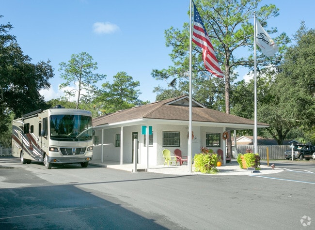


Property Detail
1505 9A State Road 207
Jacksonville, FL
8-2 PT OF NE1/4 OF SE1/4 SEC 34 & PT OF NW1/4 OF SW1/4 SEC 35 LYING NW OF SR 207 OR4551/1821
101370-0020
ST. JOHNS
Recreationalentertainmentgeneral
Florida
AE The base floodplain where base flood elevations are provided. AE Zones are now used on new format FIRMs instead of A1-A30 Zones.
1
2025
26.84 AC
2026
Greater St Augustine
020300
Jacksonville (Florida)
630 SF
NEARBY LISTINGS FOR SALE OR LEASE
-
-
View all Saint Augustine listings for sale on LoopNet.com
DEMOGRAPHICS near 1505 9A State Road 207
1 mile
3 mile
5 mile
2025 Total Population
4,895
28,427
74,118
2030 Population
5,779
33,082
86,045
Pop Growth 2025-2030
+ 18.06%
+ 16.38%
+ 16.09%
Average Age
45
44
46
2025 Total Households
1,974
11,599
32,001
HH Growth 2025-2030
+ 18.54%
+ 16.74%
+ 16.51%
Median Household Inc
$74,504
$72,003
$75,739
Avg Household Size
2.40
2.40
2.20
2025 Avg HH Vehicles
2.00
2.00
2.00
Median Home Value
$406,959
$389,385
$391,253
Median Year Built
2010
1999
1998
Nearby Places
Map Layers
Map Styles
 Street
 Aerial
Layers
 Traffic
 Biking
Places
Listings with unknown addresses are not visible on the map
- Restaurants
- Banks
- Shops
- Fitness
- Groceries
Nearby Properties
Address
Land Use
TOTAL SIZE
Lot Size
Zoning
Address
Land Use
TOTAL SIZE
Lot Size
Zoning
117,686 SF
14.52 AC
CI
Address
Land Use
TOTAL SIZE
Lot Size
Zoning
15,400 SF
40.38 AC
PUD
Address
Land Use
TOTAL SIZE
Lot Size
Zoning
532,530 SF
25.80 AC
CG
Address
Land Use
TOTAL SIZE
Lot Size
Zoning
237,460 SF
66.83 AC
Address
Land Use
TOTAL SIZE
Lot Size
Zoning
311,794 SF
39.89 AC
Address
Land Use
TOTAL SIZE
Lot Size
Zoning
118,694 SF
20.03 AC
Address
Land Use
TOTAL SIZE
Lot Size
Zoning
262,617 SF
37.08 AC
PUD
Address
Land Use
TOTAL SIZE
Lot Size
Zoning
25,155 SF
32.46 AC
PUD
Address
Land Use
TOTAL SIZE
Lot Size
Zoning
130,186 SF
21.74 AC
CG
Address
Land Use
TOTAL SIZE
Lot Size
Zoning
167,306 SF
17.02 AC
CG
Address
Land Use
TOTAL SIZE
Lot Size
Zoning
52,990 SF
5.82 AC
OR
Address
Land Use
TOTAL SIZE
Lot Size
Zoning
161,211 SF
21.70 AC
PUD
Address
Land Use
TOTAL SIZE
Lot Size
Zoning
18,174 SF
25 AC
PUD
Address
Land Use
TOTAL SIZE
Lot Size
Zoning
119,853 SF
21.34 AC
Address
Land Use
TOTAL SIZE
Lot Size
Zoning
65,082 SF
22.11 AC
Address
Land Use
TOTAL SIZE
Lot Size
Zoning
47,385 SF
12.36 AC
Address
Land Use
TOTAL SIZE
Lot Size
Zoning
2.46 AC
CI
Address
Land Use
TOTAL SIZE
Lot Size
Zoning
91,500 SF
10.62 AC
OR/CHT
Address
Land Use
TOTAL SIZE
Lot Size
Zoning
1,240 SF
29.76 AC
OR
Address
Land Use
TOTAL SIZE
Lot Size
Zoning
15.71 AC
OR
Address
Land Use
TOTAL SIZE
Lot Size
Zoning
33,602 SF
8.13 AC
Address
Land Use
TOTAL SIZE
Lot Size
Zoning
202,143 SF
22.30 AC
OR
Address
Land Use
TOTAL SIZE
Lot Size
Zoning
6,436 SF
13.09 AC
OR
Address
Land Use
TOTAL SIZE
Lot Size
Zoning
202,733 SF
23.38 AC
PUD
Address
Land Use
TOTAL SIZE
Lot Size
Zoning
196,920 SF
17.46 AC
PSD
Address
Land Use
TOTAL SIZE
Lot Size
Zoning
96,152 SF
6.79 AC
Address
Land Use
TOTAL SIZE
Lot Size
Zoning
138,830 SF
15 AC
OR
Address
Land Use
TOTAL SIZE
Lot Size
Zoning
700 SF
3.82 AC
CG
Address
Land Use
TOTAL SIZE
Lot Size
Zoning
Address
Land Use
TOTAL SIZE
Lot Size
Zoning
111,836 SF
13.47 AC
CG
The World's #1 Commercial Real Estate Marketplace
Connect with us
© 2026 CoStar Group
The information above has been obtained from sources believed reliable. While we do not doubt its accuracy we have not verified it and make no guarantee, warranty or representation about it. It is your responsibility to independently confirm its accuracy and completeness. Any projections, opinions, assumptions, or estimates used are for example only and do not represent the current or future performance of the property. The value of this transaction to you depends on tax and other factors which should be evaluated by your tax, financial, and legal advisors. You and your advisors should conduct a careful, independent investigation of the property to determine to your satisfaction the suitability of the property for your needs.