Property Record
1505 N Adams St, Lexington, NE 68850
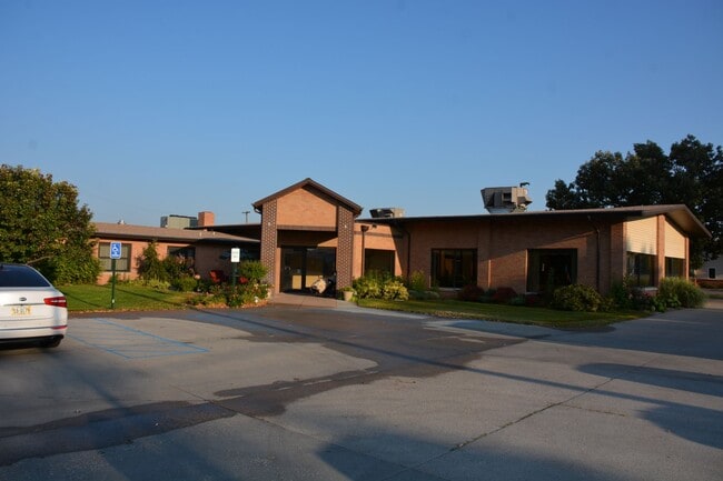
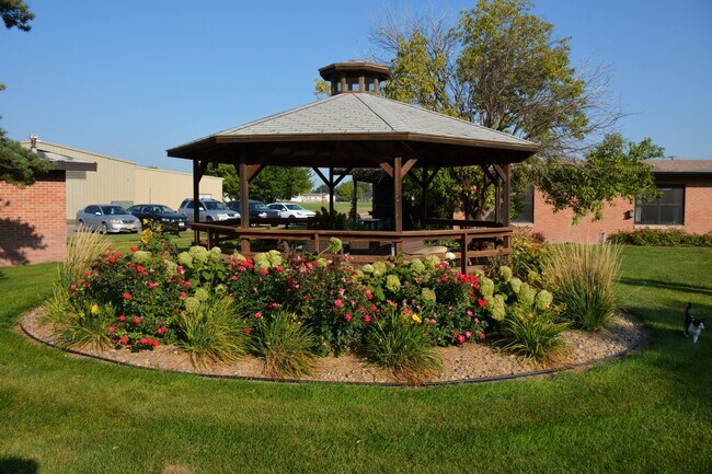
This Property Is For Sale
NEARBY LISTINGS FOR SALE OR LEASE
-
-
View all Lexington listings for sale on LoopNet.com
Property Detail
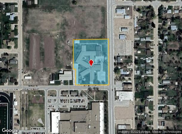
1505 N Adams St
Lexington, NE
First Add
24-0217950
00003875 LOTS 1 & 2 LANTIS FIRST ADDITION
Commercialnec
Dawson
AH
Nebraska
31047C0461C
1,2
2024
6.29 AC
2025
I-80 Corridor
968400
Other Market Areas
19,848 SF
DEMOGRAPHICS near 1505 N Adams St
1 Mile
3 Mile
5 Mile
2024 Total Population
7,173
11,409
11,933
2029 Population
7,109
11,322
11,837
Pop Growth 2024-2029
(0.89%)
(0.76%)
(0.80%)
Average Age
35
34
35
2024 Total Households
2,310
3,622
3,829
HH Growth 2024-2029
(0.87%)
(0.80%)
(0.84%)
Median Household Inc
$59,088
$57,475
$58,245
Avg Household Size
3.00
3.10
3.00
2024 Avg HH Vehicles
2.00
2.00
2.00
Median Home Value
$138,770
$134,403
$138,830
Median Year Built
1971
1973
1973
Nearby Places
Map Layers
Map Styles
 Street
 Aerial
- Restaurants
- Banks
- Shops
- Fitness
- Groceries
Nearby Properties
Address
Land Use
TOTAL SIZE
Lot Size
Zoning
Address
Land Use
TOTAL SIZE
Lot Size
Zoning
1,344 SF
128.24 AC
04-INDUSTR
Address
Land Use
TOTAL SIZE
Lot Size
Zoning
20,460 SF
1 AC
04-INDUSTR
Address
Land Use
TOTAL SIZE
Lot Size
Zoning
38,994 SF
4.86 AC
03-COMMERC
Address
Land Use
TOTAL SIZE
Lot Size
Zoning
7,143 SF
4.88 AC
02-MULTI-F
Address
Land Use
TOTAL SIZE
Lot Size
Zoning
69,010 SF
5.18 AC
00
Address
Land Use
TOTAL SIZE
Lot Size
Zoning
38,256 SF
10.07 AC
03-COMMERC
Address
Land Use
TOTAL SIZE
Lot Size
Zoning
7,804 SF
8.63 AC
03-COMMERC
Address
Land Use
TOTAL SIZE
Lot Size
Zoning
31,173 SF
2.24 AC
03-COMMERC
Address
Land Use
TOTAL SIZE
Lot Size
Zoning
11,074 SF
1.64 AC
02-MULTI-F
Address
Land Use
TOTAL SIZE
Lot Size
Zoning
7,344 SF
1.08 AC
03-COMMERC
Address
Land Use
TOTAL SIZE
Lot Size
Zoning
12,944 SF
0.76 AC
02-MULTI-F
Address
Land Use
TOTAL SIZE
Lot Size
Zoning
25,071 SF
6.93 AC
04-INDUSTR
Address
Land Use
TOTAL SIZE
Lot Size
Zoning
24,481 SF
0.52 AC
03-COMMERC
Address
Land Use
TOTAL SIZE
Lot Size
Zoning
10,000 SF
18.15 AC
03-COMMERC
Address
Land Use
TOTAL SIZE
Lot Size
Zoning
4,788 SF
2.11 AC
03-COMMERC
Address
Land Use
TOTAL SIZE
Lot Size
Zoning
17,920 SF
10.71 AC
03-COMMERC
Address
Land Use
TOTAL SIZE
Lot Size
Zoning
14,940 SF
16.85 AC
03-COMMERC
Address
Land Use
TOTAL SIZE
Lot Size
Zoning
11,550 SF
6.53 AC
03-COMMERC
Address
Land Use
TOTAL SIZE
Lot Size
Zoning
5.50 AC
03-COMMERC
Address
Land Use
TOTAL SIZE
Lot Size
Zoning
12,074 SF
20.93 AC
03-COMMERC
Address
Land Use
TOTAL SIZE
Lot Size
Zoning
34,562 SF
2.11 AC
03-COMMERC
Address
Land Use
TOTAL SIZE
Lot Size
Zoning
3,360 SF
1.61 AC
03-COMMERC
Address
Land Use
TOTAL SIZE
Lot Size
Zoning
1,456 SF
4.14 AC
03-COMMERC
Address
Land Use
TOTAL SIZE
Lot Size
Zoning
24,700 SF
1 AC
03-COMMERC
Address
Land Use
TOTAL SIZE
Lot Size
Zoning
16,444 SF
1.45 AC
03-COMMERC
Address
Land Use
TOTAL SIZE
Lot Size
Zoning
16,992 SF
1.10 AC
00
Address
Land Use
TOTAL SIZE
Lot Size
Zoning
37,500 SF
5.20 AC
04-INDUSTR
Address
Land Use
TOTAL SIZE
Lot Size
Zoning
12,438 SF
1.28 AC
03-COMMERC
Address
Land Use
TOTAL SIZE
Lot Size
Zoning
4,605 SF
2.88 AC
03-COMMERC
The World's #1 Commercial Real Estate Marketplace
Connect with us
© 2026 CoStar Group
The information above has been obtained from sources believed reliable. While we do not doubt its accuracy we have not verified it and make no guarantee, warranty or representation about it. It is your responsibility to independently confirm its accuracy and completeness. Any projections, opinions, assumptions, or estimates used are for example only and do not represent the current or future performance of the property. The value of this transaction to you depends on tax and other factors which should be evaluated by your tax, financial, and legal advisors. You and your advisors should conduct a careful, independent investigation of the property to determine to your satisfaction the suitability of the property for your needs.