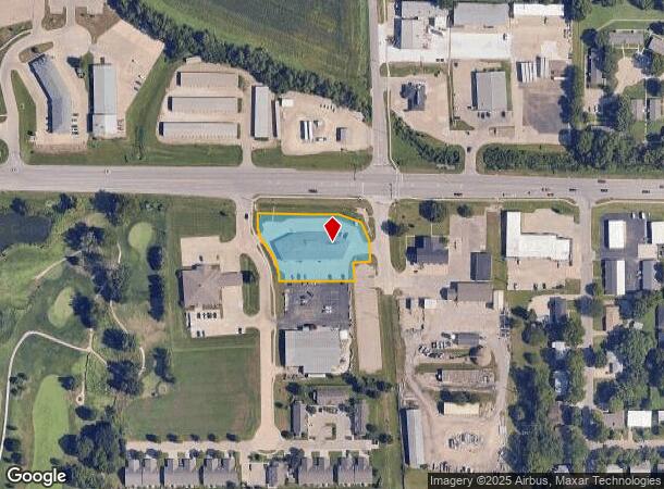
Property Record
1505 W Us Highway 24, Wamego, KS 66547

NEARBY LISTINGS FOR SALE OR LEASE
-
-
View all Wamego listings for lease on LoopNet.com
Property Detail
1505 W Us Highway 24
Manhattan, KS
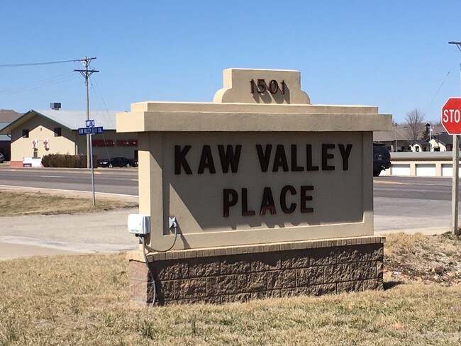
Kaw Valley Business Pk
293-05-0-40-01-001.07-0 01
KAW VALLEY BUSINESS PK, S05, T10, R10, LOT 7 - 8, ACRES 1.12, SECTION 05 TOWNSHIP 10 RANGE 10
Stripcommercialcenter
Pottawatomie
X
Kansas
20149C0504F
7,8
2024
1.12 AC
2025
Kansas Area
000200
Other Market Areas
12,624 SF
DEMOGRAPHICS near 1505 W Us Highway 24
1 Mile
3 Mile
5 Mile
2024 Total Population
4,968
7,243
8,970
2029 Population
5,411
7,891
9,767
Pop Growth 2024-2029
+ 8.92%
+ 8.95%
+ 8.89%
Average Age
39
39
38
2024 Total Households
1,937
2,809
3,432
HH Growth 2024-2029
+ 8.93%
+ 8.97%
+ 8.89%
Median Household Inc
$77,967
$78,532
$78,297
Avg Household Size
2.50
2.50
2.60
2024 Avg HH Vehicles
2.00
2.00
2.00
Median Home Value
$169,143
$169,625
$179,278
Median Year Built
1974
1975
1977
Nearby Places
- Restaurants
- Banks
- Shops
- Fitness
- Groceries
PUBLIC TRANSPORTATION
AIRPORT
Manhattan Regional
DRIVE
WALK
Distance
Manhattan Regional
35 min
22.7 mi
Freight Ports
Tulsa Port Of Catoosa
DRIVE
WALK
Distance
Tulsa Port Of Catoosa
318 min
265.8 mi
SALE & LEASE HISTORY
LISTING DATE
SALE/LEASE

Feb 21, 2017
For Lease
Dec 18, 2019
For Lease
Nearby Properties
Address
Land Use
TOTAL SIZE
Lot Size
Zoning
Address
Land Use
TOTAL SIZE
Lot Size
Zoning
138,289 SF
11.50 AC
Address
Land Use
TOTAL SIZE
Lot Size
Zoning
56,998 SF
8.68 AC
Address
Land Use
TOTAL SIZE
Lot Size
Zoning
112,022 SF
38.21 AC
Address
Land Use
TOTAL SIZE
Lot Size
Zoning
63,679 SF
2.90 AC
Address
Land Use
TOTAL SIZE
Lot Size
Zoning
42,782 SF
6.40 AC
Address
Land Use
TOTAL SIZE
Lot Size
Zoning
7,750 SF
36.04 AC
ET
Address
Land Use
TOTAL SIZE
Lot Size
Zoning
18,768 SF
5.41 AC
ET
Address
Land Use
TOTAL SIZE
Lot Size
Zoning
1,007 SF
13.60 AC
Address
Land Use
TOTAL SIZE
Lot Size
Zoning
8,959 SF
0.52 AC
Address
Land Use
TOTAL SIZE
Lot Size
Zoning
21,430 SF
1.38 AC
Address
Land Use
TOTAL SIZE
Lot Size
Zoning
1,451 SF
37.67 AC
Address
Land Use
TOTAL SIZE
Lot Size
Zoning
12,183 SF
27.17 AC
ET
Address
Land Use
TOTAL SIZE
Lot Size
Zoning
18,730 SF
14.44 AC
A1
Address
Land Use
TOTAL SIZE
Lot Size
Zoning
26,559 SF
6.38 AC
Address
Land Use
TOTAL SIZE
Lot Size
Zoning
12,656 SF
2.30 AC
Address
Land Use
TOTAL SIZE
Lot Size
Zoning
6,398 SF
5.80 AC
Address
Land Use
TOTAL SIZE
Lot Size
Zoning
9,788 SF
1.87 AC
Address
Land Use
TOTAL SIZE
Lot Size
Zoning
9,000 SF
14.30 AC
ET
Address
Land Use
TOTAL SIZE
Lot Size
Zoning
12,000 SF
2.75 AC
Address
Land Use
TOTAL SIZE
Lot Size
Zoning
9,296 SF
0.19 AC
Address
Land Use
TOTAL SIZE
Lot Size
Zoning
6,922 SF
3.80 AC
Address
Land Use
TOTAL SIZE
Lot Size
Zoning
2,114 SF
4.86 AC
Address
Land Use
TOTAL SIZE
Lot Size
Zoning
40,820 SF
42.03 AC
Address
Land Use
TOTAL SIZE
Lot Size
Zoning
12,378 SF
0.17 AC
Address
Land Use
TOTAL SIZE
Lot Size
Zoning
5,302 SF
0.34 AC
Address
Land Use
TOTAL SIZE
Lot Size
Zoning
49,372 SF
42.03 AC
Address
Land Use
TOTAL SIZE
Lot Size
Zoning
64,462 SF
21.96 AC
ET
Address
Land Use
TOTAL SIZE
Lot Size
Zoning
5,180 SF
0.79 AC
Address
Land Use
TOTAL SIZE
Lot Size
Zoning
Address
Land Use
TOTAL SIZE
Lot Size
Zoning
65,142 SF
42.03 AC
The World's #1 Commercial Real Estate Marketplace
Connect with us
© 2025 CoStar Group
The information above has been obtained from sources believed reliable. While we do not doubt its accuracy we have not verified it and make no guarantee, warranty or representation about it. It is your responsibility to independently confirm its accuracy and completeness. Any projections, opinions, assumptions, or estimates used are for example only and do not represent the current or future performance of the property. The value of this transaction to you depends on tax and other factors which should be evaluated by your tax, financial, and legal advisors. You and your advisors should conduct a careful, independent investigation of the property to determine to your satisfaction the suitability of the property for your needs.