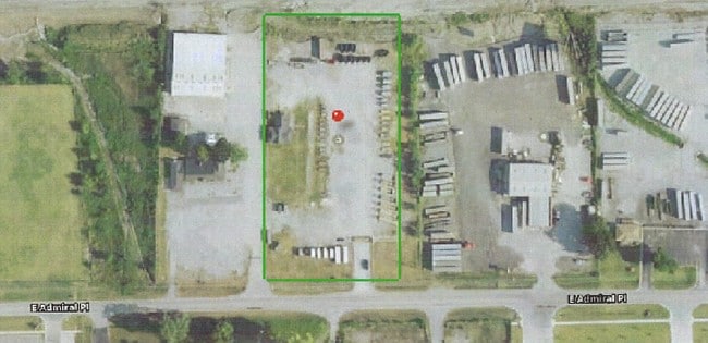
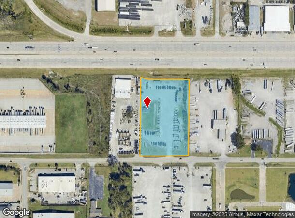
Property Record
15053 E Admiral Pl, Tulsa, OK 74116
NEARBY LISTINGS FOR SALE OR LEASE
Property Detail
15053 E Admiral Pl
Tulsa, OK
Unplatted
99403-94-03-02130
BEG 40N & 169.92E SWC GOVT LT 3 TH E318.30 N492.40 W266.11 NW53.90 S505.47 POB SEC 03 19 14 3.61 ACS
Commercialacreage
Tulsa
X
Oklahoma
40131C0350J
3
2025
3.61 AC
2025
East
007308
Tulsa
1,289 SF
DEMOGRAPHICS near 15053 E Admiral Pl
1 Mile
3 Mile
5 Mile
2024 Total Population
1,289
28,068
103,376
2029 Population
1,358
29,141
107,748
Pop Growth 2024-2029
+ 5.35%
+ 3.82%
+ 4.23%
Average Age
40
36
35
2024 Total Households
488
10,106
37,958
HH Growth 2024-2029
+ 5.33%
+ 3.94%
+ 4.23%
Median Household Inc
$65,878
$47,334
$49,810
Avg Household Size
2.60
2.70
2.60
2024 Avg HH Vehicles
2.00
2.00
2.00
Median Home Value
$177,407
$105,478
$141,179
Median Year Built
1973
1973
1975
Nearby Places
Map Layers
Map Styles
 Street
 Aerial
- Restaurants
- Banks
- Shops
- Fitness
- Groceries
PUBLIC TRANSPORTATION
AIRPORT
Tulsa International
DRIVE
WALK
Distance
Tulsa International
17 min
11.2 mi
Freight Ports
Tulsa Port Of Catoosa
DRIVE
WALK
Distance
Tulsa Port Of Catoosa
13 min
8.6 mi
SALE & LEASE HISTORY
LISTING DATE
SALE/LEASE

Dec 21, 2018
For Sale
Nearby Properties
Address
Land Use
TOTAL SIZE
Lot Size
Zoning
Address
Land Use
TOTAL SIZE
Lot Size
Zoning
349,823 SF
203.39 AC
IL
Address
Land Use
TOTAL SIZE
Lot Size
Zoning
725,973 SF
122.30 AC
IM
Address
Land Use
TOTAL SIZE
Lot Size
Zoning
112,556 SF
11.07 AC
CH
Address
Land Use
TOTAL SIZE
Lot Size
Zoning
11,184 SF
638.56 AC
Address
Land Use
TOTAL SIZE
Lot Size
Zoning
106,270 SF
9.47 AC
RM0
Address
Land Use
TOTAL SIZE
Lot Size
Zoning
124,648 SF
21.23 AC
IL
Address
Land Use
TOTAL SIZE
Lot Size
Zoning
32,370 SF
45.90 AC
AG
Address
Land Use
TOTAL SIZE
Lot Size
Zoning
39,375 SF
70 AC
AG
Address
Land Use
TOTAL SIZE
Lot Size
Zoning
28,465 SF
6.71 AC
RS3
Address
Land Use
TOTAL SIZE
Lot Size
Zoning
56,531 SF
7.79 AC
RS3
Address
Land Use
TOTAL SIZE
Lot Size
Zoning
498,836 SF
50.22 AC
CS
Address
Land Use
TOTAL SIZE
Lot Size
Zoning
673,050 SF
52.77 AC
IM
Address
Land Use
TOTAL SIZE
Lot Size
Zoning
40,202 SF
2.93 AC
RM0
Address
Land Use
TOTAL SIZE
Lot Size
Zoning
293,564 SF
23.75 AC
RM1
Address
Land Use
TOTAL SIZE
Lot Size
Zoning
14,237 SF
2.28 AC
CS
Address
Land Use
TOTAL SIZE
Lot Size
Zoning
265,350 SF
11.85 AC
RM1
Address
Land Use
TOTAL SIZE
Lot Size
Zoning
371,153 SF
22.82 AC
IL
Address
Land Use
TOTAL SIZE
Lot Size
Zoning
22,825 SF
2.38 AC
CS
Address
Land Use
TOTAL SIZE
Lot Size
Zoning
129,087 SF
43.40 AC
IR
Address
Land Use
TOTAL SIZE
Lot Size
Zoning
492,786 SF
76.58 AC
IL
Address
Land Use
TOTAL SIZE
Lot Size
Zoning
21,255 SF
8.22 AC
RM1
Address
Land Use
TOTAL SIZE
Lot Size
Zoning
45,196 SF
3.64 AC
RS3
Address
Land Use
TOTAL SIZE
Lot Size
Zoning
3,720 SF
158.66 AC
Address
Land Use
TOTAL SIZE
Lot Size
Zoning
43,891 SF
4.88 AC
RS3
Address
Land Use
TOTAL SIZE
Lot Size
Zoning
219,538 SF
20.13 AC
IL
Address
Land Use
TOTAL SIZE
Lot Size
Zoning
10,674 SF
14.18 AC
RS3
Address
Land Use
TOTAL SIZE
Lot Size
Zoning
6,000 SF
346.13 AC
Address
Land Use
TOTAL SIZE
Lot Size
Zoning
4,125 SF
54.35 AC
CS
Address
Land Use
TOTAL SIZE
Lot Size
Zoning
137,668 SF
13.67 AC
IM
Address
Land Use
TOTAL SIZE
Lot Size
Zoning
34,595 SF
4.35 AC
CS
The World's #1 Commercial Real Estate Marketplace
Connect with us
© 2025 CoStar Group
The information above has been obtained from sources believed reliable. While we do not doubt its accuracy we have not verified it and make no guarantee, warranty or representation about it. It is your responsibility to independently confirm its accuracy and completeness. Any projections, opinions, assumptions, or estimates used are for example only and do not represent the current or future performance of the property. The value of this transaction to you depends on tax and other factors which should be evaluated by your tax, financial, and legal advisors. You and your advisors should conduct a careful, independent investigation of the property to determine to your satisfaction the suitability of the property for your needs.