Property Record
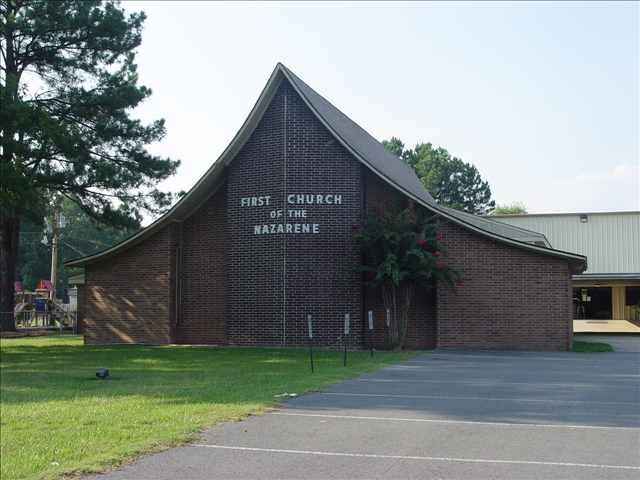
1506 N Jp Wright Loop Rd, Jacksonville, AR 72076


Property Detail
1506 N Jp Wright Loop Rd
12J-010-00-081-00
PT E1/2SE SE BEG50N OF SW COR N250 E450S250TO N LN LOOP RD W450 TO BEG 17 3N 10W E X E M P T AND: PT E1/2 SE SE MPDA COM SW COR E1/2 SE SE TH N0*2150E305.39 TO POB N87*5330E450 N0*2150E130 S87*5330W450 S0*2150W130 TO POB
Religious
Pulaski
AE The base floodplain where base flood elevations are provided. AE Zones are now used on new format FIRMs instead of A1-A30 Zones.
Arkansas
2025
4.03 AC
2025
Outlying Pulaski County
003609
Little Rock/N Little Rock
20,816 SF
Little Rock-North Little Rock-Conway, AR
NEARBY LISTINGS FOR SALE OR LEASE
-
-
View all Jacksonville listings for sale on LoopNet.com
DEMOGRAPHICS near 1506 N Jp Wright Loop Rd
1 mile
3 mile
5 mile
2025 Total Population
5,254
23,459
35,848
2030 Population
5,278
23,695
36,314
Pop Growth 2025-2030
+ 0.46%
+ 1.01%
+ 1.30%
Average Age
40
38
38
2025 Total Households
2,177
9,440
14,105
HH Growth 2025-2030
+ 0.55%
+ 1.01%
+ 1.33%
Median Household Inc
$54,910
$46,547
$52,791
Avg Household Size
2.30
2.40
2.40
2025 Avg HH Vehicles
2.00
2.00
2.00
Median Home Value
$177,186
$166,405
$175,798
Median Year Built
1981
1978
1980
Nearby Places
Map Layers
Map Styles
 Street
 Aerial
Transit
 Traffic
 Biking
Places
Listings with unknown addresses are not visible on the map
- Restaurants
- Banks
- Shops
- Fitness
- Groceries
PUBLIC TRANSPORTATION
AIRPORT
Bill and Hillary Clinton Ntl/Adams Field
Drive
Walk
Distance
Bill and Hillary Clinton Ntl/Adams Field
23 min
18.1 mi
Freight Ports
Port of Shreveport
Drive
Walk
Distance
Port of Shreveport
269 min
249.1 mi
Nearby Properties
Address
Land Use
TOTAL SIZE
Lot Size
Zoning
Address
Land Use
TOTAL SIZE
Lot Size
Zoning
78,183 SF
2.77 AC
Address
Land Use
TOTAL SIZE
Lot Size
Zoning
338,000 SF
22.81 AC
Address
Land Use
TOTAL SIZE
Lot Size
Zoning
116,987 SF
39.02 AC
Address
Land Use
TOTAL SIZE
Lot Size
Zoning
130,195 SF
10.11 AC
Address
Land Use
TOTAL SIZE
Lot Size
Zoning
92,654 SF
50.12 AC
Address
Land Use
TOTAL SIZE
Lot Size
Zoning
10 SF
10.14 AC
Address
Land Use
TOTAL SIZE
Lot Size
Zoning
5,850 SF
21.81 AC
Address
Land Use
TOTAL SIZE
Lot Size
Zoning
55,127 SF
11.26 AC
Address
Land Use
TOTAL SIZE
Lot Size
Zoning
76,936 SF
48.38 AC
Address
Land Use
TOTAL SIZE
Lot Size
Zoning
76,192 SF
27.71 AC
Address
Land Use
TOTAL SIZE
Lot Size
Zoning
137,320 SF
14.27 AC
Address
Land Use
TOTAL SIZE
Lot Size
Zoning
60,232 SF
12.88 AC
Address
Land Use
TOTAL SIZE
Lot Size
Zoning
45,006 SF
6.33 AC
Address
Land Use
TOTAL SIZE
Lot Size
Zoning
37,333 SF
6.43 AC
Address
Land Use
TOTAL SIZE
Lot Size
Zoning
58,120 SF
8.58 AC
Address
Land Use
TOTAL SIZE
Lot Size
Zoning
71,861 SF
5.91 AC
Address
Land Use
TOTAL SIZE
Lot Size
Zoning
36,642 SF
3.99 AC
Address
Land Use
TOTAL SIZE
Lot Size
Zoning
86,675 SF
4.73 AC
Address
Land Use
TOTAL SIZE
Lot Size
Zoning
68,246 SF
10.71 AC
Address
Land Use
TOTAL SIZE
Lot Size
Zoning
10,318 SF
18.13 AC
Address
Land Use
TOTAL SIZE
Lot Size
Zoning
71,046 SF
9.18 AC
Address
Land Use
TOTAL SIZE
Lot Size
Zoning
33,668 SF
2.67 AC
Address
Land Use
TOTAL SIZE
Lot Size
Zoning
34,988 SF
9.14 AC
Address
Land Use
TOTAL SIZE
Lot Size
Zoning
6,576 SF
122.66 AC
Address
Land Use
TOTAL SIZE
Lot Size
Zoning
14,005 SF
5.45 AC
Address
Land Use
TOTAL SIZE
Lot Size
Zoning
1,426 SF
3.28 AC
Address
Land Use
TOTAL SIZE
Lot Size
Zoning
43,630 SF
12.38 AC
Address
Land Use
TOTAL SIZE
Lot Size
Zoning
7,853 SF
6.12 AC
Address
Land Use
TOTAL SIZE
Lot Size
Zoning
8,944 SF
10.64 AC
Address
Land Use
TOTAL SIZE
Lot Size
Zoning
37,258 SF
6.49 AC
The World's #1 Commercial Real Estate Marketplace
Connect with us
© 2026 CoStar Group
The information above has been obtained from sources believed reliable. While we do not doubt its accuracy we have not verified it and make no guarantee, warranty or representation about it. It is your responsibility to independently confirm its accuracy and completeness. Any projections, opinions, assumptions, or estimates used are for example only and do not represent the current or future performance of the property. The value of this transaction to you depends on tax and other factors which should be evaluated by your tax, financial, and legal advisors. You and your advisors should conduct a careful, independent investigation of the property to determine to your satisfaction the suitability of the property for your needs.