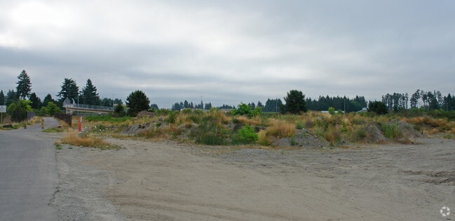
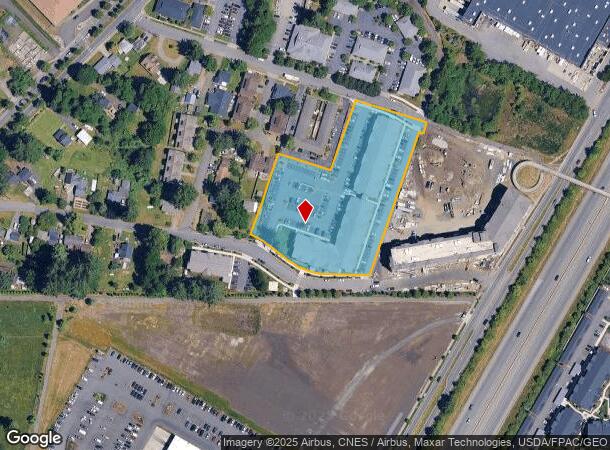
Property Record
1507 Bishop Rd Sw, Tumwater, WA 98512
NEARBY LISTINGS FOR SALE OR LEASE
Property Detail
1507 Bishop Rd Sw
12703242200
Bla 20-1005-Tw
Multifamilydwelling
SECTION 03 TOWNSHIP 17 RANGE 2W QUARTER SE NW BLA230384TW TR A DOCUMENT 4998381 LESS ROW 4982687
X
Thurston
53067C0281F
Washington
2024
2.09 AC
2024
Tumwater/S Olympia
010920
Olympia
100,890 SF
Olympia-Lacey-Tumwater, WA
DEMOGRAPHICS near 1507 Bishop Rd Sw
1 Mile
3 Mile
5 Mile
2024 Total Population
7,583
40,814
106,042
2029 Population
8,128
43,371
112,136
Pop Growth 2024-2029
+ 7.19%
+ 6.27%
+ 5.75%
Average Age
42
41
41
2024 Total Households
3,468
16,972
44,646
HH Growth 2024-2029
+ 7.24%
+ 6.26%
+ 5.88%
Median Household Inc
$59,723
$78,621
$75,770
Avg Household Size
2.10
2.40
2.30
2024 Avg HH Vehicles
2.00
2.00
2.00
Median Home Value
$327,536
$416,476
$414,066
Median Year Built
1982
1989
1989
Nearby Places
Map Layers
Map Styles
 Street
 Aerial
- Restaurants
- Banks
- Shops
- Fitness
- Groceries
PUBLIC TRANSPORTATION
COMMUTER RAIL
Olympia-Lacey Amtrak Station (Amtrak Cascades - Amtrak, Coast Starlight - Amtrak)
DRIVE
WALK
Distance
Olympia-Lacey Amtrak Station (Amtrak Cascades - Amtrak, Coast Starlight - Amtrak)
20 min
9.3 mi
Freight Ports
Port of Tacoma
DRIVE
WALK
Distance
Port of Tacoma
47 min
34.9 mi
Nearby Properties
Address
Land Use
TOTAL SIZE
Lot Size
Zoning
Address
Land Use
TOTAL SIZE
Lot Size
Zoning
523,407 SF
86.49 AC
R-4-8
Address
Land Use
TOTAL SIZE
Lot Size
Zoning
1,099,200 SF
79.09 AC
LI
Address
Land Use
TOTAL SIZE
Lot Size
Zoning
395,355 SF
35.74 AC
TC
Address
Land Use
TOTAL SIZE
Lot Size
Zoning
353,503 SF
36.94 AC
MFM
Address
Land Use
TOTAL SIZE
Lot Size
Zoning
184,887 SF
41 AC
SFM1
Address
Land Use
TOTAL SIZE
Lot Size
Zoning
235,042 SF
17.16 AC
MFM
Address
Land Use
TOTAL SIZE
Lot Size
Zoning
226,221 SF
Address
Land Use
TOTAL SIZE
Lot Size
Zoning
273,091 SF
17.87 AC
PO/RM
Address
Land Use
TOTAL SIZE
Lot Size
Zoning
146,122 SF
Address
Land Use
TOTAL SIZE
Lot Size
Zoning
163,487 SF
34.49 AC
CS
Address
Land Use
TOTAL SIZE
Lot Size
Zoning
102,698 SF
14.81 AC
LI
Address
Land Use
TOTAL SIZE
Lot Size
Zoning
197,571 SF
52.35 AC
R-4-8
Address
Land Use
TOTAL SIZE
Lot Size
Zoning
199,920 SF
14.38 AC
Address
Land Use
TOTAL SIZE
Lot Size
Zoning
199,880 SF
14.54 AC
Address
Land Use
TOTAL SIZE
Lot Size
Zoning
147,418 SF
11.74 AC
MFH
Address
Land Use
TOTAL SIZE
Lot Size
Zoning
175,938 SF
13 AC
MFM
Address
Land Use
TOTAL SIZE
Lot Size
Zoning
120,284 SF
118 AC
ARI2
Address
Land Use
TOTAL SIZE
Lot Size
Zoning
155,386 SF
6.88 AC
CBC
Address
Land Use
TOTAL SIZE
Lot Size
Zoning
80,956 SF
20.97 AC
SFL
Address
Land Use
TOTAL SIZE
Lot Size
Zoning
140,850 SF
5.73 AC
MFH
Address
Land Use
TOTAL SIZE
Lot Size
Zoning
151,654 SF
6.75 AC
CBC
Address
Land Use
TOTAL SIZE
Lot Size
Zoning
157,625 SF
1.46 AC
TC2
Address
Land Use
TOTAL SIZE
Lot Size
Zoning
110,064 SF
3.47 AC
UV
Address
Land Use
TOTAL SIZE
Lot Size
Zoning
78,580 SF
21.38 AC
ARI
Address
Land Use
TOTAL SIZE
Lot Size
Zoning
105,464 SF
3.06 AC
UV
Address
Land Use
TOTAL SIZE
Lot Size
Zoning
112,020 SF
5.91 AC
MFH
Address
Land Use
TOTAL SIZE
Lot Size
Zoning
96,853 SF
20.40 AC
PUD
Address
Land Use
TOTAL SIZE
Lot Size
Zoning
131,905 SF
1.30 AC
TC
Address
Land Use
TOTAL SIZE
Lot Size
Zoning
149,802 SF
Address
Land Use
TOTAL SIZE
Lot Size
Zoning
248,879 SF
11.16 AC
LI
The World's #1 Commercial Real Estate Marketplace
Connect with us
© 2026 CoStar Group
The information above has been obtained from sources believed reliable. While we do not doubt its accuracy we have not verified it and make no guarantee, warranty or representation about it. It is your responsibility to independently confirm its accuracy and completeness. Any projections, opinions, assumptions, or estimates used are for example only and do not represent the current or future performance of the property. The value of this transaction to you depends on tax and other factors which should be evaluated by your tax, financial, and legal advisors. You and your advisors should conduct a careful, independent investigation of the property to determine to your satisfaction the suitability of the property for your needs.