Property Record
1507 Golf Course Rd Se, Rio Rancho, NM 87124


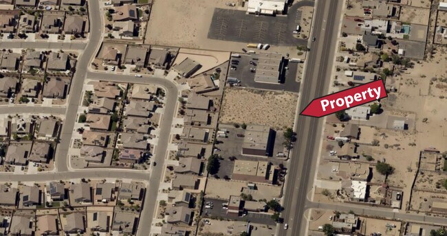

This Property Is For Sale
Property Detail
1507 Golf Course Rd Se
Albuquerque, NM
LEGAL: SUBD: RIO RANCHO ESTATES BLOCK: 83 LOT: 61 UNIT: 16 PLAT#3354 FORM LOTS 49A & 50A
1-012-067-409-524
SANDOVAL
Vacantlandnec
New Mexico
B and X Area of moderate flood hazard, usually the area between the limits of the 100-year and 500-year floods.
61
2024
0.83 AC
2025
Rio Rancho
010705
Albuquerque
NEARBY LISTINGS FOR SALE OR LEASE
DEMOGRAPHICS near 1507 Golf Course Rd Se
1 mile
3 mile
5 mile
2024 Total Population
13,669
89,618
161,943
2029 Population
14,694
93,624
167,808
Pop Growth 2024-2029
+ 7.50%
+ 4.47%
+ 3.62%
Average Age
39
41
41
2024 Total Households
4,994
34,921
61,673
HH Growth 2024-2029
+ 7.65%
+ 4.35%
+ 3.53%
Median Household Inc
$80,967
$76,048
$79,227
Avg Household Size
2.70
2.50
2.60
2024 Avg HH Vehicles
2.00
2.00
2.00
Median Home Value
$255,979
$256,411
$266,825
Median Year Built
2001
1994
1995
Nearby Places
Map Layers
Map Styles
 Street
 Aerial
Transit
 Traffic
 Biking
Places
Listings with unknown addresses are not visible on the map
- Restaurants
- Banks
- Shops
- Fitness
- Groceries
PUBLIC TRANSPORTATION
COMMUTER RAIL
Drive
Walk
Distance
15 min
7.1 mi
Drive
Walk
Distance
15 min
7.7 mi
AIRPORT
Albuquerque International Sunport
Drive
Walk
Distance
Albuquerque International Sunport
45 min
22.2 mi
Nearby Properties
Address
Land Use
TOTAL SIZE
Lot Size
Zoning
Address
Land Use
TOTAL SIZE
Lot Size
Zoning
2,095,144 SF
123.59 AC
Address
Land Use
TOTAL SIZE
Lot Size
Zoning
1,087,991 SF
55.76 AC
Address
Land Use
TOTAL SIZE
Lot Size
Zoning
494,839 SF
37.05 AC
Address
Land Use
TOTAL SIZE
Lot Size
Zoning
212,122 SF
9.99 AC
Address
Land Use
TOTAL SIZE
Lot Size
Zoning
381,500 SF
111.32 AC
Address
Land Use
TOTAL SIZE
Lot Size
Zoning
410,793 SF
32.43 AC
Address
Land Use
TOTAL SIZE
Lot Size
Zoning
313,427 SF
45.52 AC
Address
Land Use
TOTAL SIZE
Lot Size
Zoning
67,905 SF
4.25 AC
Address
Land Use
TOTAL SIZE
Lot Size
Zoning
221,360 SF
8.78 AC
Address
Land Use
TOTAL SIZE
Lot Size
Zoning
176,140 SF
6.15 AC
Address
Land Use
TOTAL SIZE
Lot Size
Zoning
Address
Land Use
TOTAL SIZE
Lot Size
Zoning
36,528 SF
13.05 AC
Address
Land Use
TOTAL SIZE
Lot Size
Zoning
106,332 SF
21.64 AC
Address
Land Use
TOTAL SIZE
Lot Size
Zoning
229,216 SF
20.25 AC
Address
Land Use
TOTAL SIZE
Lot Size
Zoning
69,724 SF
7.86 AC
Address
Land Use
TOTAL SIZE
Lot Size
Zoning
25,668 SF
22.52 AC
Address
Land Use
TOTAL SIZE
Lot Size
Zoning
93,440 SF
12.91 AC
Address
Land Use
TOTAL SIZE
Lot Size
Zoning
66,000 SF
85.14 AC
Address
Land Use
TOTAL SIZE
Lot Size
Zoning
307,481 SF
17.50 AC
Address
Land Use
TOTAL SIZE
Lot Size
Zoning
137,071 SF
8.30 AC
Address
Land Use
TOTAL SIZE
Lot Size
Zoning
207,228 SF
19.57 AC
Address
Land Use
TOTAL SIZE
Lot Size
Zoning
62,881 SF
4.67 AC
Address
Land Use
TOTAL SIZE
Lot Size
Zoning
214,871 SF
20.04 AC
Address
Land Use
TOTAL SIZE
Lot Size
Zoning
40,920 SF
11.83 AC
Address
Land Use
TOTAL SIZE
Lot Size
Zoning
142,351 SF
7.59 AC
Address
Land Use
TOTAL SIZE
Lot Size
Zoning
124,106 SF
30.54 AC
Address
Land Use
TOTAL SIZE
Lot Size
Zoning
152,894 SF
14.11 AC
Address
Land Use
TOTAL SIZE
Lot Size
Zoning
126,044 SF
4.48 AC
Address
Land Use
TOTAL SIZE
Lot Size
Zoning
68,123 SF
6.81 AC
Address
Land Use
TOTAL SIZE
Lot Size
Zoning
143,736 SF
9.91 AC
The World's #1 Commercial Real Estate Marketplace
Connect with us
© 2026 CoStar Group
The information above has been obtained from sources believed reliable. While we do not doubt its accuracy we have not verified it and make no guarantee, warranty or representation about it. It is your responsibility to independently confirm its accuracy and completeness. Any projections, opinions, assumptions, or estimates used are for example only and do not represent the current or future performance of the property. The value of this transaction to you depends on tax and other factors which should be evaluated by your tax, financial, and legal advisors. You and your advisors should conduct a careful, independent investigation of the property to determine to your satisfaction the suitability of the property for your needs.