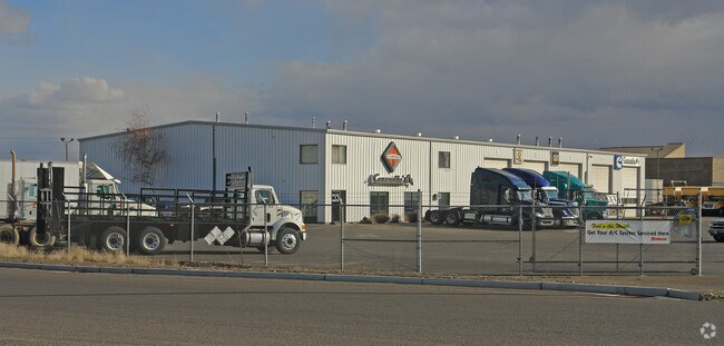
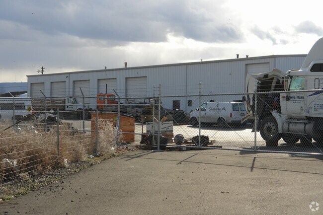
Property Record
1509 S 22Nd St, Yakima, WA 98901

NEARBY LISTINGS FOR SALE OR LEASE
Property Detail
1509 S 22Nd St
191329-41409
Goodwins Five Acre
Commercialnec
SECTION 29 TOWNSHIP 13 RANGE 19 QUARTER SE: PLAT GOODWINS FIVE ACRE TRACTS (A-18): DESCRIBED AS FOLLOWS: ALL THAT PORTION OF TRACTS 34 AND 39, COMMENCING AT A POINT 1337 FEET SOUTH OF THE CENTER OF SECTION 29, SAID POINT BEING THE 16TH CORNER SHOWN O
X
Yakima
53077C1053D
Washington
2025
4.47 AC
2025
Greater Yakima
001702
Yakima
12,800 SF
Yakima, WA
DEMOGRAPHICS near 1509 S 22Nd St
1 Mile
3 Mile
5 Mile
2024 Total Population
3,412
55,333
97,974
2029 Population
3,421
55,523
98,313
Pop Growth 2024-2029
+ 0.26%
+ 0.34%
+ 0.35%
Average Age
32
34
36
2024 Total Households
1,018
18,669
34,944
HH Growth 2024-2029
+ 0.20%
+ 0.30%
+ 0.37%
Median Household Inc
$46,428
$45,277
$52,062
Avg Household Size
3.30
2.80
2.70
2024 Avg HH Vehicles
2.00
2.00
2.00
Median Home Value
$148,507
$185,883
$228,136
Median Year Built
1977
1968
1970
Nearby Places
Map Layers
Map Styles
 Street
 Aerial
- Restaurants
- Banks
- Shops
- Fitness
- Groceries
PUBLIC TRANSPORTATION
AIRPORT
Yakima Air Trml/McAllister Field
DRIVE
WALK
Distance
Yakima Air Trml/McAllister Field
11 min
4.9 mi
Freight Ports
Port of Tacoma
DRIVE
WALK
Distance
Port of Tacoma
184 min
156.9 mi
Nearby Properties
Address
Land Use
TOTAL SIZE
Lot Size
Zoning
Address
Land Use
TOTAL SIZE
Lot Size
Zoning
390,527 SF
11.86 AC
R3
Address
Land Use
TOTAL SIZE
Lot Size
Zoning
197,341 SF
36.70 AC
GC
Address
Land Use
TOTAL SIZE
Lot Size
Zoning
326,323 SF
30.05 AC
R2
Address
Land Use
TOTAL SIZE
Lot Size
Zoning
87,068 SF
2.89 AC
CBD
Address
Land Use
TOTAL SIZE
Lot Size
Zoning
208,322 SF
3.69 AC
PUB
Address
Land Use
TOTAL SIZE
Lot Size
Zoning
176,098 SF
1.67 AC
CBD
Address
Land Use
TOTAL SIZE
Lot Size
Zoning
106,878 SF
3.46 AC
RD
Address
Land Use
TOTAL SIZE
Lot Size
Zoning
129,042 SF
6.53 AC
R3
Address
Land Use
TOTAL SIZE
Lot Size
Zoning
82,436 SF
11 AC
RD
Address
Land Use
TOTAL SIZE
Lot Size
Zoning
121,488 SF
5.97 AC
R3
Address
Land Use
TOTAL SIZE
Lot Size
Zoning
345,698 SF
3.52 AC
C1
Address
Land Use
TOTAL SIZE
Lot Size
Zoning
100,992 SF
9.15 AC
RD
Address
Land Use
TOTAL SIZE
Lot Size
Zoning
91,856 SF
9.17 AC
RD
Address
Land Use
TOTAL SIZE
Lot Size
Zoning
56,505 SF
2.75 AC
C1
Address
Land Use
TOTAL SIZE
Lot Size
Zoning
97,056 SF
5.80 AC
R3
Address
Land Use
TOTAL SIZE
Lot Size
Zoning
64,171 SF
48.08 AC
PUB
Address
Land Use
TOTAL SIZE
Lot Size
Zoning
197,263 SF
18.08 AC
C1
Address
Land Use
TOTAL SIZE
Lot Size
Zoning
128,789 SF
6.65 AC
R3
Address
Land Use
TOTAL SIZE
Lot Size
Zoning
135,634 SF
9.84 AC
C1
Address
Land Use
TOTAL SIZE
Lot Size
Zoning
97,976 SF
3.98 AC
SCC
Address
Land Use
TOTAL SIZE
Lot Size
Zoning
84,714 SF
4.40 AC
R3
Address
Land Use
TOTAL SIZE
Lot Size
Zoning
325,959 SF
11.95 AC
M2
Address
Land Use
TOTAL SIZE
Lot Size
Zoning
83,856 SF
4.23 AC
R3
Address
Land Use
TOTAL SIZE
Lot Size
Zoning
80,374 SF
8.99 AC
C1
Address
Land Use
TOTAL SIZE
Lot Size
Zoning
114,406 SF
15.50 AC
PUB
Address
Land Use
TOTAL SIZE
Lot Size
Zoning
94,724 SF
0.79 AC
CBD
Address
Land Use
TOTAL SIZE
Lot Size
Zoning
73,917 SF
1.01 AC
CBD
Address
Land Use
TOTAL SIZE
Lot Size
Zoning
151,831 SF
21.08 AC
M1
Address
Land Use
TOTAL SIZE
Lot Size
Zoning
43,687 SF
3.33 AC
C1
Address
Land Use
TOTAL SIZE
Lot Size
Zoning
64,593 SF
10.02 AC
R1
The World's #1 Commercial Real Estate Marketplace
Connect with us
© 2026 CoStar Group
The information above has been obtained from sources believed reliable. While we do not doubt its accuracy we have not verified it and make no guarantee, warranty or representation about it. It is your responsibility to independently confirm its accuracy and completeness. Any projections, opinions, assumptions, or estimates used are for example only and do not represent the current or future performance of the property. The value of this transaction to you depends on tax and other factors which should be evaluated by your tax, financial, and legal advisors. You and your advisors should conduct a careful, independent investigation of the property to determine to your satisfaction the suitability of the property for your needs.