Property Record
1509 S Gustin Rd, Salt Lake City, UT 84104

NEARBY LISTINGS FOR SALE OR LEASE
Property Detail
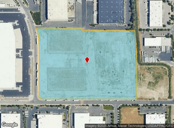
1509 S Gustin Rd
Salt Lake City, UT
Hamilton Minor Sub
15-17-127-008-0000
LOT 12A, HAMILTON MINOR SUB. 9671-0001 9765-0671
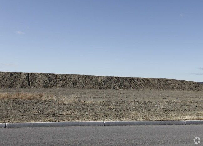
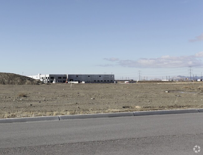
Industrialacreage
Salt Lake
X
Utah
49035C0280E
12a
2024
16.98 AC
2025
West Valley/Lake Park
114500
Salt Lake City
DEMOGRAPHICS near 1509 S Gustin Rd
1 Mile
3 Mile
5 Mile
2024 Total Population
3
43,341
210,034
2029 Population
3
43,425
212,456
Pop Growth 2024-2029
0.00%
+ 0.19%
+ 1.15%
Average Age
0
34
35
2024 Total Households
1
12,825
69,801
HH Growth 2024-2029
0.00%
+ 0.15%
+ 1.56%
Median Household Inc
$0
$59,165
$63,318
Avg Household Size
.00
3.20
2.80
2024 Avg HH Vehicles
.00
2.00
2.00
Median Home Value
$0
$294,388
$331,555
Median Year Built
0
1977
1982
Nearby Places
- Restaurants
- Banks
- Shops
- Fitness
- Groceries
PUBLIC TRANSPORTATION
COMMUTER RAIL
North Temple Station (FrontRunner - Utah Transit Authority (UTA))
DRIVE
WALK
Distance
North Temple Station (FrontRunner - Utah Transit Authority (UTA))
14 min
6.7 mi
Warm Springs Relief Point (FrontRunner - Utah Transit Authority (UTA))
DRIVE
WALK
Distance
Warm Springs Relief Point (FrontRunner - Utah Transit Authority (UTA))
15 min
8.2 mi
AIRPORT
Salt Lake City International
DRIVE
WALK
Distance
Salt Lake City International
7 min
3.6 mi
Freight Ports
Port of Stockton
DRIVE
WALK
Distance
Port of Stockton
709 min
694.1 mi
Nearby Properties
Address
Land Use
TOTAL SIZE
Lot Size
Zoning
Address
Land Use
TOTAL SIZE
Lot Size
Zoning
871,116 SF
45.92 AC
M-1
Address
Land Use
TOTAL SIZE
Lot Size
Zoning
22,022 SF
308 AC
AIRPRT
Address
Land Use
TOTAL SIZE
Lot Size
Zoning
906,418 SF
46.97 AC
IP-M-1
Address
Land Use
TOTAL SIZE
Lot Size
Zoning
252,420 SF
15.26 AC
TSA-MU
Address
Land Use
TOTAL SIZE
Lot Size
Zoning
673,062 SF
15.84 AC
RM
Address
Land Use
TOTAL SIZE
Lot Size
Zoning
867,303 SF
49 AC
IP-M-1
Address
Land Use
TOTAL SIZE
Lot Size
Zoning
690,542 SF
35.75 AC
M-1
Address
Land Use
TOTAL SIZE
Lot Size
Zoning
554,622 SF
35.88 AC
M-1
Address
Land Use
TOTAL SIZE
Lot Size
Zoning
322,076 SF
16.32 AC
PL
Address
Land Use
TOTAL SIZE
Lot Size
Zoning
432,730 SF
13.03 AC
R-M
Address
Land Use
TOTAL SIZE
Lot Size
Zoning
76,096 SF
17.30 AC
RM
Address
Land Use
TOTAL SIZE
Lot Size
Zoning
10,353 SF
143.39 AC
IP-CG
Address
Land Use
TOTAL SIZE
Lot Size
Zoning
544,602 SF
34.39 AC
M1
Address
Land Use
TOTAL SIZE
Lot Size
Zoning
429,554 SF
24.49 AC
M1
Address
Land Use
TOTAL SIZE
Lot Size
Zoning
505,079 SF
30.07 AC
M-1
Address
Land Use
TOTAL SIZE
Lot Size
Zoning
1,932 SF
33.44 AC
TSAMUC
Address
Land Use
TOTAL SIZE
Lot Size
Zoning
482,870 SF
31.13 AC
M-1
Address
Land Use
TOTAL SIZE
Lot Size
Zoning
505,800 SF
23.87 AC
M-1
Address
Land Use
TOTAL SIZE
Lot Size
Zoning
11,040 SF
175.57 AC
AIRPRT
Address
Land Use
TOTAL SIZE
Lot Size
Zoning
475,592 SF
24.09 AC
M-1
Address
Land Use
TOTAL SIZE
Lot Size
Zoning
505,079 SF
25.87 AC
M-1
Address
Land Use
TOTAL SIZE
Lot Size
Zoning
29.13 AC
C-2
Address
Land Use
TOTAL SIZE
Lot Size
Zoning
426,280 SF
19.84 AC
M1
Address
Land Use
TOTAL SIZE
Lot Size
Zoning
491,507 SF
28.48 AC
M-1
Address
Land Use
TOTAL SIZE
Lot Size
Zoning
289,725 SF
8.42 AC
1108
Address
Land Use
TOTAL SIZE
Lot Size
Zoning
491,507 SF
28.28 AC
M-1
Address
Land Use
TOTAL SIZE
Lot Size
Zoning
116,268 SF
8.07 AC
RMF-45
Address
Land Use
TOTAL SIZE
Lot Size
Zoning
436,903 SF
27.09 AC
M-1
Address
Land Use
TOTAL SIZE
Lot Size
Zoning
436,875 SF
26.95 AC
M-1
Address
Land Use
TOTAL SIZE
Lot Size
Zoning
431,400 SF
23.99 AC
IP-M-1
The World's #1 Commercial Real Estate Marketplace
Connect with us
© 2025 CoStar Group
The information above has been obtained from sources believed reliable. While we do not doubt its accuracy we have not verified it and make no guarantee, warranty or representation about it. It is your responsibility to independently confirm its accuracy and completeness. Any projections, opinions, assumptions, or estimates used are for example only and do not represent the current or future performance of the property. The value of this transaction to you depends on tax and other factors which should be evaluated by your tax, financial, and legal advisors. You and your advisors should conduct a careful, independent investigation of the property to determine to your satisfaction the suitability of the property for your needs.