Property Record
151 16Th St, Hawley, MN 56549


Property Detail
151 16Th St
Fargo, ND-MN
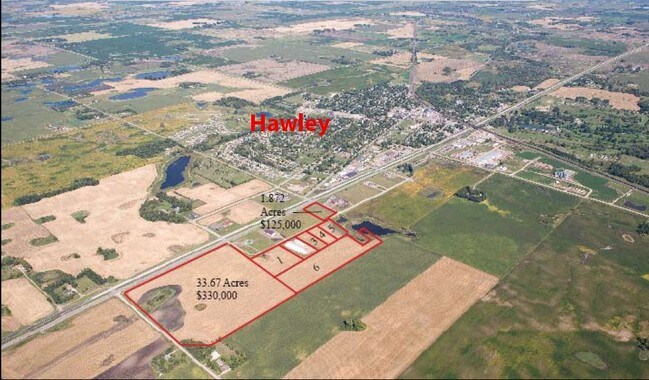
NW4NW4 LESS 7.06 AC & HWY 11-139-45 SECTION 11 TOWNSHIP 139 RANGE 045
13-011-2500
CLAY
Industrialgeneral
Minnesota
B and X Area of moderate flood hazard, usually the area between the limits of the 100-year and 500-year floods.
28.67 AC
2026
Fargo
2025
Other Market Areas
030201
NEARBY LISTINGS FOR SALE OR LEASE
-
-
View all Hawley listings for sale on LoopNet.com
DEMOGRAPHICS near 151 16Th St
1 mile
3 mile
5 mile
2025 Total Population
742
2,325
3,036
2030 Population
702
2,209
2,900
Pop Growth 2025-2030
(5.39%)
(4.99%)
(4.48%)
Average Age
38
39
40
2025 Total Households
289
879
1,127
HH Growth 2025-2030
(5.19%)
(5.23%)
(4.70%)
Median Household Inc
$90,853
$92,338
$94,230
Avg Household Size
2.50
2.60
2.60
2025 Avg HH Vehicles
2.00
2.00
2.00
Median Home Value
$305,208
$316,346
$326,415
Median Year Built
1973
1973
1974
Nearby Places
Map Layers
Map Styles
 Street
 Aerial
Layers
 Traffic
 Biking
Places
Listings with unknown addresses are not visible on the map
- Restaurants
- Banks
- Shops
- Fitness
- Groceries
PUBLIC TRANSPORTATION
AIRPORT
Hector International
Drive
Walk
Distance
Hector International
38 min
25.6 mi
Freight Ports
Port Milwaukee
Drive
Walk
Distance
Port Milwaukee
631 min
570.7 mi
Nearby Properties
Address
Land Use
TOTAL SIZE
Lot Size
Zoning
Address
Land Use
TOTAL SIZE
Lot Size
Zoning
6.55 AC
Address
Land Use
TOTAL SIZE
Lot Size
Zoning
8.63 AC
Address
Land Use
TOTAL SIZE
Lot Size
Zoning
14.62 AC
Address
Land Use
TOTAL SIZE
Lot Size
Zoning
43.23 AC
Address
Land Use
TOTAL SIZE
Lot Size
Zoning
4.01 AC
Address
Land Use
TOTAL SIZE
Lot Size
Zoning
0.34 AC
Address
Land Use
TOTAL SIZE
Lot Size
Zoning
1.20 AC
Address
Land Use
TOTAL SIZE
Lot Size
Zoning
1.36 AC
Address
Land Use
TOTAL SIZE
Lot Size
Zoning
0.17 AC
Address
Land Use
TOTAL SIZE
Lot Size
Zoning
4.48 AC
Address
Land Use
TOTAL SIZE
Lot Size
Zoning
4.89 AC
Address
Land Use
TOTAL SIZE
Lot Size
Zoning
42.45 AC
Address
Land Use
TOTAL SIZE
Lot Size
Zoning
129.79 AC
Address
Land Use
TOTAL SIZE
Lot Size
Zoning
1.07 AC
Address
Land Use
TOTAL SIZE
Lot Size
Zoning
3.80 AC
Address
Land Use
TOTAL SIZE
Lot Size
Zoning
1.95 AC
Address
Land Use
TOTAL SIZE
Lot Size
Zoning
2.92 AC
Address
Land Use
TOTAL SIZE
Lot Size
Zoning
257.95 AC
Address
Land Use
TOTAL SIZE
Lot Size
Zoning
335.22 AC
Address
Land Use
TOTAL SIZE
Lot Size
Zoning
73.35 AC
Address
Land Use
TOTAL SIZE
Lot Size
Zoning
147.31 AC
Address
Land Use
TOTAL SIZE
Lot Size
Zoning
Address
Land Use
TOTAL SIZE
Lot Size
Zoning
268.60 AC
Address
Land Use
TOTAL SIZE
Lot Size
Zoning
159.80 AC
Address
Land Use
TOTAL SIZE
Lot Size
Zoning
0.36 AC
Address
Land Use
TOTAL SIZE
Lot Size
Zoning
225.47 AC
Address
Land Use
TOTAL SIZE
Lot Size
Zoning
150.66 AC
Address
Land Use
TOTAL SIZE
Lot Size
Zoning
129.30 AC
Address
Land Use
TOTAL SIZE
Lot Size
Zoning
176.52 AC
The World's #1 Commercial Real Estate Marketplace
Connect with us
© 2026 CoStar Group
The information above has been obtained from sources believed reliable. While we do not doubt its accuracy we have not verified it and make no guarantee, warranty or representation about it. It is your responsibility to independently confirm its accuracy and completeness. Any projections, opinions, assumptions, or estimates used are for example only and do not represent the current or future performance of the property. The value of this transaction to you depends on tax and other factors which should be evaluated by your tax, financial, and legal advisors. You and your advisors should conduct a careful, independent investigation of the property to determine to your satisfaction the suitability of the property for your needs.