Property Record
151 30Th Ave, Columbus, GA 31903

Save to a Folder
{{folder.Name}}
{{folder.ListingIds.length}} Properties
{{folder.ListingIds.length}} Property
Create a New Folder
Property Detail
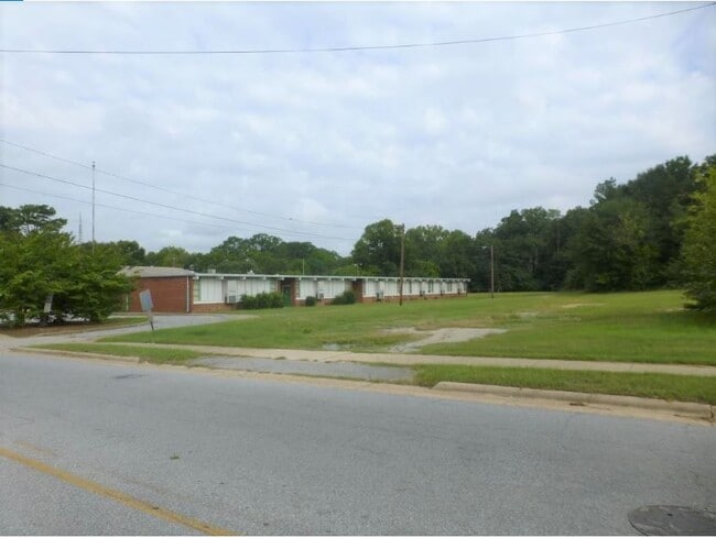
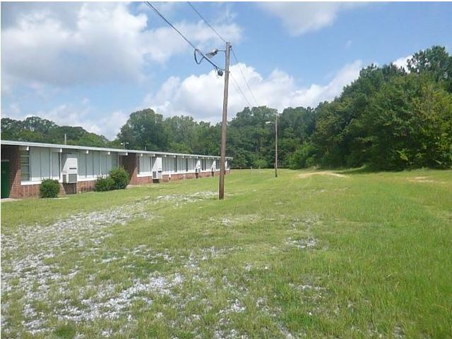
151 30Th Ave
042-011-049
NITS BK A TOM KENDRICK SUR NT 30TH AVE SCHOOL
Commercialnec
Muscogee
AE The base floodplain where base flood elevations are provided. AE Zones are now used on new format FIRMs instead of A1-A30 Zones.
Georgia
2025
4.76 AC
2025
Greater Columbus
002700
Columbus GA
17,534 SF
Columbus, GA-AL
NEARBY LISTINGS FOR SALE OR LEASE
-
-
View all Columbus listings for sale on LoopNet.com
DEMOGRAPHICS near 151 30Th Ave
1 mile
3 mile
5 mile
2025 Total Population
7,451
58,259
135,983
2030 Population
7,472
57,640
135,140
Pop Growth 2025-2030
+ 0.28%
(1.06%)
(0.62%)
Average Age
36
39
37
2025 Total Households
3,011
24,906
54,772
HH Growth 2025-2030
+ 0.53%
(0.79%)
(0.68%)
Median Household Inc
$28,882
$35,277
$40,943
Avg Household Size
2.40
2.30
2.40
2025 Avg HH Vehicles
1.00
1.00
1.00
Median Home Value
$78,153
$134,028
$145,070
Median Year Built
1968
1967
1970
Nearby Places
Map Layers
Map Styles
 Street
 Aerial
Layers
 Traffic
 Biking
Places
Listings with unknown addresses are not visible on the map
- Restaurants
- Banks
- Shops
- Fitness
- Groceries
PUBLIC TRANSPORTATION
AIRPORT
Columbus
Drive
Walk
Distance
Columbus
15 min
7.4 mi
SALE & LEASE HISTORY
LISTING DATE
SALE/LEASE

Sep 03, 2020
For Sale
Nearby Properties
Address
Land Use
TOTAL SIZE
Lot Size
Zoning
Address
Land Use
TOTAL SIZE
Lot Size
Zoning
32,750 SF
4.01 AC
Address
Land Use
TOTAL SIZE
Lot Size
Zoning
Address
Land Use
TOTAL SIZE
Lot Size
Zoning
97,648 SF
17.40 AC
Address
Land Use
TOTAL SIZE
Lot Size
Zoning
5,592 SF
13.41 AC
Address
Land Use
TOTAL SIZE
Lot Size
Zoning
56,095 SF
25.91 AC
Address
Land Use
TOTAL SIZE
Lot Size
Zoning
27,621 SF
6.33 AC
Address
Land Use
TOTAL SIZE
Lot Size
Zoning
2.31 AC
Address
Land Use
TOTAL SIZE
Lot Size
Zoning
32,238 SF
7.21 AC
Address
Land Use
TOTAL SIZE
Lot Size
Zoning
4,802 SF
22.77 AC
Address
Land Use
TOTAL SIZE
Lot Size
Zoning
31,847 SF
1.21 AC
Address
Land Use
TOTAL SIZE
Lot Size
Zoning
4,334 SF
13.29 AC
Address
Land Use
TOTAL SIZE
Lot Size
Zoning
133,276 SF
36.76 AC
Address
Land Use
TOTAL SIZE
Lot Size
Zoning
247,570 SF
28.07 AC
Address
Land Use
TOTAL SIZE
Lot Size
Zoning
1.21 AC
Address
Land Use
TOTAL SIZE
Lot Size
Zoning
34,866 SF
2.34 AC
Address
Land Use
TOTAL SIZE
Lot Size
Zoning
63.48 AC
Address
Land Use
TOTAL SIZE
Lot Size
Zoning
29,640 SF
1.11 AC
Address
Land Use
TOTAL SIZE
Lot Size
Zoning
83,295 SF
17.87 AC
Address
Land Use
TOTAL SIZE
Lot Size
Zoning
78,948 SF
6 AC
Address
Land Use
TOTAL SIZE
Lot Size
Zoning
90.59 AC
Address
Land Use
TOTAL SIZE
Lot Size
Zoning
56,775 SF
4.26 AC
Address
Land Use
TOTAL SIZE
Lot Size
Zoning
5,686 SF
17.64 AC
Address
Land Use
TOTAL SIZE
Lot Size
Zoning
48,100 SF
9 AC
Address
Land Use
TOTAL SIZE
Lot Size
Zoning
5,508 SF
61.13 AC
Address
Land Use
TOTAL SIZE
Lot Size
Zoning
4,538 SF
22.18 AC
Address
Land Use
TOTAL SIZE
Lot Size
Zoning
5,414 SF
17.11 AC
Address
Land Use
TOTAL SIZE
Lot Size
Zoning
68,746 SF
4.32 AC
Address
Land Use
TOTAL SIZE
Lot Size
Zoning
5,514 SF
15.28 AC
Address
Land Use
TOTAL SIZE
Lot Size
Zoning
32,202 SF
8.42 AC
Address
Land Use
TOTAL SIZE
Lot Size
Zoning
30,375 SF
33.14 AC
The World's #1 Commercial Real Estate Marketplace
Connect with us
© 2026 CoStar Group
The information above has been obtained from sources believed reliable. While we do not doubt its accuracy we have not verified it and make no guarantee, warranty or representation about it. It is your responsibility to independently confirm its accuracy and completeness. Any projections, opinions, assumptions, or estimates used are for example only and do not represent the current or future performance of the property. The value of this transaction to you depends on tax and other factors which should be evaluated by your tax, financial, and legal advisors. You and your advisors should conduct a careful, independent investigation of the property to determine to your satisfaction the suitability of the property for your needs.