Property Record
151 E Collins Rd, Fort Wayne, IN 46825
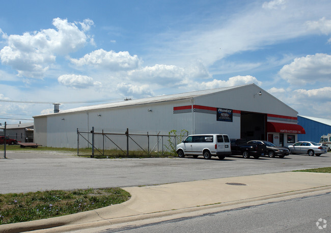


Property Detail
151 E Collins Rd
02-07-23-453-003.000-073
SPEEDWAY ADD SEC 2 BLOCK 1 E 150 OF W 461.4 FT
Vehiclerentalsvehiclesales
ALLEN
B and X Area of moderate flood hazard, usually the area between the limits of the 100-year and 500-year floods.
Indiana
2024
0.62 AC
2025
North Fort Wayne
003304
Fort Wayne
7,200 SF
Fort Wayne, IN
NEARBY LISTINGS FOR SALE OR LEASE
DEMOGRAPHICS near 151 E Collins Rd
1 mile
3 mile
5 mile
2025 Total Population
6,108
75,097
175,712
2030 Population
6,269
77,367
181,204
Pop Growth 2025-2030
+ 2.64%
+ 3.02%
+ 3.13%
Average Age
36
38
38
2025 Total Households
2,643
32,172
72,638
HH Growth 2025-2030
+ 2.91%
+ 3.20%
+ 3.27%
Median Household Inc
$47,742
$53,413
$56,009
Avg Household Size
2.20
2.20
2.30
2025 Avg HH Vehicles
2.00
2.00
2.00
Median Home Value
$153,668
$168,704
$185,925
Median Year Built
1970
1966
1970
Nearby Places
Map Layers
Map Styles
 Street
 Aerial
Transit
 Traffic
 Biking
Places
Listings with unknown addresses are not visible on the map
- Restaurants
- Banks
- Shops
- Fitness
- Groceries
PUBLIC TRANSPORTATION
AIRPORT
Fort Wayne International
Drive
Walk
Distance
Fort Wayne International
26 min
14.1 mi
Freight Ports
Port of Toledo
Drive
Walk
Distance
Port of Toledo
141 min
107.5 mi
Nearby Properties
Address
Land Use
TOTAL SIZE
Lot Size
Zoning
Address
Land Use
TOTAL SIZE
Lot Size
Zoning
460,252 SF
47.79 AC
Address
Land Use
TOTAL SIZE
Lot Size
Zoning
921,633 SF
18.04 AC
Address
Land Use
TOTAL SIZE
Lot Size
Zoning
487,059 SF
160.30 AC
Address
Land Use
TOTAL SIZE
Lot Size
Zoning
380,319 SF
430.55 AC
Address
Land Use
TOTAL SIZE
Lot Size
Zoning
510,305 SF
634.50 AC
Address
Land Use
TOTAL SIZE
Lot Size
Zoning
855,487 SF
95.76 AC
Address
Land Use
TOTAL SIZE
Lot Size
Zoning
242,556 SF
17.18 AC
Address
Land Use
TOTAL SIZE
Lot Size
Zoning
702,400 SF
37.91 AC
Address
Land Use
TOTAL SIZE
Lot Size
Zoning
129,080 SF
15.77 AC
Address
Land Use
TOTAL SIZE
Lot Size
Zoning
348,452 SF
7.97 AC
Address
Land Use
TOTAL SIZE
Lot Size
Zoning
180,657 SF
0.90 AC
Address
Land Use
TOTAL SIZE
Lot Size
Zoning
401,523 SF
273.50 AC
Address
Land Use
TOTAL SIZE
Lot Size
Zoning
303,926 SF
1,956.20 AC
Address
Land Use
TOTAL SIZE
Lot Size
Zoning
75,843 SF
254.25 AC
Address
Land Use
TOTAL SIZE
Lot Size
Zoning
342,303 SF
378.46 AC
Address
Land Use
TOTAL SIZE
Lot Size
Zoning
15,182 SF
1 AC
Address
Land Use
TOTAL SIZE
Lot Size
Zoning
126,510 SF
12.98 AC
Address
Land Use
TOTAL SIZE
Lot Size
Zoning
68,817 SF
14.72 AC
Address
Land Use
TOTAL SIZE
Lot Size
Zoning
171,655 SF
9.18 AC
Address
Land Use
TOTAL SIZE
Lot Size
Zoning
82,968 SF
7.43 AC
Address
Land Use
TOTAL SIZE
Lot Size
Zoning
171,121 SF
15.40 AC
Address
Land Use
TOTAL SIZE
Lot Size
Zoning
75,690 SF
268.40 AC
Address
Land Use
TOTAL SIZE
Lot Size
Zoning
173,019 SF
2.28 AC
Address
Land Use
TOTAL SIZE
Lot Size
Zoning
171,450 SF
3.29 AC
Address
Land Use
TOTAL SIZE
Lot Size
Zoning
295,073 SF
27.09 AC
Address
Land Use
TOTAL SIZE
Lot Size
Zoning
32,189 SF
9.65 AC
Address
Land Use
TOTAL SIZE
Lot Size
Zoning
161,200 SF
8.07 AC
Address
Land Use
TOTAL SIZE
Lot Size
Zoning
150,912 SF
4.77 AC
Address
Land Use
TOTAL SIZE
Lot Size
Zoning
222,349 SF
322.70 AC
Address
Land Use
TOTAL SIZE
Lot Size
Zoning
255,864 SF
9.21 AC
The World's #1 Commercial Real Estate Marketplace
Connect with us
© 2026 CoStar Group
The information above has been obtained from sources believed reliable. While we do not doubt its accuracy we have not verified it and make no guarantee, warranty or representation about it. It is your responsibility to independently confirm its accuracy and completeness. Any projections, opinions, assumptions, or estimates used are for example only and do not represent the current or future performance of the property. The value of this transaction to you depends on tax and other factors which should be evaluated by your tax, financial, and legal advisors. You and your advisors should conduct a careful, independent investigation of the property to determine to your satisfaction the suitability of the property for your needs.