Property Record
151 E Ohio Ave, Lake Helen, FL 32744


NEARBY LISTINGS FOR SALE OR LEASE
-
-
View all Lake Helen listings for sale on LoopNet.com
Property Detail
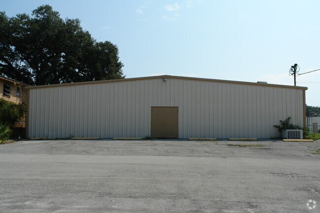
151 E Ohio Ave
7130-02-64-0010
Lake Helen
Privateschool
30-17-31 BLK 175 & N 1/2 BLK 176 LAKE HELEN MB 2 PG 93 MB 12 PG 12 & ADJ E 1/2 LAKEVIEW AVE VAC PER RES #84-4 PER OR 3738 PG 3857 PER OR 6517 PGS 2907-2910 PER OR 6526 PGS 3739-3742 PER OR 7244 PG 4144 PER OR 7618 PG 3763 PER OR 7618 PG 3828
A
Volusia
12127C0630K
Florida
2025
15.14 AC
2025
SE Volusia County
091001
Deltona/Daytona Beach
141,190 SF
Deltona-Daytona Beach-Ormond Beach, FL
DEMOGRAPHICS near 151 E Ohio Ave
1 Mile
3 Mile
5 Mile
2024 Total Population
2,362
21,413
79,001
2029 Population
2,621
23,720
87,052
Pop Growth 2024-2029
+ 10.97%
+ 10.77%
+ 10.19%
Average Age
44
44
42
2024 Total Households
957
8,117
29,695
HH Growth 2024-2029
+ 11.08%
+ 10.95%
+ 10.34%
Median Household Inc
$68,069
$72,393
$65,867
Avg Household Size
2.50
2.60
2.60
2024 Avg HH Vehicles
2.00
2.00
2.00
Median Home Value
$312,698
$281,531
$238,325
Median Year Built
1985
2000
1989
Nearby Places
Map Layers
Map Styles
 Street
 Aerial
- Restaurants
- Banks
- Shops
- Fitness
- Groceries
PUBLIC TRANSPORTATION
COMMUTER RAIL
Deland (Silver Meteor - Amtrak, Silver Star - Amtrak, SunRail - Amtrak)
DRIVE
WALK
Distance
Deland (Silver Meteor - Amtrak, Silver Star - Amtrak, SunRail - Amtrak)
19 min
9.8 mi
AIRPORT
Daytona Beach International
DRIVE
WALK
Distance
Daytona Beach International
28 min
20.7 mi
Orlando Sanford International
DRIVE
WALK
Distance
Orlando Sanford International
36 min
23.0 mi
Freight Ports
Port Canaveral
DRIVE
WALK
Distance
Port Canaveral
91 min
74.5 mi
Nearby Properties
Address
Land Use
TOTAL SIZE
Lot Size
Zoning
Address
Land Use
TOTAL SIZE
Lot Size
Zoning
204,239 SF
31.36 AC
Address
Land Use
TOTAL SIZE
Lot Size
Zoning
423,073 SF
12.48 AC
Address
Land Use
TOTAL SIZE
Lot Size
Zoning
352,859 SF
16 AC
R4C2
Address
Land Use
TOTAL SIZE
Lot Size
Zoning
339,508 SF
72.75 AC
01A3
Address
Land Use
TOTAL SIZE
Lot Size
Zoning
153,800 SF
69.32 AC
P
Address
Land Use
TOTAL SIZE
Lot Size
Zoning
33,371 SF
12.86 AC
Address
Land Use
TOTAL SIZE
Lot Size
Zoning
92,897 SF
70.05 AC
01A1
Address
Land Use
TOTAL SIZE
Lot Size
Zoning
115,145 SF
29.26 AC
A3
Address
Land Use
TOTAL SIZE
Lot Size
Zoning
100,345 SF
19.70 AC
Address
Land Use
TOTAL SIZE
Lot Size
Zoning
7,318 SF
1.90 AC
Address
Land Use
TOTAL SIZE
Lot Size
Zoning
28.62 AC
01A1
Address
Land Use
TOTAL SIZE
Lot Size
Zoning
57,885 SF
4.45 AC
Address
Land Use
TOTAL SIZE
Lot Size
Zoning
54,784 SF
0.84 AC
Address
Land Use
TOTAL SIZE
Lot Size
Zoning
65.94 AC
Address
Land Use
TOTAL SIZE
Lot Size
Zoning
28,908 SF
0.67 AC
Address
Land Use
TOTAL SIZE
Lot Size
Zoning
46.31 AC
A32
Address
Land Use
TOTAL SIZE
Lot Size
Zoning
18,262 SF
4.05 AC
01A3
Address
Land Use
TOTAL SIZE
Lot Size
Zoning
83,829 SF
9.46 AC
Address
Land Use
TOTAL SIZE
Lot Size
Zoning
50,912 SF
6.18 AC
01B
Address
Land Use
TOTAL SIZE
Lot Size
Zoning
41.03 AC
01I1
Address
Land Use
TOTAL SIZE
Lot Size
Zoning
28,131 SF
3.92 AC
Address
Land Use
TOTAL SIZE
Lot Size
Zoning
24,726 SF
2.50 AC
Address
Land Use
TOTAL SIZE
Lot Size
Zoning
90,919 SF
5.05 AC
01R4
Address
Land Use
TOTAL SIZE
Lot Size
Zoning
27.26 AC
01A1
Address
Land Use
TOTAL SIZE
Lot Size
Zoning
65,612 SF
4.80 AC
IPUD
Address
Land Use
TOTAL SIZE
Lot Size
Zoning
28.64 AC
Address
Land Use
TOTAL SIZE
Lot Size
Zoning
30 AC
01A3
Address
Land Use
TOTAL SIZE
Lot Size
Zoning
46.97 AC
Address
Land Use
TOTAL SIZE
Lot Size
Zoning
63,126 SF
8.45 AC
IPUDC
The World's #1 Commercial Real Estate Marketplace
Connect with us
© 2025 CoStar Group
The information above has been obtained from sources believed reliable. While we do not doubt its accuracy we have not verified it and make no guarantee, warranty or representation about it. It is your responsibility to independently confirm its accuracy and completeness. Any projections, opinions, assumptions, or estimates used are for example only and do not represent the current or future performance of the property. The value of this transaction to you depends on tax and other factors which should be evaluated by your tax, financial, and legal advisors. You and your advisors should conduct a careful, independent investigation of the property to determine to your satisfaction the suitability of the property for your needs.