Property Record
151 Hickory Point Rd, Hickory, KY 42051

NEARBY LISTINGS FOR SALE OR LEASE
Property Detail
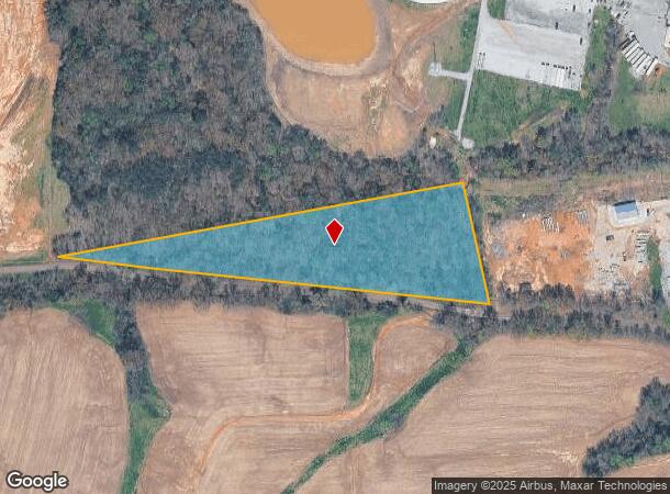
151 Hickory Point Rd
Commercialnec
5.811 ACRES (86-7)
X
Graves
21083C0150C
Kentucky
2025
5.81 AC
2025
Other Market Areas
020700
Mayfield, KY
30,000 SF
086.00.00.087.01
DEMOGRAPHICS near 151 Hickory Point Rd
1 mile
3 mile
5 mile
2024 Total Population
365
2,043
5,151
2029 Population
361
2,019
5,085
Pop Growth 2024-2029
(1.10%)
(1.17%)
(1.28%)
Average Age
41
41
41
2024 Total Households
150
837
2,073
HH Growth 2024-2029
(1.33%)
(1.08%)
(1.25%)
Median Household Inc
$68,749
$63,442
$48,505
Avg Household Size
2.40
2.40
2.40
2024 Avg HH Vehicles
2.00
2.00
2.00
Median Home Value
$153,124
$152,416
$146,742
Median Year Built
1980
1979
1978
Nearby Places
Map Layers
Map Styles
 Street
 Aerial
Transit
 Traffic
 Biking
Places
Listings with unknown addresses are not visible on the map
- Restaurants
- Banks
- Shops
- Fitness
- Groceries
SALE & LEASE HISTORY
LISTING DATE
SALE/LEASE

Mar 13, 2019
For Sale
Jan 20, 2020
For Sale
Nearby Properties
Address
Land Use
TOTAL SIZE
Lot Size
Zoning
Address
Land Use
TOTAL SIZE
Lot Size
Zoning
Address
Land Use
TOTAL SIZE
Lot Size
Zoning
47.40 AC
Address
Land Use
TOTAL SIZE
Lot Size
Zoning
34.38 AC
R
Address
Land Use
TOTAL SIZE
Lot Size
Zoning
100,000 SF
12.63 AC
R
Address
Land Use
TOTAL SIZE
Lot Size
Zoning
16,192 SF
14 AC
Address
Land Use
TOTAL SIZE
Lot Size
Zoning
10 AC
RESIDENTIA
Address
Land Use
TOTAL SIZE
Lot Size
Zoning
1,680 SF
23 AC
R
Address
Land Use
TOTAL SIZE
Lot Size
Zoning
7.67 AC
R
Address
Land Use
TOTAL SIZE
Lot Size
Zoning
2,808 SF
8.74 AC
RESIDENTIA
Address
Land Use
TOTAL SIZE
Lot Size
Zoning
6.60 AC
R
Address
Land Use
TOTAL SIZE
Lot Size
Zoning
12.03 AC
R
Address
Land Use
TOTAL SIZE
Lot Size
Zoning
187.84 AC
R
Address
Land Use
TOTAL SIZE
Lot Size
Zoning
Address
Land Use
TOTAL SIZE
Lot Size
Zoning
1,800 SF
11.57 AC
R
Address
Land Use
TOTAL SIZE
Lot Size
Zoning
Address
Land Use
TOTAL SIZE
Lot Size
Zoning
Address
Land Use
TOTAL SIZE
Lot Size
Zoning
1,176 SF
17.90 AC
R
Address
Land Use
TOTAL SIZE
Lot Size
Zoning
8,000 SF
0.83 AC
R
Address
Land Use
TOTAL SIZE
Lot Size
Zoning
63 AC
R
Address
Land Use
TOTAL SIZE
Lot Size
Zoning
9.50 AC
Address
Land Use
TOTAL SIZE
Lot Size
Zoning
3.25 AC
RESIDENTIA
Address
Land Use
TOTAL SIZE
Lot Size
Zoning
4,160 SF
2.14 AC
Address
Land Use
TOTAL SIZE
Lot Size
Zoning
74,400 SF
7.99 AC
Address
Land Use
TOTAL SIZE
Lot Size
Zoning
4,960 SF
1.65 AC
R
Address
Land Use
TOTAL SIZE
Lot Size
Zoning
8,400 SF
1.59 AC
R
Address
Land Use
TOTAL SIZE
Lot Size
Zoning
1,560 SF
1.11 AC
R
Address
Land Use
TOTAL SIZE
Lot Size
Zoning
2,302,403 SF
41.61 AC
R
Address
Land Use
TOTAL SIZE
Lot Size
Zoning
4,571 SF
2.60 AC
R
Address
Land Use
TOTAL SIZE
Lot Size
Zoning
15,000 SF
8 AC
R
Address
Land Use
TOTAL SIZE
Lot Size
Zoning
The World's #1 Commercial Real Estate Marketplace
Connect with us
© 2026 CoStar Group
The information above has been obtained from sources believed reliable. While we do not doubt its accuracy we have not verified it and make no guarantee, warranty or representation about it. It is your responsibility to independently confirm its accuracy and completeness. Any projections, opinions, assumptions, or estimates used are for example only and do not represent the current or future performance of the property. The value of this transaction to you depends on tax and other factors which should be evaluated by your tax, financial, and legal advisors. You and your advisors should conduct a careful, independent investigation of the property to determine to your satisfaction the suitability of the property for your needs.