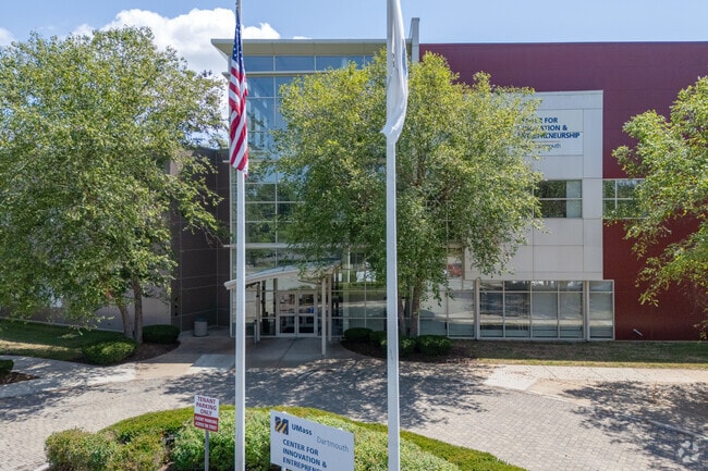
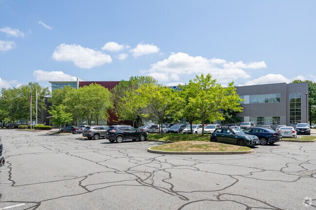
Property Record
151 Martine St, Fall River, MA 02723

Property Detail
151 Martine St
FALL-000025J-000000-000002
Bristol
Publicschool
Massachusetts
MBD
2
A Areas with a 1% annual chance of flooding and a 26% chance of flooding over the life of a 30-year mortgage.
3.83 AC
0
Attleboro/New Bedford
2025
Boston
640800
Providence-Warwick, RI-MA
60,358 SF
NEARBY LISTINGS FOR SALE OR LEASE
DEMOGRAPHICS near 151 Martine St
1 mile
3 mile
5 mile
2025 Total Population
10,885
89,194
126,838
2030 Population
11,072
90,453
128,331
Pop Growth 2025-2030
+ 1.72%
+ 1.41%
+ 1.18%
Average Age
40
40
42
2025 Total Households
4,983
39,000
54,478
HH Growth 2025-2030
+ 1.77%
+ 1.50%
+ 1.29%
Median Household Inc
$39,601
$53,208
$64,157
Avg Household Size
2.10
2.20
2.30
2025 Avg HH Vehicles
1.00
1.00
2.00
Median Home Value
$380,583
$396,945
$414,345
Median Year Built
1948
1948
1950
Nearby Places
Map Layers
Map Styles
 Street
 Aerial
Layers
 Traffic
 Biking
Places
Listings with unknown addresses are not visible on the map
- Restaurants
- Banks
- Shops
- Fitness
- Groceries
PUBLIC TRANSPORTATION
AIRPORT
Rhode Island Tf Green International
Drive
Walk
Distance
Rhode Island Tf Green International
40 min
26.0 mi
Freight Ports
Port of New Bedford Harbor
Drive
Walk
Distance
Port of New Bedford Harbor
19 min
12.9 mi
Nearby Properties
Address
Land Use
TOTAL SIZE
Lot Size
Zoning
Address
Land Use
TOTAL SIZE
Lot Size
Zoning
634,182 SF
63.86 AC
N/A
Address
Land Use
TOTAL SIZE
Lot Size
Zoning
203,989 SF
2.01 AC
A-2
Address
Land Use
TOTAL SIZE
Lot Size
Zoning
73,957 SF
46.62 AC
CO
Address
Land Use
TOTAL SIZE
Lot Size
Zoning
183,732 SF
5.50 AC
IND
Address
Land Use
TOTAL SIZE
Lot Size
Zoning
14.30 AC
G
Address
Land Use
TOTAL SIZE
Lot Size
Zoning
212,639 SF
22.75 AC
S
Address
Land Use
TOTAL SIZE
Lot Size
Zoning
6.16 AC
B-L
Address
Land Use
TOTAL SIZE
Lot Size
Zoning
118,979 SF
6.65 AC
M
Address
Land Use
TOTAL SIZE
Lot Size
Zoning
90.84 AC
N/A
Address
Land Use
TOTAL SIZE
Lot Size
Zoning
140,946 SF
8.24 AC
S
Address
Land Use
TOTAL SIZE
Lot Size
Zoning
132,666 SF
18.97 AC
IND
Address
Land Use
TOTAL SIZE
Lot Size
Zoning
16.08 AC
N/A
Address
Land Use
TOTAL SIZE
Lot Size
Zoning
107,441 SF
2.10 AC
N/A
Address
Land Use
TOTAL SIZE
Lot Size
Zoning
113,643 SF
4.95 AC
R-4
Address
Land Use
TOTAL SIZE
Lot Size
Zoning
559.70 AC
S
Address
Land Use
TOTAL SIZE
Lot Size
Zoning
116,036 SF
2.43 AC
R-4
Address
Land Use
TOTAL SIZE
Lot Size
Zoning
78,883 SF
40.99 AC
N/A
Address
Land Use
TOTAL SIZE
Lot Size
Zoning
136,622 SF
55.54 AC
S
Address
Land Use
TOTAL SIZE
Lot Size
Zoning
126,146 SF
1.18 AC
A-2
Address
Land Use
TOTAL SIZE
Lot Size
Zoning
3,016 SF
16.79 AC
M
Address
Land Use
TOTAL SIZE
Lot Size
Zoning
85,692 SF
4.05 AC
S
Address
Land Use
TOTAL SIZE
Lot Size
Zoning
177,051 SF
3.13 AC
CBD
Address
Land Use
TOTAL SIZE
Lot Size
Zoning
194,181 SF
3.40 AC
Address
Land Use
TOTAL SIZE
Lot Size
Zoning
160,234 SF
2.98 AC
CBD
Address
Land Use
TOTAL SIZE
Lot Size
Zoning
11.17 AC
MBD
Address
Land Use
TOTAL SIZE
Lot Size
Zoning
153,134 SF
14.57 AC
IND
Address
Land Use
TOTAL SIZE
Lot Size
Zoning
75,736 SF
1.39 AC
B-L
Address
Land Use
TOTAL SIZE
Lot Size
Zoning
22.36 AC
B-N
Address
Land Use
TOTAL SIZE
Lot Size
Zoning
131,086 SF
2.29 AC
CBD
Address
Land Use
TOTAL SIZE
Lot Size
Zoning
119,932 SF
4.79 AC
G
The World's #1 Commercial Real Estate Marketplace
Connect with us
© 2026 CoStar Group
The information above has been obtained from sources believed reliable. While we do not doubt its accuracy we have not verified it and make no guarantee, warranty or representation about it. It is your responsibility to independently confirm its accuracy and completeness. Any projections, opinions, assumptions, or estimates used are for example only and do not represent the current or future performance of the property. The value of this transaction to you depends on tax and other factors which should be evaluated by your tax, financial, and legal advisors. You and your advisors should conduct a careful, independent investigation of the property to determine to your satisfaction the suitability of the property for your needs.