Property Record
151 Quarrystone Cir, Cary, NC 27519
NEARBY LISTINGS FOR SALE OR LEASE
Property Detail
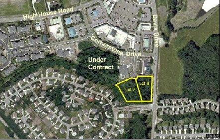
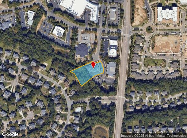
151 Quarrystone Cir
0744.03-41-9378-000
Quarrystone Circle Land Condominium
Officebuilding
QUARRYSTONE CIRCLE LAND CONDOMINIUM UNA
X
Wake
3720074400K
North Carolina
0
1.04 AC
2025
Cary
053425
Raleigh/Durham
5,760 SF
Raleigh, NC
DEMOGRAPHICS near 151 Quarrystone Cir
1 Mile
3 Mile
5 Mile
2024 Total Population
11,710
87,267
218,516
2029 Population
12,571
94,522
237,971
Pop Growth 2024-2029
+ 7.35%
+ 8.31%
+ 8.90%
Average Age
41
39
38
2024 Total Households
4,074
32,121
81,448
HH Growth 2024-2029
+ 7.34%
+ 8.25%
+ 8.90%
Median Household Inc
$163,563
$133,063
$121,392
Avg Household Size
2.90
2.70
2.60
2024 Avg HH Vehicles
2.00
2.00
2.00
Median Home Value
$470,250
$452,946
$441,782
Median Year Built
1996
1998
2000
Nearby Places
- Restaurants
- Banks
- Shops
- Fitness
- Groceries
PUBLIC TRANSPORTATION
COMMUTER RAIL
Cary Station (Piedmont - North Carolina by Train (NC Train))
DRIVE
WALK
Distance
Cary Station (Piedmont - North Carolina by Train (NC Train))
9 min
4.5 mi
AIRPORT
Raleigh-Durham International
DRIVE
WALK
Distance
Raleigh-Durham International
18 min
8.7 mi
Nearby Properties
Address
Land Use
TOTAL SIZE
Lot Size
Zoning
Address
Land Use
TOTAL SIZE
Lot Size
Zoning
517,812 SF
18.51 AC
RMFP
Address
Land Use
TOTAL SIZE
Lot Size
Zoning
534,604 SF
16.38 AC
RMFM
Address
Land Use
TOTAL SIZE
Lot Size
Zoning
429,107 SF
13.67 AC
RMFP
Address
Land Use
TOTAL SIZE
Lot Size
Zoning
453,970 SF
41.48 AC
RMF-C
Address
Land Use
TOTAL SIZE
Lot Size
Zoning
414,214 SF
11.23 AC
OIP
Address
Land Use
TOTAL SIZE
Lot Size
Zoning
444,236 SF
8.51 AC
ORDP
Address
Land Use
TOTAL SIZE
Lot Size
Zoning
269,702 SF
14.66 AC
GCM
Address
Land Use
TOTAL SIZE
Lot Size
Zoning
280,706 SF
15.38 AC
PUD-C
Address
Land Use
TOTAL SIZE
Lot Size
Zoning
368,195 SF
32.11 AC
HDR
Address
Land Use
TOTAL SIZE
Lot Size
Zoning
323,036 SF
30.09 AC
RMF-C
Address
Land Use
TOTAL SIZE
Lot Size
Zoning
263,023 SF
72.48 AC
R40
Address
Land Use
TOTAL SIZE
Lot Size
Zoning
394,181 SF
28.62 AC
HDR
Address
Land Use
TOTAL SIZE
Lot Size
Zoning
263,094 SF
36.79 AC
ORD
Address
Land Use
TOTAL SIZE
Lot Size
Zoning
295,946 SF
15.35 AC
RMFM
Address
Land Use
TOTAL SIZE
Lot Size
Zoning
364,972 SF
35.18 AC
RMF-C
Address
Land Use
TOTAL SIZE
Lot Size
Zoning
282,961 SF
5.59 AC
GCP
Address
Land Use
TOTAL SIZE
Lot Size
Zoning
358,853 SF
16.94 AC
RMFP
Address
Land Use
TOTAL SIZE
Lot Size
Zoning
273,637 SF
19.57 AC
C-NAC
Address
Land Use
TOTAL SIZE
Lot Size
Zoning
294,088 SF
24.72 AC
RMF-C
Address
Land Use
TOTAL SIZE
Lot Size
Zoning
287,626 SF
14.61 AC
MUPD
Address
Land Use
TOTAL SIZE
Lot Size
Zoning
198,055 SF
16.62 AC
TRM
Address
Land Use
TOTAL SIZE
Lot Size
Zoning
285,822 SF
24.57 AC
RMFP
Address
Land Use
TOTAL SIZE
Lot Size
Zoning
208,446 SF
9.39 AC
RMFP
Address
Land Use
TOTAL SIZE
Lot Size
Zoning
209,936 SF
55.26 AC
R8
Address
Land Use
TOTAL SIZE
Lot Size
Zoning
236,374 SF
20.53 AC
HDR
Address
Land Use
TOTAL SIZE
Lot Size
Zoning
145,001 SF
20.31 AC
PC-CZ
Address
Land Use
TOTAL SIZE
Lot Size
Zoning
191,865 SF
8.12 AC
NAC
Address
Land Use
TOTAL SIZE
Lot Size
Zoning
190,473 SF
6.46 AC
GCP
Address
Land Use
TOTAL SIZE
Lot Size
Zoning
225,296 SF
9.57 AC
PUD-C
Address
Land Use
TOTAL SIZE
Lot Size
Zoning
170,284 SF
8.64 AC
OIP
The World's #1 Commercial Real Estate Marketplace
Connect with us
© 2025 CoStar Group
The information above has been obtained from sources believed reliable. While we do not doubt its accuracy we have not verified it and make no guarantee, warranty or representation about it. It is your responsibility to independently confirm its accuracy and completeness. Any projections, opinions, assumptions, or estimates used are for example only and do not represent the current or future performance of the property. The value of this transaction to you depends on tax and other factors which should be evaluated by your tax, financial, and legal advisors. You and your advisors should conduct a careful, independent investigation of the property to determine to your satisfaction the suitability of the property for your needs.