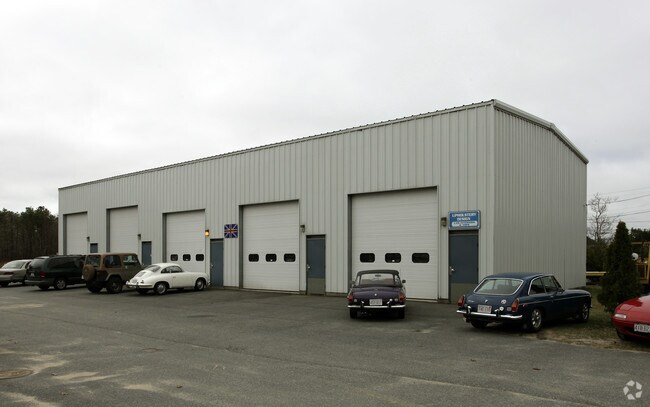
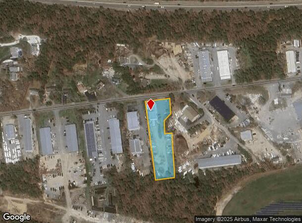
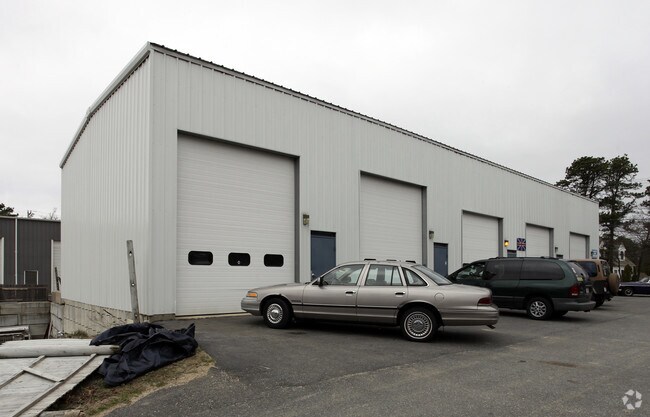
Property Record
151 Queen Anne Rd, Harwich, MA 02645
NEARBY LISTINGS FOR SALE OR LEASE
-
-
View all Harwich listings for sale on LoopNet.com
Property Detail
151 Queen Anne Rd
Commercialbuilding
Barnstable
X
Massachusetts
25001C0603J
1.41 AC
2025
Other Market Areas
2025
Barnstable Town, MA
011002
HARW-000057-000000-G000003-000010
4,000 SF
DEMOGRAPHICS near 151 Queen Anne Rd
1 Mile
3 Mile
5 Mile
2024 Total Population
1,435
16,527
43,132
2029 Population
1,459
17,262
44,979
Pop Growth 2024-2029
+ 1.67%
+ 4.45%
+ 4.28%
Average Age
48
51
52
2024 Total Households
558
7,854
20,532
HH Growth 2024-2029
+ 1.43%
+ 4.51%
+ 4.23%
Median Household Inc
$76,889
$71,730
$77,793
Avg Household Size
2.40
2.00
2.00
2024 Avg HH Vehicles
2.00
2.00
2.00
Median Home Value
$479,604
$550,688
$532,192
Median Year Built
1983
1974
1974
Nearby Places
Map Layers
Map Styles
 Street
 Aerial
- Restaurants
- Banks
- Shops
- Fitness
- Groceries
PUBLIC TRANSPORTATION
AIRPORT
Nantucket Memorial
DRIVE
WALK
Distance
Nantucket Memorial
168 min
43.8 mi
Freight Ports
Port of New Bedford Harbor
DRIVE
WALK
Distance
Port of New Bedford Harbor
83 min
58.3 mi
Nearby Properties
Address
Land Use
TOTAL SIZE
Lot Size
Zoning
Address
Land Use
TOTAL SIZE
Lot Size
Zoning
49.58 AC
E
Address
Land Use
TOTAL SIZE
Lot Size
Zoning
13.34 AC
E
Address
Land Use
TOTAL SIZE
Lot Size
Zoning
138,804 SF
15.94 AC
Address
Land Use
TOTAL SIZE
Lot Size
Zoning
2,117 SF
Address
Land Use
TOTAL SIZE
Lot Size
Zoning
7.03 AC
Address
Land Use
TOTAL SIZE
Lot Size
Zoning
184.82 AC
E
Address
Land Use
TOTAL SIZE
Lot Size
Zoning
12.93 AC
R
Address
Land Use
TOTAL SIZE
Lot Size
Zoning
83,860 SF
9.96 AC
RESD.
Address
Land Use
TOTAL SIZE
Lot Size
Zoning
3,200 SF
142.32 AC
E
Address
Land Use
TOTAL SIZE
Lot Size
Zoning
3.58 AC
R
Address
Land Use
TOTAL SIZE
Lot Size
Zoning
3,480 SF
22.78 AC
E
Address
Land Use
TOTAL SIZE
Lot Size
Zoning
Address
Land Use
TOTAL SIZE
Lot Size
Zoning
153.96 AC
E
Address
Land Use
TOTAL SIZE
Lot Size
Zoning
4.88 AC
E
Address
Land Use
TOTAL SIZE
Lot Size
Zoning
59,054 SF
9.53 AC
R
Address
Land Use
TOTAL SIZE
Lot Size
Zoning
1.52 AC
R
Address
Land Use
TOTAL SIZE
Lot Size
Zoning
Address
Land Use
TOTAL SIZE
Lot Size
Zoning
2,003 SF
1.57 AC
R
Address
Land Use
TOTAL SIZE
Lot Size
Zoning
0.78 AC
R
Address
Land Use
TOTAL SIZE
Lot Size
Zoning
6,276 SF
0.80 AC
R
Address
Land Use
TOTAL SIZE
Lot Size
Zoning
0.80 AC
R
Address
Land Use
TOTAL SIZE
Lot Size
Zoning
9.77 AC
Address
Land Use
TOTAL SIZE
Lot Size
Zoning
14.54 AC
Address
Land Use
TOTAL SIZE
Lot Size
Zoning
45.75 AC
R
Address
Land Use
TOTAL SIZE
Lot Size
Zoning
0.41 AC
R
Address
Land Use
TOTAL SIZE
Lot Size
Zoning
1.55 AC
R
Address
Land Use
TOTAL SIZE
Lot Size
Zoning
26,948 SF
Address
Land Use
TOTAL SIZE
Lot Size
Zoning
1.03 AC
R
Address
Land Use
TOTAL SIZE
Lot Size
Zoning
4,744 SF
0.44 AC
R
Address
Land Use
TOTAL SIZE
Lot Size
Zoning
38,518 SF
5.09 AC
The World's #1 Commercial Real Estate Marketplace
Connect with us
© 2025 CoStar Group
The information above has been obtained from sources believed reliable. While we do not doubt its accuracy we have not verified it and make no guarantee, warranty or representation about it. It is your responsibility to independently confirm its accuracy and completeness. Any projections, opinions, assumptions, or estimates used are for example only and do not represent the current or future performance of the property. The value of this transaction to you depends on tax and other factors which should be evaluated by your tax, financial, and legal advisors. You and your advisors should conduct a careful, independent investigation of the property to determine to your satisfaction the suitability of the property for your needs.