Property Record
107 Royal Oaks Ln, Lexington, SC 29072
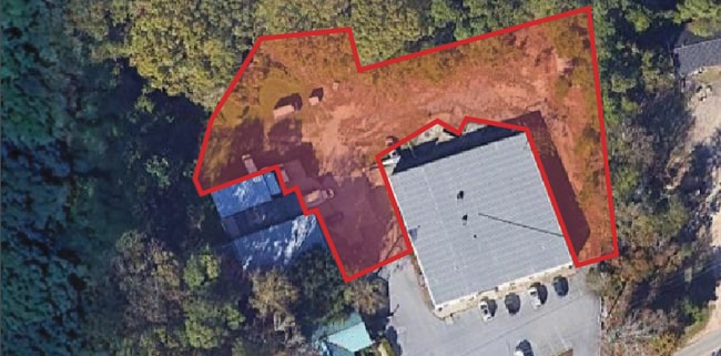
Property Detail
107 Royal Oaks Ln
003698-03-065
LOT 4 & PART OF LOT 2
Publicstorage
LEXINGTON
ID
South Carolina
B and X Area of moderate flood hazard, usually the area between the limits of the 100-year and 500-year floods.
4-2
2025
2 AC
2024
Lexington
020506
Columbia
2,376 SF
Columbia, SC
NEARBY LISTINGS FOR SALE OR LEASE
DEMOGRAPHICS near 107 Royal Oaks Ln
1 mile
3 mile
5 mile
2025 Total Population
2,989
42,157
127,329
2030 Population
3,156
44,116
132,270
Pop Growth 2025-2030
+ 5.59%
+ 4.65%
+ 3.88%
Average Age
41
40
40
2025 Total Households
1,220
17,844
53,809
HH Growth 2025-2030
+ 5.82%
+ 4.83%
+ 4.17%
Median Household Inc
$98,912
$72,994
$63,701
Avg Household Size
2.40
2.30
2.20
2025 Avg HH Vehicles
2.00
2.00
2.00
Median Home Value
$268,598
$257,589
$226,662
Median Year Built
1993
1984
1983
Nearby Places
Map Layers
Map Styles
 Street
 Aerial
Layers
 Traffic
 Biking
Places
Listings with unknown addresses are not visible on the map
- Restaurants
- Banks
- Shops
- Fitness
- Groceries
PUBLIC TRANSPORTATION
COMMUTER RAIL
Columbia Amtrak Station (Silver Star - Amtrak)
Drive
Walk
Distance
Columbia Amtrak Station (Silver Star - Amtrak)
14 min
7.7 mi
AIRPORT
Columbia Metro
Drive
Walk
Distance
Columbia Metro
23 min
11.0 mi
Freight Ports
North Charleston Terminal
Drive
Walk
Distance
North Charleston Terminal
122 min
107.3 mi
Nearby Properties
Address
Land Use
TOTAL SIZE
Lot Size
Zoning
Address
Land Use
TOTAL SIZE
Lot Size
Zoning
128,160 SF
9.31 AC
RM-HD
Address
Land Use
TOTAL SIZE
Lot Size
Zoning
183,392 SF
14.77 AC
RM-HD
Address
Land Use
TOTAL SIZE
Lot Size
Zoning
129,108 SF
11.90 AC
RM-HD
Address
Land Use
TOTAL SIZE
Lot Size
Zoning
89,376 SF
6.85 AC
CAC
Address
Land Use
TOTAL SIZE
Lot Size
Zoning
44,296 SF
14.01 AC
GC
Address
Land Use
TOTAL SIZE
Lot Size
Zoning
82,874 SF
6.99 AC
GC
Address
Land Use
TOTAL SIZE
Lot Size
Zoning
78,288 SF
5.14 AC
GC
Address
Land Use
TOTAL SIZE
Lot Size
Zoning
107,578 SF
10.32 AC
RM-HD
Address
Land Use
TOTAL SIZE
Lot Size
Zoning
208,016 SF
14.28 AC
GC
Address
Land Use
TOTAL SIZE
Lot Size
Zoning
70,000 SF
11.32 AC
LI
Address
Land Use
TOTAL SIZE
Lot Size
Zoning
42,072 SF
2.01 AC
GC
Address
Land Use
TOTAL SIZE
Lot Size
Zoning
12,325 SF
3.29 AC
OI
Address
Land Use
TOTAL SIZE
Lot Size
Zoning
77,016 SF
5.05 AC
GC
Address
Land Use
TOTAL SIZE
Lot Size
Zoning
131,078 SF
12.55 AC
RM-HD
Address
Land Use
TOTAL SIZE
Lot Size
Zoning
36,369 SF
4.97 AC
OI
Address
Land Use
TOTAL SIZE
Lot Size
Zoning
70,713 SF
8.64 AC
GC
Address
Land Use
TOTAL SIZE
Lot Size
Zoning
58,664 SF
6.01 AC
Address
Land Use
TOTAL SIZE
Lot Size
Zoning
21,475 SF
4.97 AC
GC
Address
Land Use
TOTAL SIZE
Lot Size
Zoning
40,544 SF
3.50 AC
RM-HD
Address
Land Use
TOTAL SIZE
Lot Size
Zoning
61,180 SF
5.85 AC
RM-HD
Address
Land Use
TOTAL SIZE
Lot Size
Zoning
10,200 SF
1.73 AC
GC
Address
Land Use
TOTAL SIZE
Lot Size
Zoning
60,085 SF
2.35 AC
GC
Address
Land Use
TOTAL SIZE
Lot Size
Zoning
52,802 SF
2.25 AC
GC
Address
Land Use
TOTAL SIZE
Lot Size
Zoning
34,841 SF
2.01 AC
GC
Address
Land Use
TOTAL SIZE
Lot Size
Zoning
17,055 SF
2.25 AC
GC
Address
Land Use
TOTAL SIZE
Lot Size
Zoning
35,312 SF
4.54 AC
CAC
Address
Land Use
TOTAL SIZE
Lot Size
Zoning
8,330 SF
19.10 AC
ID
Address
Land Use
TOTAL SIZE
Lot Size
Zoning
15,160 SF
1.64 AC
O-I
Address
Land Use
TOTAL SIZE
Lot Size
Zoning
4,547 SF
1.63 AC
OI
Address
Land Use
TOTAL SIZE
Lot Size
Zoning
8,240 SF
1.05 AC
CAC
The World's #1 Commercial Real Estate Marketplace
Connect with us
© 2026 CoStar Group
The information above has been obtained from sources believed reliable. While we do not doubt its accuracy we have not verified it and make no guarantee, warranty or representation about it. It is your responsibility to independently confirm its accuracy and completeness. Any projections, opinions, assumptions, or estimates used are for example only and do not represent the current or future performance of the property. The value of this transaction to you depends on tax and other factors which should be evaluated by your tax, financial, and legal advisors. You and your advisors should conduct a careful, independent investigation of the property to determine to your satisfaction the suitability of the property for your needs.