Property Record
151 S 7Th St, Macclenny, FL 32063
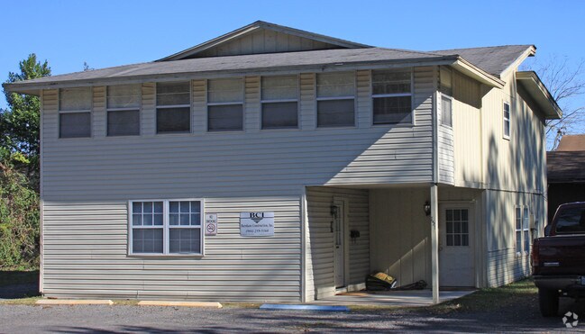

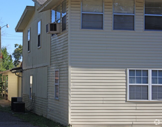
Property Detail
151 S 7Th St
Jacksonville, FL
LEG 000066 ACRES A LOT IN THE NW 1/4 OF BLK 43 TOWN OF MACCLENNY DB D PG 800 DESC IN OR 2010-5143 & (LESS OR 2012-0095) & OR 2015-6066 & OR 2015-6067
32-2S-22-0049-0043-0060
Baker
Officebuilding
Florida
B and X Area of moderate flood hazard, usually the area between the limits of the 100-year and 500-year floods.
144
2025
0.66 AC
2025
Baker County
040102
Jacksonville (Florida)
2,388 SF
NEARBY LISTINGS FOR SALE OR LEASE
DEMOGRAPHICS near 151 S 7Th St
1 mile
3 mile
5 mile
2025 Total Population
7,227
15,407
18,978
2030 Population
7,932
16,727
20,553
Pop Growth 2025-2030
+ 9.76%
+ 8.57%
+ 8.30%
Average Age
38
39
39
2025 Total Households
2,502
5,392
6,612
HH Growth 2025-2030
+ 10.23%
+ 8.83%
+ 8.61%
Median Household Inc
$65,072
$71,884
$73,685
Avg Household Size
2.80
2.80
2.80
2025 Avg HH Vehicles
2.00
2.00
2.00
Median Home Value
$253,700
$260,105
$265,618
Median Year Built
1990
1991
1992
Nearby Places
Map Layers
Map Styles
 Street
 Aerial
Layers
 Traffic
 Biking
Places
Listings with unknown addresses are not visible on the map
- Restaurants
- Banks
- Shops
- Fitness
- Groceries
PUBLIC TRANSPORTATION
AIRPORT
Jacksonville International
Drive
Walk
Distance
Jacksonville International
53 min
39.5 mi
Freight Ports
Jacksonville Port
Drive
Walk
Distance
Jacksonville Port
44 min
33.3 mi
Nearby Properties
Address
Land Use
TOTAL SIZE
Lot Size
Zoning
Address
Land Use
TOTAL SIZE
Lot Size
Zoning
866,822 SF
123.04 AC
Address
Land Use
TOTAL SIZE
Lot Size
Zoning
100,000 SF
70.13 AC
Address
Land Use
TOTAL SIZE
Lot Size
Zoning
123,102 SF
70.72 AC
Address
Land Use
TOTAL SIZE
Lot Size
Zoning
100,000 SF
27.17 AC
Address
Land Use
TOTAL SIZE
Lot Size
Zoning
67,000 SF
20 AC
Address
Land Use
TOTAL SIZE
Lot Size
Zoning
160,877 SF
26.94 AC
Address
Land Use
TOTAL SIZE
Lot Size
Zoning
52,920 SF
9.51 AC
Address
Land Use
TOTAL SIZE
Lot Size
Zoning
65,821 SF
2.50 AC
Address
Land Use
TOTAL SIZE
Lot Size
Zoning
49,892 SF
2.58 AC
Address
Land Use
TOTAL SIZE
Lot Size
Zoning
70,998 SF
6.89 AC
Address
Land Use
TOTAL SIZE
Lot Size
Zoning
43,429 SF
6.85 AC
Address
Land Use
TOTAL SIZE
Lot Size
Zoning
6,200 SF
25.96 AC
Address
Land Use
TOTAL SIZE
Lot Size
Zoning
59,035 SF
3.90 AC
Address
Land Use
TOTAL SIZE
Lot Size
Zoning
33,512 SF
3.14 AC
Address
Land Use
TOTAL SIZE
Lot Size
Zoning
93,924 SF
26.81 AC
Address
Land Use
TOTAL SIZE
Lot Size
Zoning
29,512 SF
5.60 AC
Address
Land Use
TOTAL SIZE
Lot Size
Zoning
41,157 SF
7.60 AC
Address
Land Use
TOTAL SIZE
Lot Size
Zoning
38,674 SF
4.58 AC
Address
Land Use
TOTAL SIZE
Lot Size
Zoning
29,625 SF
12.63 AC
Address
Land Use
TOTAL SIZE
Lot Size
Zoning
23,400 SF
2.32 AC
Address
Land Use
TOTAL SIZE
Lot Size
Zoning
43,546 SF
16.62 AC
Address
Land Use
TOTAL SIZE
Lot Size
Zoning
3,360 SF
16.77 AC
Address
Land Use
TOTAL SIZE
Lot Size
Zoning
32,911 SF
3.60 AC
Address
Land Use
TOTAL SIZE
Lot Size
Zoning
13,387 SF
1.82 AC
Address
Land Use
TOTAL SIZE
Lot Size
Zoning
24,518 SF
3.01 AC
Address
Land Use
TOTAL SIZE
Lot Size
Zoning
13,094 SF
1.85 AC
Address
Land Use
TOTAL SIZE
Lot Size
Zoning
3,872 SF
131.02 AC
Address
Land Use
TOTAL SIZE
Lot Size
Zoning
18.86 AC
Address
Land Use
TOTAL SIZE
Lot Size
Zoning
10,000 SF
11 AC
Address
Land Use
TOTAL SIZE
Lot Size
Zoning
11,799 SF
1.44 AC
The World's #1 Commercial Real Estate Marketplace
Connect with us
© 2026 CoStar Group
The information above has been obtained from sources believed reliable. While we do not doubt its accuracy we have not verified it and make no guarantee, warranty or representation about it. It is your responsibility to independently confirm its accuracy and completeness. Any projections, opinions, assumptions, or estimates used are for example only and do not represent the current or future performance of the property. The value of this transaction to you depends on tax and other factors which should be evaluated by your tax, financial, and legal advisors. You and your advisors should conduct a careful, independent investigation of the property to determine to your satisfaction the suitability of the property for your needs.