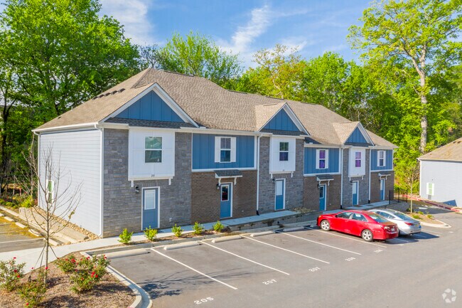
Property Record
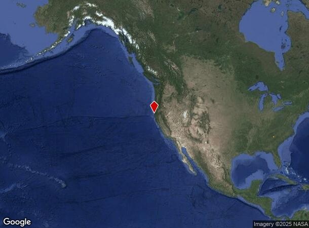
1510 Claire Ct, Eureka, CA 95501

NEARBY LISTINGS FOR SALE OR LEASE
-
-
View all Eureka listings for sale on LoopNet.com
Property Detail
1510 Claire Ct
4044-18-42-8488
As Built Survey For Dorothy L Dobson
Residentialacreage
OAK CRESTE OF CLEMSON CONDOS, COMMON AREA PLAT 609/233
X
Pickens
45007C0090E
South Carolina
2024
2.18 AC
2024
Southwest Pickens County
011205
Greenville/Spartanburg
40,774 SF
Greenville-Anderson-Greer, SC
DEMOGRAPHICS near 1510 Claire Ct
1 Mile
3 Mile
5 Mile
2024 Total Population
4,896
21,876
42,737
2029 Population
5,075
22,369
44,337
Pop Growth 2024-2029
+ 3.66%
+ 2.25%
+ 3.74%
Average Age
30
32
35
2024 Total Households
1,619
7,404
16,483
HH Growth 2024-2029
+ 4.01%
+ 2.49%
+ 4.15%
Median Household Inc
$31,666
$38,155
$40,414
Avg Household Size
2.40
2.30
2.30
2024 Avg HH Vehicles
2.00
2.00
2.00
Median Home Value
$336,702
$279,039
$233,458
Median Year Built
1985
1988
1990
Nearby Places
Map Layers
Map Styles
 Street
 Aerial
- Restaurants
- Banks
- Shops
- Fitness
- Groceries
PUBLIC TRANSPORTATION
AIRPORT
California Redwood Coast-Humboldt County
DRIVE
WALK
Distance
California Redwood Coast-Humboldt County
25 min
17.0 mi
Freight Ports
Port of Coos Bay, OR
DRIVE
WALK
Distance
Port of Coos Bay, OR
292 min
217.0 mi
SALE & LEASE HISTORY
LISTING DATE
SALE/LEASE

Mar 23, 2022
For Sale
Nearby Properties
Address
Land Use
TOTAL SIZE
Lot Size
Zoning
Address
Land Use
TOTAL SIZE
Lot Size
Zoning
8.22 AC
HM,RS-6000
Address
Land Use
TOTAL SIZE
Lot Size
Zoning
126,563 SF
10.81 AC
CS
Address
Land Use
TOTAL SIZE
Lot Size
Zoning
10.57 AC
R-1
Address
Land Use
TOTAL SIZE
Lot Size
Zoning
45,840 SF
21.83 AC
MG
Address
Land Use
TOTAL SIZE
Lot Size
Zoning
9.39 AC
MG
Address
Land Use
TOTAL SIZE
Lot Size
Zoning
3.96 AC
RM-1000,NR
Address
Land Use
TOTAL SIZE
Lot Size
Zoning
11.29 AC
P
Address
Land Use
TOTAL SIZE
Lot Size
Zoning
2.11 AC
RM-1000
Address
Land Use
TOTAL SIZE
Lot Size
Zoning
3.72 AC
C-1/GO
Address
Land Use
TOTAL SIZE
Lot Size
Zoning
4.65 AC
HM
Address
Land Use
TOTAL SIZE
Lot Size
Zoning
1.19 AC
C-1-Q
Address
Land Use
TOTAL SIZE
Lot Size
Zoning
7.14 AC
CS
Address
Land Use
TOTAL SIZE
Lot Size
Zoning
1.86 AC
CS
Address
Land Use
TOTAL SIZE
Lot Size
Zoning
6.75 AC
CP
Address
Land Use
TOTAL SIZE
Lot Size
Zoning
7.64 AC
CP
Address
Land Use
TOTAL SIZE
Lot Size
Zoning
0.61 AC
Address
Land Use
TOTAL SIZE
Lot Size
Zoning
2.06 AC
R-4*;RM-30
Address
Land Use
TOTAL SIZE
Lot Size
Zoning
5.59 AC
NR,CP
Address
Land Use
TOTAL SIZE
Lot Size
Zoning
18.36 AC
MC/A
Address
Land Use
TOTAL SIZE
Lot Size
Zoning
41,346 SF
0.32 AC
Address
Land Use
TOTAL SIZE
Lot Size
Zoning
7,148 SF
0.46 AC
OR-AR
Address
Land Use
TOTAL SIZE
Lot Size
Zoning
55,552 SF
7.98 AC
A,AC,CS-PD
Address
Land Use
TOTAL SIZE
Lot Size
Zoning
26,829 SF
2.47 AC
C-1
Address
Land Use
TOTAL SIZE
Lot Size
Zoning
4.70 AC
MC
Address
Land Use
TOTAL SIZE
Lot Size
Zoning
0.62 AC
RM-1000
Address
Land Use
TOTAL SIZE
Lot Size
Zoning
0.45 AC
CC-LW
The World's #1 Commercial Real Estate Marketplace
Connect with us
© 2026 CoStar Group
The information above has been obtained from sources believed reliable. While we do not doubt its accuracy we have not verified it and make no guarantee, warranty or representation about it. It is your responsibility to independently confirm its accuracy and completeness. Any projections, opinions, assumptions, or estimates used are for example only and do not represent the current or future performance of the property. The value of this transaction to you depends on tax and other factors which should be evaluated by your tax, financial, and legal advisors. You and your advisors should conduct a careful, independent investigation of the property to determine to your satisfaction the suitability of the property for your needs.