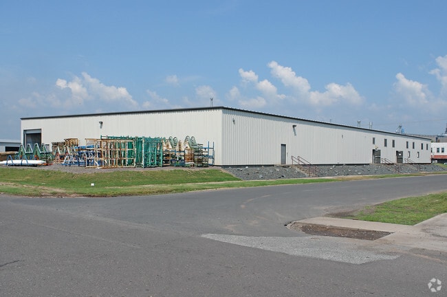
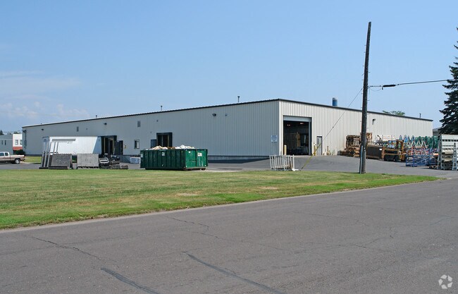
Property Record
1510 N 5Th St, Superior, WI 54880
NEARBY LISTINGS FOR SALE OR LEASE
Property Detail
1510 N 5Th St
Duluth, MN-WI
WEST SUPERIOR FIRST DIVISION LOTS 1 THROUGH 28, BLK 41 & ALLEY VACATED
04-804-00390-00
Douglas
Industrialgeneral
Wisconsin
X
1
27137C3880E
2.41 AC
2024
Superior
2024
Duluth
021100
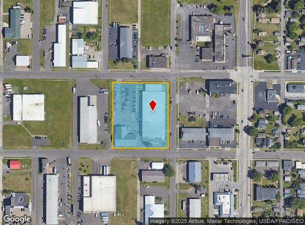
DEMOGRAPHICS near 1510 N 5Th St
1 Mile
3 Mile
5 Mile
2024 Total Population
4,978
26,138
59,475
2029 Population
4,937
25,813
58,699
Pop Growth 2024-2029
(0.82%)
(1.24%)
(1.30%)
Average Age
38
39
39
2024 Total Households
2,485
11,644
27,245
HH Growth 2024-2029
(0.89%)
(1.31%)
(1.33%)
Median Household Inc
$32,377
$47,275
$48,594
Avg Household Size
1.90
2.10
2.00
2024 Avg HH Vehicles
1.00
2.00
2.00
Median Home Value
$77,753
$151,371
$160,741
Median Year Built
1949
1949
1949
Nearby Places
Map Layers
Map Styles
 Street
 Aerial
- Restaurants
- Banks
- Shops
- Fitness
- Groceries
PUBLIC TRANSPORTATION
AIRPORT
Duluth International
DRIVE
WALK
Distance
Duluth International
26 min
12.2 mi
Nearby Properties
Address
Land Use
TOTAL SIZE
Lot Size
Zoning
Address
Land Use
TOTAL SIZE
Lot Size
Zoning
175 AC
W1
Address
Land Use
TOTAL SIZE
Lot Size
Zoning
2.81 AC
PDD
Address
Land Use
TOTAL SIZE
Lot Size
Zoning
1.45 AC
C3
Address
Land Use
TOTAL SIZE
Lot Size
Zoning
107,796 SF
9.19 AC
Address
Land Use
TOTAL SIZE
Lot Size
Zoning
68,296 SF
0.38 AC
Address
Land Use
TOTAL SIZE
Lot Size
Zoning
135.91 AC
M2
Address
Land Use
TOTAL SIZE
Lot Size
Zoning
1.36 AC
C2
Address
Land Use
TOTAL SIZE
Lot Size
Zoning
21.96 AC
Address
Land Use
TOTAL SIZE
Lot Size
Zoning
1,200 SF
10.74 AC
Address
Land Use
TOTAL SIZE
Lot Size
Zoning
5,392 SF
24.92 AC
Address
Land Use
TOTAL SIZE
Lot Size
Zoning
4.17 AC
C2
Address
Land Use
TOTAL SIZE
Lot Size
Zoning
8.50 AC
W1
Address
Land Use
TOTAL SIZE
Lot Size
Zoning
28.37 AC
W1
Address
Land Use
TOTAL SIZE
Lot Size
Zoning
2.47 AC
C2
Address
Land Use
TOTAL SIZE
Lot Size
Zoning
71,967 SF
0.16 AC
Address
Land Use
TOTAL SIZE
Lot Size
Zoning
24,389 SF
1.68 AC
Address
Land Use
TOTAL SIZE
Lot Size
Zoning
52.06 AC
M2
Address
Land Use
TOTAL SIZE
Lot Size
Zoning
557,127 SF
37 AC
Address
Land Use
TOTAL SIZE
Lot Size
Zoning
185,313 SF
Address
Land Use
TOTAL SIZE
Lot Size
Zoning
96,000 SF
1.35 AC
Address
Land Use
TOTAL SIZE
Lot Size
Zoning
2 AC
R3
Address
Land Use
TOTAL SIZE
Lot Size
Zoning
92,040 SF
2.18 AC
C2
Address
Land Use
TOTAL SIZE
Lot Size
Zoning
72,748 SF
5.23 AC
R3
Address
Land Use
TOTAL SIZE
Lot Size
Zoning
169,373 SF
6.54 AC
Address
Land Use
TOTAL SIZE
Lot Size
Zoning
6.01 AC
M2
Address
Land Use
TOTAL SIZE
Lot Size
Zoning
0.68 AC
R3
Address
Land Use
TOTAL SIZE
Lot Size
Zoning
2.44 AC
C2
Address
Land Use
TOTAL SIZE
Lot Size
Zoning
20.01 AC
Address
Land Use
TOTAL SIZE
Lot Size
Zoning
1.63 AC
The World's #1 Commercial Real Estate Marketplace
Connect with us
© 2025 CoStar Group
The information above has been obtained from sources believed reliable. While we do not doubt its accuracy we have not verified it and make no guarantee, warranty or representation about it. It is your responsibility to independently confirm its accuracy and completeness. Any projections, opinions, assumptions, or estimates used are for example only and do not represent the current or future performance of the property. The value of this transaction to you depends on tax and other factors which should be evaluated by your tax, financial, and legal advisors. You and your advisors should conduct a careful, independent investigation of the property to determine to your satisfaction the suitability of the property for your needs.