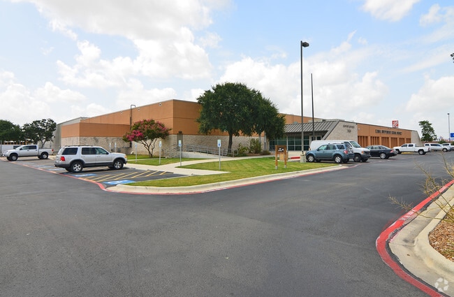
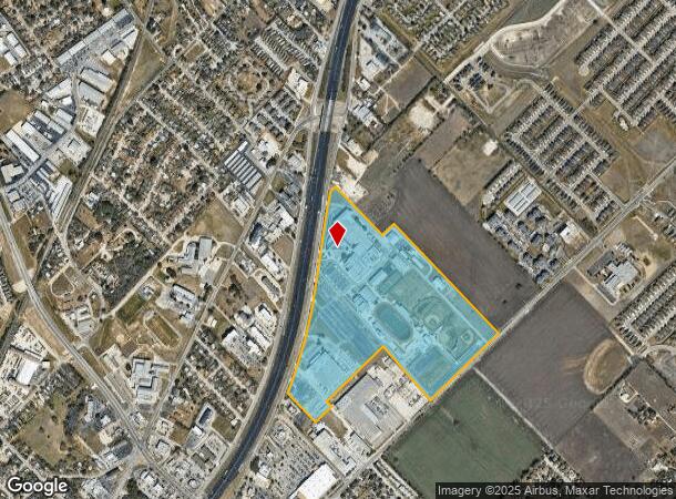
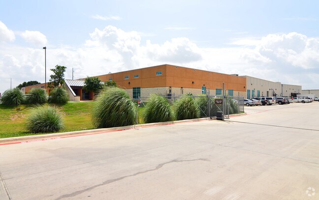
Property Record
1510 N Interstate 35 N, New Braunfels, TX 78130
NEARBY LISTINGS FOR SALE OR LEASE
Property Detail
1510 N Interstate 35 N
San Antonio-New Braunfels, TX
Industry
25-0200-0003-00
INDUSTRY, LOT 3V
Commercialnec
Comal
X
Texas
48091C0455G
3v
0
82.50 AC
2025
Comal County
310502
San Antonio
381,528 SF
DEMOGRAPHICS near 1510 N Interstate 35 N
1 Mile
3 Mile
5 Mile
2024 Total Population
9,721
62,057
117,535
2029 Population
13,401
82,993
154,856
Pop Growth 2024-2029
+ 37.86%
+ 33.74%
+ 31.75%
Average Age
35
38
38
2024 Total Households
3,631
24,290
44,340
HH Growth 2024-2029
+ 37.73%
+ 34.34%
+ 32.38%
Median Household Inc
$81,275
$81,730
$83,343
Avg Household Size
2.50
2.50
2.60
2024 Avg HH Vehicles
2.00
2.00
2.00
Median Home Value
$218,100
$265,022
$276,032
Median Year Built
2004
2002
2005
Nearby Places
Map Layers
Map Styles
 Street
 Aerial
- Restaurants
- Banks
- Shops
- Fitness
- Groceries
PUBLIC TRANSPORTATION
AIRPORT
San Antonio International
DRIVE
WALK
Distance
San Antonio International
35 min
29.1 mi
Freight Ports
Calhoun Port
DRIVE
WALK
Distance
Calhoun Port
169 min
144.1 mi
Nearby Properties
Address
Land Use
TOTAL SIZE
Lot Size
Zoning
Address
Land Use
TOTAL SIZE
Lot Size
Zoning
111.44 AC
Address
Land Use
TOTAL SIZE
Lot Size
Zoning
396,438 SF
55.62 AC
Address
Land Use
TOTAL SIZE
Lot Size
Zoning
458,447 SF
19 AC
Address
Land Use
TOTAL SIZE
Lot Size
Zoning
350,595 SF
21.78 AC
Address
Land Use
TOTAL SIZE
Lot Size
Zoning
331,273 SF
14.02 AC
Address
Land Use
TOTAL SIZE
Lot Size
Zoning
464,934 SF
12.95 AC
Address
Land Use
TOTAL SIZE
Lot Size
Zoning
538,760 SF
21.01 AC
Address
Land Use
TOTAL SIZE
Lot Size
Zoning
292,822 SF
12.29 AC
Address
Land Use
TOTAL SIZE
Lot Size
Zoning
248,377 SF
23.66 AC
Address
Land Use
TOTAL SIZE
Lot Size
Zoning
352,688 SF
23.58 AC
Address
Land Use
TOTAL SIZE
Lot Size
Zoning
Address
Land Use
TOTAL SIZE
Lot Size
Zoning
414,220 SF
11.56 AC
Address
Land Use
TOTAL SIZE
Lot Size
Zoning
314,265 SF
10.10 AC
Address
Land Use
TOTAL SIZE
Lot Size
Zoning
48,548 SF
125 AC
Address
Land Use
TOTAL SIZE
Lot Size
Zoning
271,410 SF
13.13 AC
Address
Land Use
TOTAL SIZE
Lot Size
Zoning
319,423 SF
14.59 AC
Address
Land Use
TOTAL SIZE
Lot Size
Zoning
170,266 SF
16.78 AC
Address
Land Use
TOTAL SIZE
Lot Size
Zoning
304,441 SF
17.46 AC
Address
Land Use
TOTAL SIZE
Lot Size
Zoning
261,155 SF
11.57 AC
Address
Land Use
TOTAL SIZE
Lot Size
Zoning
269,288 SF
16.32 AC
Address
Land Use
TOTAL SIZE
Lot Size
Zoning
Address
Land Use
TOTAL SIZE
Lot Size
Zoning
146,400 SF
17.36 AC
Address
Land Use
TOTAL SIZE
Lot Size
Zoning
103,782 SF
105.82 AC
Address
Land Use
TOTAL SIZE
Lot Size
Zoning
282,995 SF
21.83 AC
Address
Land Use
TOTAL SIZE
Lot Size
Zoning
238,683 SF
9.42 AC
Address
Land Use
TOTAL SIZE
Lot Size
Zoning
257,960 SF
8.85 AC
Address
Land Use
TOTAL SIZE
Lot Size
Zoning
186,838 SF
14.53 AC
Address
Land Use
TOTAL SIZE
Lot Size
Zoning
145,856 SF
9.52 AC
Address
Land Use
TOTAL SIZE
Lot Size
Zoning
163,226 SF
29.14 AC
The World's #1 Commercial Real Estate Marketplace
Connect with us
© 2025 CoStar Group
The information above has been obtained from sources believed reliable. While we do not doubt its accuracy we have not verified it and make no guarantee, warranty or representation about it. It is your responsibility to independently confirm its accuracy and completeness. Any projections, opinions, assumptions, or estimates used are for example only and do not represent the current or future performance of the property. The value of this transaction to you depends on tax and other factors which should be evaluated by your tax, financial, and legal advisors. You and your advisors should conduct a careful, independent investigation of the property to determine to your satisfaction the suitability of the property for your needs.