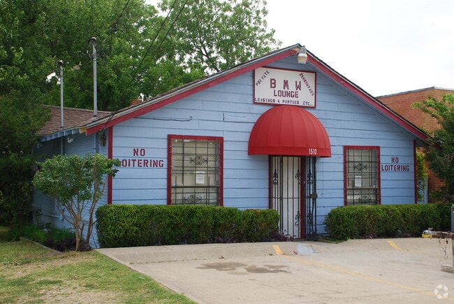
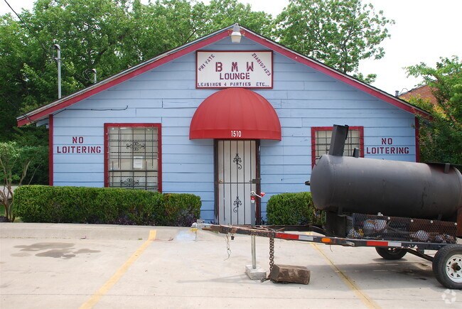
Property Record
1510 S Ewing Ave, Dallas, TX 75216


Property Detail
1510 S Ewing Ave
Dallas-Fort Worth-Arlington, TX
GLENWOOD AMENDED BLK 20/3746 LT 3 INT202500036051 DD01292025 CO-DC 3746 020 00300 2DA3746 020
00000286576000000
DALLAS
Storebuilding
Texas
B and X Area of moderate flood hazard, usually the area between the limits of the 100-year and 500-year floods.
3
2024
0.17 AC
2025
SW Dallas County
021000
Dallas/Ft Worth
2,488 SF
NEARBY LISTINGS FOR SALE OR LEASE
DEMOGRAPHICS near 1510 S Ewing Ave
1 mile
3 mile
5 mile
2025 Total Population
17,106
132,250
341,697
2030 Population
17,680
137,272
355,322
Pop Growth 2025-2030
+ 3.36%
+ 3.80%
+ 3.99%
Average Age
37
36
37
2025 Total Households
5,422
44,742
130,291
HH Growth 2025-2030
+ 3.38%
+ 3.99%
+ 4.39%
Median Household Inc
$52,670
$55,215
$64,129
Avg Household Size
3.10
2.80
2.50
2025 Avg HH Vehicles
2.00
2.00
2.00
Median Home Value
$225,789
$249,299
$254,117
Median Year Built
1956
1958
1974
Nearby Places
Map Layers
Map Styles
 Street
 Aerial
Layers
 Traffic
 Biking
Places
Listings with unknown addresses are not visible on the map
- Restaurants
- Banks
- Shops
- Fitness
- Groceries
PUBLIC TRANSPORTATION
TRANSIT/SUBWAY
Illinois (Blue Line - Dallas Area Rapid Transit (DART))
Drive
Walk
Distance
Illinois (Blue Line - Dallas Area Rapid Transit (DART))
3 min
13 min
0.7 mi
Dallas Zoo (Red Line - Dallas Area Rapid Transit (DART))
Drive
Walk
Distance
Dallas Zoo (Red Line - Dallas Area Rapid Transit (DART))
2 min
17 min
0.9 mi
COMMUTER RAIL
Drive
Walk
Distance
8 min
4.5 mi
Drive
Walk
Distance
12 min
7.1 mi
AIRPORT
Dallas Love Field
Drive
Walk
Distance
Dallas Love Field
18 min
9.5 mi
Dallas-Fort Worth International
Drive
Walk
Distance
Dallas-Fort Worth International
32 min
23.7 mi
SALE & LEASE HISTORY
LISTING DATE
SALE/LEASE

Jun 06, 2018
For Sale
Nearby Properties
Address
Land Use
TOTAL SIZE
Lot Size
Zoning
Address
Land Use
TOTAL SIZE
Lot Size
Zoning
1,298,826 SF
33.16 AC
Z163
Address
Land Use
TOTAL SIZE
Lot Size
Zoning
271,956 SF
23.18 AC
Z298
Address
Land Use
TOTAL SIZE
Lot Size
Zoning
26,896 SF
3.56 AC
Z239
Address
Land Use
TOTAL SIZE
Lot Size
Zoning
179,370 SF
13.18 AC
Z248
Address
Land Use
TOTAL SIZE
Lot Size
Zoning
419,729 SF
3.62 AC
Z115
Address
Land Use
TOTAL SIZE
Lot Size
Zoning
381,448 SF
19.99 AC
Z151
Address
Land Use
TOTAL SIZE
Lot Size
Zoning
513,833 SF
0.17 AC
Z59
Address
Land Use
TOTAL SIZE
Lot Size
Zoning
512,628 SF
2.72 AC
Z239
Address
Land Use
TOTAL SIZE
Lot Size
Zoning
290,902 SF
13.90 AC
Z151
Address
Land Use
TOTAL SIZE
Lot Size
Zoning
404,722 SF
3.72 AC
Z239
Address
Land Use
TOTAL SIZE
Lot Size
Zoning
428,759 SF
16.39 AC
Z239
Address
Land Use
TOTAL SIZE
Lot Size
Zoning
343,006 SF
0.53 AC
Z239
Address
Land Use
TOTAL SIZE
Lot Size
Zoning
223,496 SF
3.94 AC
Z164
Address
Land Use
TOTAL SIZE
Lot Size
Zoning
423,864 SF
3.56 AC
Z164
Address
Land Use
TOTAL SIZE
Lot Size
Zoning
8,727 SF
28.76 AC
Z298
Address
Land Use
TOTAL SIZE
Lot Size
Zoning
73,708 SF
1.82 AC
Z239
Address
Land Use
TOTAL SIZE
Lot Size
Zoning
13.95 AC
Z115
Address
Land Use
TOTAL SIZE
Lot Size
Zoning
260,602 SF
6.64 AC
Address
Land Use
TOTAL SIZE
Lot Size
Zoning
333,215 SF
3.04 AC
Address
Land Use
TOTAL SIZE
Lot Size
Zoning
473,025 SF
3.92 AC
Z239
Address
Land Use
TOTAL SIZE
Lot Size
Zoning
400,492 SF
2.26 AC
Z239
Address
Land Use
TOTAL SIZE
Lot Size
Zoning
337,587 SF
0.16 AC
Z297
Address
Land Use
TOTAL SIZE
Lot Size
Zoning
286,203 SF
1.37 AC
Z239
Address
Land Use
TOTAL SIZE
Lot Size
Zoning
358,714 SF
2.85 AC
Z151
Address
Land Use
TOTAL SIZE
Lot Size
Zoning
141,588 SF
20.33 AC
Z46
Address
Land Use
TOTAL SIZE
Lot Size
Zoning
532,726 SF
64.28 AC
Z248
Address
Land Use
TOTAL SIZE
Lot Size
Zoning
291,174 SF
9.49 AC
Z239
Address
Land Use
TOTAL SIZE
Lot Size
Zoning
395,982 SF
3.21 AC
Z239
Address
Land Use
TOTAL SIZE
Lot Size
Zoning
556,046 SF
2.23 AC
Z239
Address
Land Use
TOTAL SIZE
Lot Size
Zoning
236,300 SF
4.76 AC
Z239
The World's #1 Commercial Real Estate Marketplace
Connect with us
© 2026 CoStar Group
The information above has been obtained from sources believed reliable. While we do not doubt its accuracy we have not verified it and make no guarantee, warranty or representation about it. It is your responsibility to independently confirm its accuracy and completeness. Any projections, opinions, assumptions, or estimates used are for example only and do not represent the current or future performance of the property. The value of this transaction to you depends on tax and other factors which should be evaluated by your tax, financial, and legal advisors. You and your advisors should conduct a careful, independent investigation of the property to determine to your satisfaction the suitability of the property for your needs.