Property Record
1511 Central St, Bethany, MO 64424
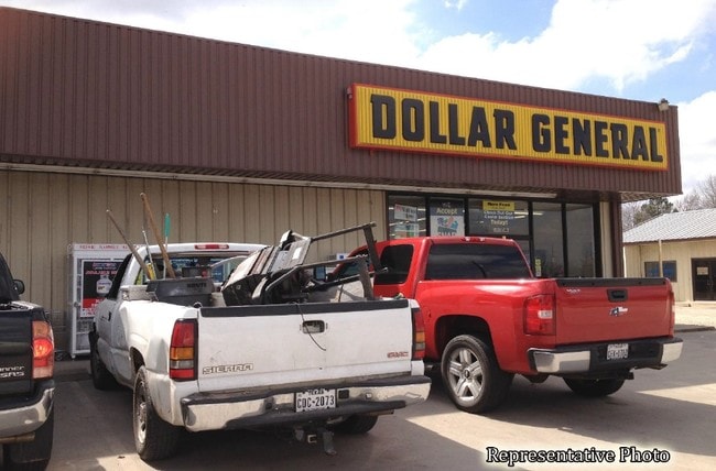


Property Detail
1511 Central St
19-2.0-10-4-07-6
1ST SURVEY, E 24.75' OF LOT 6 & ALL OF LOT 7, BLK 3
Storebuilding
Harrison
B and X Area of moderate flood hazard, usually the area between the limits of the 100-year and 500-year floods.
Missouri
2025
6-7
2025
0.16 AC
950300
Missouri North Area
6,696 SF
Other Market Areas
NEARBY LISTINGS FOR SALE OR LEASE
DEMOGRAPHICS near 1511 Central St
1 mile
3 mile
5 mile
2025 Total Population
2,369
3,083
3,528
2030 Population
2,363
3,066
3,509
Pop Growth 2025-2030
(0.25%)
(0.55%)
(0.54%)
Average Age
42
43
43
2025 Total Households
1,043
1,356
1,526
HH Growth 2025-2030
(0.29%)
(0.59%)
(0.59%)
Median Household Inc
$51,696
$51,277
$51,797
Avg Household Size
2.10
2.10
2.20
2025 Avg HH Vehicles
2.00
2.00
2.00
Median Home Value
$142,091
$143,292
$147,472
Median Year Built
1966
1966
1966
Nearby Places
Map Layers
Map Styles
 Street
 Aerial
Transit
 Traffic
 Biking
Places
Listings with unknown addresses are not visible on the map
- Restaurants
- Banks
- Shops
- Fitness
- Groceries
SALE & LEASE HISTORY
LISTING DATE
SALE/LEASE

Jul 07, 2020
For Sale
Dec 13, 2016
For Sale
Aug 25, 2017
For Lease
Nearby Properties
Address
Land Use
TOTAL SIZE
Lot Size
Zoning
Address
Land Use
TOTAL SIZE
Lot Size
Zoning
99,581 SF
8 AC
Address
Land Use
TOTAL SIZE
Lot Size
Zoning
8,040 SF
6.90 AC
Address
Land Use
TOTAL SIZE
Lot Size
Zoning
48,000 SF
9.80 AC
Address
Land Use
TOTAL SIZE
Lot Size
Zoning
5,676 SF
3.70 AC
Address
Land Use
TOTAL SIZE
Lot Size
Zoning
4,632 SF
2.10 AC
Address
Land Use
TOTAL SIZE
Lot Size
Zoning
5,250 SF
12.78 AC
Address
Land Use
TOTAL SIZE
Lot Size
Zoning
17,570 SF
7.60 AC
Address
Land Use
TOTAL SIZE
Lot Size
Zoning
10,246 SF
2.65 AC
Address
Land Use
TOTAL SIZE
Lot Size
Zoning
3,192 SF
0.86 AC
Address
Land Use
TOTAL SIZE
Lot Size
Zoning
18,708 SF
3.50 AC
Address
Land Use
TOTAL SIZE
Lot Size
Zoning
25,902 SF
1 AC
Address
Land Use
TOTAL SIZE
Lot Size
Zoning
40,626 SF
2.70 AC
Address
Land Use
TOTAL SIZE
Lot Size
Zoning
7,159 SF
1.60 AC
Address
Land Use
TOTAL SIZE
Lot Size
Zoning
42,973 SF
7.90 AC
Address
Land Use
TOTAL SIZE
Lot Size
Zoning
1,260 SF
17.56 AC
Address
Land Use
TOTAL SIZE
Lot Size
Zoning
4,613 SF
0.74 AC
Address
Land Use
TOTAL SIZE
Lot Size
Zoning
4,164 SF
0.43 AC
Address
Land Use
TOTAL SIZE
Lot Size
Zoning
24,000 SF
4.81 AC
Address
Land Use
TOTAL SIZE
Lot Size
Zoning
8,989 SF
1 AC
Address
Land Use
TOTAL SIZE
Lot Size
Zoning
3,080 SF
1.10 AC
Address
Land Use
TOTAL SIZE
Lot Size
Zoning
20,063 SF
3.50 AC
Address
Land Use
TOTAL SIZE
Lot Size
Zoning
12,288 SF
2.90 AC
Address
Land Use
TOTAL SIZE
Lot Size
Zoning
9,520 SF
1.85 AC
Address
Land Use
TOTAL SIZE
Lot Size
Zoning
3,422 SF
135.60 AC
Address
Land Use
TOTAL SIZE
Lot Size
Zoning
7,396 SF
0.91 AC
Address
Land Use
TOTAL SIZE
Lot Size
Zoning
4,000 SF
4.20 AC
Address
Land Use
TOTAL SIZE
Lot Size
Zoning
4,080 SF
1.22 AC
Address
Land Use
TOTAL SIZE
Lot Size
Zoning
6,160 SF
5.12 AC
Address
Land Use
TOTAL SIZE
Lot Size
Zoning
28,536 SF
5.90 AC
Address
Land Use
TOTAL SIZE
Lot Size
Zoning
7,440 SF
2.23 AC
The World's #1 Commercial Real Estate Marketplace
Connect with us
© 2026 CoStar Group
The information above has been obtained from sources believed reliable. While we do not doubt its accuracy we have not verified it and make no guarantee, warranty or representation about it. It is your responsibility to independently confirm its accuracy and completeness. Any projections, opinions, assumptions, or estimates used are for example only and do not represent the current or future performance of the property. The value of this transaction to you depends on tax and other factors which should be evaluated by your tax, financial, and legal advisors. You and your advisors should conduct a careful, independent investigation of the property to determine to your satisfaction the suitability of the property for your needs.