Property Record
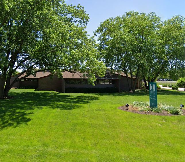
1511 N Blackhawk Blvd, Rockton, IL 61072


NEARBY LISTINGS FOR SALE OR LEASE
Property Detail
1511 N Blackhawk Blvd
04-18-101-001
BEGN 88.72 FT E OF NW COR SEC 18-46-2TH E 128.38 FT TH SWLY 446.50 FT TH W264.28 FT TO ELY R/W OF BLACKHAWK BLVDTH NELY 315.75 FT TO CURVE TH NELY 19
Officebuilding
Winnebago
X
Illinois
17201C0131E
2 AC
2024
I-39 Corr/Winnebago Cnty
2024
Chicago
004002
Rockford, IL
DEMOGRAPHICS near 1511 N Blackhawk Blvd
1 Mile
3 Mile
5 Mile
2024 Total Population
4,144
33,475
64,812
2029 Population
4,068
33,313
64,697
Pop Growth 2024-2029
(1.83%)
(0.48%)
(0.18%)
Average Age
40
39
39
2024 Total Households
1,707
12,785
24,680
HH Growth 2024-2029
(1.82%)
(0.43%)
(0.13%)
Median Household Inc
$63,726
$64,844
$66,287
Avg Household Size
2.40
2.50
2.50
2024 Avg HH Vehicles
2.00
2.00
2.00
Median Home Value
$144,513
$143,639
$150,884
Median Year Built
1984
1972
1970
Nearby Places
Map Layers
Map Styles
 Street
 Aerial
- Restaurants
- Banks
- Shops
- Fitness
- Groceries
PUBLIC TRANSPORTATION
AIRPORT
Chicago/Rockford International
DRIVE
WALK
Distance
Chicago/Rockford International
43 min
23.4 mi
Freight Ports
Port Milwaukee
DRIVE
WALK
Distance
Port Milwaukee
94 min
78.0 mi
SALE & LEASE HISTORY
LISTING DATE
SALE/LEASE

Jul 28, 2022
For Sale
Aug 04, 2022
For Sale
Nearby Properties
Address
Land Use
TOTAL SIZE
Lot Size
Zoning
Address
Land Use
TOTAL SIZE
Lot Size
Zoning
202,676 SF
16.36 AC
Address
Land Use
TOTAL SIZE
Lot Size
Zoning
0.84 AC
Address
Land Use
TOTAL SIZE
Lot Size
Zoning
33.53 AC
Address
Land Use
TOTAL SIZE
Lot Size
Zoning
121.46 AC
Address
Land Use
TOTAL SIZE
Lot Size
Zoning
131,218 SF
1.65 AC
Address
Land Use
TOTAL SIZE
Lot Size
Zoning
48,036 SF
1.26 AC
Address
Land Use
TOTAL SIZE
Lot Size
Zoning
52,026 SF
1.99 AC
Address
Land Use
TOTAL SIZE
Lot Size
Zoning
47,561 SF
0.58 AC
Address
Land Use
TOTAL SIZE
Lot Size
Zoning
57,745 SF
9.24 AC
Address
Land Use
TOTAL SIZE
Lot Size
Zoning
66,654 SF
1.63 AC
Address
Land Use
TOTAL SIZE
Lot Size
Zoning
23,715 SF
1.61 AC
Address
Land Use
TOTAL SIZE
Lot Size
Zoning
66.74 AC
Address
Land Use
TOTAL SIZE
Lot Size
Zoning
0.39 AC
Address
Land Use
TOTAL SIZE
Lot Size
Zoning
38,644 SF
0.98 AC
Address
Land Use
TOTAL SIZE
Lot Size
Zoning
6.03 AC
Address
Land Use
TOTAL SIZE
Lot Size
Zoning
14,440 SF
1.72 AC
Address
Land Use
TOTAL SIZE
Lot Size
Zoning
8 AC
CN - COMM
Address
Land Use
TOTAL SIZE
Lot Size
Zoning
Address
Land Use
TOTAL SIZE
Lot Size
Zoning
12.78 AC
Address
Land Use
TOTAL SIZE
Lot Size
Zoning
29,488 SF
2.05 AC
Address
Land Use
TOTAL SIZE
Lot Size
Zoning
32,433 SF
0.29 AC
Address
Land Use
TOTAL SIZE
Lot Size
Zoning
31,920 SF
0.68 AC
Address
Land Use
TOTAL SIZE
Lot Size
Zoning
18,548 SF
1.54 AC
Address
Land Use
TOTAL SIZE
Lot Size
Zoning
34,903 SF
2.08 AC
Address
Land Use
TOTAL SIZE
Lot Size
Zoning
Address
Land Use
TOTAL SIZE
Lot Size
Zoning
20,835 SF
0.66 AC
Address
Land Use
TOTAL SIZE
Lot Size
Zoning
17,327 SF
1.75 AC
Address
Land Use
TOTAL SIZE
Lot Size
Zoning
40,749 SF
1.25 AC
Address
Land Use
TOTAL SIZE
Lot Size
Zoning
37,396 SF
0.77 AC
Address
Land Use
TOTAL SIZE
Lot Size
Zoning
218,074 SF
39.93 AC
IG GENERAL
The World's #1 Commercial Real Estate Marketplace
Connect with us
© 2026 CoStar Group
The information above has been obtained from sources believed reliable. While we do not doubt its accuracy we have not verified it and make no guarantee, warranty or representation about it. It is your responsibility to independently confirm its accuracy and completeness. Any projections, opinions, assumptions, or estimates used are for example only and do not represent the current or future performance of the property. The value of this transaction to you depends on tax and other factors which should be evaluated by your tax, financial, and legal advisors. You and your advisors should conduct a careful, independent investigation of the property to determine to your satisfaction the suitability of the property for your needs.