Property Record
1511 N Project Dr, Tempe, AZ 85288
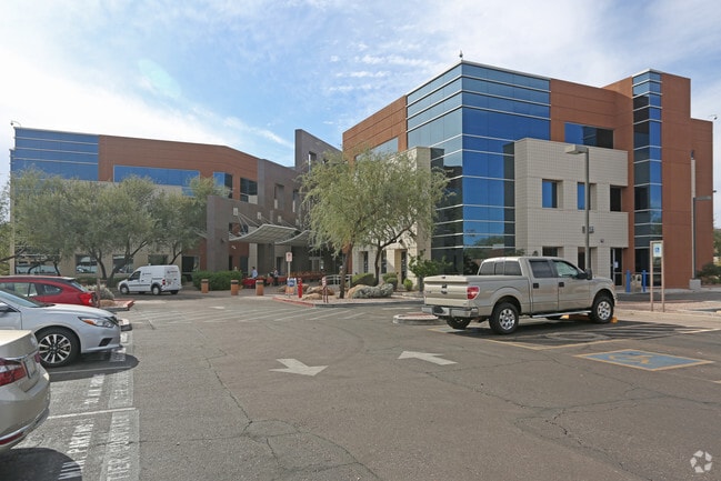


Property Detail
1511 N Project Dr
Phoenix-Mesa-Chandler, AZ
LOT 7 PT N2 NE4 & LOT 8 PT N2 NW4 EX ANY PT RD LY WI/IN P/F 00-190215
124-19-005A
Maricopa
Utilities
Arizona
I-1
7,8
C and X Area of minimal flood hazard, usually depicted on FIRMs as above the 500-year flood level.
8.65 AC
0
Tempe
2025
Phoenix
320100
NEARBY LISTINGS FOR SALE OR LEASE
DEMOGRAPHICS near 1511 N Project Dr
1 mile
3 mile
5 mile
2025 Total Population
3,773
121,231
350,742
2030 Population
4,077
127,214
366,627
Pop Growth 2025-2030
+ 8.06%
+ 4.94%
+ 4.53%
Average Age
34
34
36
2025 Total Households
2,156
52,346
151,568
HH Growth 2025-2030
+ 8.44%
+ 5.38%
+ 4.87%
Median Household Inc
$75,097
$68,760
$73,807
Avg Household Size
1.70
2.10
2.20
2025 Avg HH Vehicles
2.00
2.00
2.00
Median Home Value
$373,683
$509,967
$489,203
Median Year Built
1996
1985
1980
Nearby Places
Map Layers
Map Styles
 Street
 Aerial
Layers
 Traffic
 Biking
Places
Listings with unknown addresses are not visible on the map
- Restaurants
- Banks
- Shops
- Fitness
- Groceries
PUBLIC TRANSPORTATION
TRANSIT/SUBWAY
Priest Dr/Washington St (METRO Light Rail - Valley Metro (Phoenix Light Rail))
Drive
Walk
Distance
Priest Dr/Washington St (METRO Light Rail - Valley Metro (Phoenix Light Rail))
0 min
5 min
0.3 mi
Center Pkwy/Washington (METRO Light Rail - Valley Metro (Phoenix Light Rail))
Drive
Walk
Distance
Center Pkwy/Washington (METRO Light Rail - Valley Metro (Phoenix Light Rail))
2 min
17 min
0.9 mi
AIRPORT
Phoenix Sky Harbor International
Drive
Walk
Distance
Phoenix Sky Harbor International
7 min
3.4 mi
Phoenix-Mesa Gateway
Drive
Walk
Distance
Phoenix-Mesa Gateway
38 min
26.3 mi
Freight Ports
Port of San Diego
Drive
Walk
Distance
Port of San Diego
403 min
362.7 mi
Nearby Properties
Address
Land Use
TOTAL SIZE
Lot Size
Zoning
Address
Land Use
TOTAL SIZE
Lot Size
Zoning
4.59 AC
I-1
Address
Land Use
TOTAL SIZE
Lot Size
Zoning
2,901,193 SF
20.73 AC
A-1
Address
Land Use
TOTAL SIZE
Lot Size
Zoning
75,000 SF
12.19 AC
I-1
Address
Land Use
TOTAL SIZE
Lot Size
Zoning
2.63 AC
I-1
Address
Land Use
TOTAL SIZE
Lot Size
Zoning
111,886 SF
3.46 AC
C-G
Address
Land Use
TOTAL SIZE
Lot Size
Zoning
3.62 AC
Address
Land Use
TOTAL SIZE
Lot Size
Zoning
Address
Land Use
TOTAL SIZE
Lot Size
Zoning
199,677 SF
14.55 AC
C-3
Address
Land Use
TOTAL SIZE
Lot Size
Zoning
401,544 SF
64.59 AC
GID
Address
Land Use
TOTAL SIZE
Lot Size
Zoning
2,089,643 SF
33.80 AC
MU-ED
Address
Land Use
TOTAL SIZE
Lot Size
Zoning
1,227,029 SF
7.39 AC
R-6
Address
Land Use
TOTAL SIZE
Lot Size
Zoning
106,575 SF
2.50 AC
I-1
Address
Land Use
TOTAL SIZE
Lot Size
Zoning
1,056,321 SF
35.93 AC
R1-6
Address
Land Use
TOTAL SIZE
Lot Size
Zoning
1,102,629 SF
12.33 AC
R-3
Address
Land Use
TOTAL SIZE
Lot Size
Zoning
2.54 AC
Address
Land Use
TOTAL SIZE
Lot Size
Zoning
4.76 AC
C-G
Address
Land Use
TOTAL SIZE
Lot Size
Zoning
571,804 SF
0.98 AC
CSS
Address
Land Use
TOTAL SIZE
Lot Size
Zoning
462,201 SF
6.74 AC
I-1
Address
Land Use
TOTAL SIZE
Lot Size
Zoning
44,971 SF
2.06 AC
C-R
Address
Land Use
TOTAL SIZE
Lot Size
Zoning
58,061 SF
5.43 AC
C-C
Address
Land Use
TOTAL SIZE
Lot Size
Zoning
697,894 SF
8.43 AC
PAD
Address
Land Use
TOTAL SIZE
Lot Size
Zoning
3,010 SF
35.44 AC
R110
Address
Land Use
TOTAL SIZE
Lot Size
Zoning
76,801 SF
4.79 AC
R1-6
Address
Land Use
TOTAL SIZE
Lot Size
Zoning
498,595 SF
9.01 AC
C-C
Address
Land Use
TOTAL SIZE
Lot Size
Zoning
511,014 SF
5.01 AC
I-1
Address
Land Use
TOTAL SIZE
Lot Size
Zoning
9,344 SF
134.45 AC
R3
The World's #1 Commercial Real Estate Marketplace
Connect with us
© 2026 CoStar Group
The information above has been obtained from sources believed reliable. While we do not doubt its accuracy we have not verified it and make no guarantee, warranty or representation about it. It is your responsibility to independently confirm its accuracy and completeness. Any projections, opinions, assumptions, or estimates used are for example only and do not represent the current or future performance of the property. The value of this transaction to you depends on tax and other factors which should be evaluated by your tax, financial, and legal advisors. You and your advisors should conduct a careful, independent investigation of the property to determine to your satisfaction the suitability of the property for your needs.