Property Record
1511 N Route 42, Lebanon, OH 45036

This Property Is For Sale
NEARBY LISTINGS FOR SALE OR LEASE
Property Detail
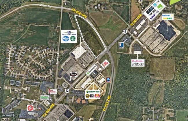
1511 N Route 42
09-25-100-020
4 -4-25 70.0670 AC.
Farms
Warren
X
Ohio
39165C0133E
70.07 AC
2023
Outlying Warren County
2023
Cincinnati/Dayton
031500
Cincinnati, OH-KY-IN
3,756 SF
DEMOGRAPHICS near 1511 N Route 42
1 Mile
3 Mile
5 Mile
2024 Total Population
2,033
25,264
36,474
2029 Population
2,206
27,476
39,645
Pop Growth 2024-2029
+ 8.51%
+ 8.76%
+ 8.69%
Average Age
40
40
40
2024 Total Households
791
9,472
13,429
HH Growth 2024-2029
+ 8.47%
+ 9.25%
+ 9.06%
Median Household Inc
$77,518
$77,858
$85,308
Avg Household Size
2.40
2.50
2.60
2024 Avg HH Vehicles
2.00
2.00
2.00
Median Home Value
$236,911
$245,024
$270,105
Median Year Built
1975
1984
1988
Nearby Places
Map Layers
Map Styles
 Street
 Aerial
- Restaurants
- Banks
- Shops
- Fitness
- Groceries
Nearby Properties
Address
Land Use
TOTAL SIZE
Lot Size
Zoning
Address
Land Use
TOTAL SIZE
Lot Size
Zoning
93,197 SF
78.42 AC
Address
Land Use
TOTAL SIZE
Lot Size
Zoning
Address
Land Use
TOTAL SIZE
Lot Size
Zoning
16.77 AC
Address
Land Use
TOTAL SIZE
Lot Size
Zoning
75.95 AC
R1
Address
Land Use
TOTAL SIZE
Lot Size
Zoning
16.77 AC
Address
Land Use
TOTAL SIZE
Lot Size
Zoning
2.36 AC
Address
Land Use
TOTAL SIZE
Lot Size
Zoning
12,992 SF
7.57 AC
Address
Land Use
TOTAL SIZE
Lot Size
Zoning
180,062 SF
18 AC
Address
Land Use
TOTAL SIZE
Lot Size
Zoning
44,735 SF
80.43 AC
Address
Land Use
TOTAL SIZE
Lot Size
Zoning
2,468 SF
4.60 AC
Address
Land Use
TOTAL SIZE
Lot Size
Zoning
27,840 SF
4.05 AC
Address
Land Use
TOTAL SIZE
Lot Size
Zoning
39,383 SF
26.29 AC
Address
Land Use
TOTAL SIZE
Lot Size
Zoning
31,420 SF
10.36 AC
Address
Land Use
TOTAL SIZE
Lot Size
Zoning
216,555 SF
26.43 AC
Address
Land Use
TOTAL SIZE
Lot Size
Zoning
53,677 SF
10.95 AC
Address
Land Use
TOTAL SIZE
Lot Size
Zoning
42,767 SF
32.58 AC
Address
Land Use
TOTAL SIZE
Lot Size
Zoning
13,488 SF
2.36 AC
Address
Land Use
TOTAL SIZE
Lot Size
Zoning
35,101 SF
19.32 AC
Address
Land Use
TOTAL SIZE
Lot Size
Zoning
7,752 SF
2.23 AC
Address
Land Use
TOTAL SIZE
Lot Size
Zoning
23,941 SF
8.53 AC
Address
Land Use
TOTAL SIZE
Lot Size
Zoning
110,102 SF
10.44 AC
Address
Land Use
TOTAL SIZE
Lot Size
Zoning
31,054 SF
4.34 AC
Address
Land Use
TOTAL SIZE
Lot Size
Zoning
9,038 SF
5.67 AC
Address
Land Use
TOTAL SIZE
Lot Size
Zoning
38,677 SF
14.97 AC
Address
Land Use
TOTAL SIZE
Lot Size
Zoning
65,600 SF
8.84 AC
Address
Land Use
TOTAL SIZE
Lot Size
Zoning
50,952 SF
8.98 AC
Address
Land Use
TOTAL SIZE
Lot Size
Zoning
48,122 SF
13.71 AC
Address
Land Use
TOTAL SIZE
Lot Size
Zoning
15,932 SF
33 AC
Address
Land Use
TOTAL SIZE
Lot Size
Zoning
2,880 SF
23.21 AC
Address
Land Use
TOTAL SIZE
Lot Size
Zoning
1.93 AC
The World's #1 Commercial Real Estate Marketplace
Connect with us
© 2026 CoStar Group
The information above has been obtained from sources believed reliable. While we do not doubt its accuracy we have not verified it and make no guarantee, warranty or representation about it. It is your responsibility to independently confirm its accuracy and completeness. Any projections, opinions, assumptions, or estimates used are for example only and do not represent the current or future performance of the property. The value of this transaction to you depends on tax and other factors which should be evaluated by your tax, financial, and legal advisors. You and your advisors should conduct a careful, independent investigation of the property to determine to your satisfaction the suitability of the property for your needs.