Property Record
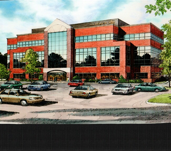
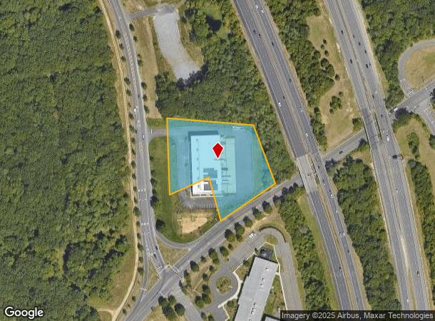
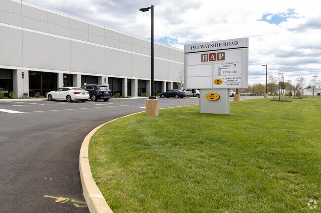
1511 Wayside Rd, Asbury Park, NJ 07712
NEARBY LISTINGS FOR SALE OR LEASE
Property Detail
1511 Wayside Rd
New York-Jersey City-White Plains, NY-NJ
ADDITIONAL LOTS: 32
49-00113-01-00030
Monmouth
Industrialgeneral
New Jersey
X
30
34025C0189F
3.88 AC
2024
Eastern Monmouth
2025
Northern New Jersey
806600
DEMOGRAPHICS near 1511 Wayside Rd
1 Mile
3 Mile
5 Mile
2024 Total Population
1,777
44,142
130,459
2029 Population
1,753
43,643
130,067
Pop Growth 2024-2029
(1.35%)
(1.13%)
(0.30%)
Average Age
47
44
42
2024 Total Households
830
18,927
49,957
HH Growth 2024-2029
(1.69%)
(1.63%)
(0.64%)
Median Household Inc
$99,518
$94,222
$97,667
Avg Household Size
2.10
2.30
2.50
2024 Avg HH Vehicles
2.00
2.00
2.00
Median Home Value
$466,666
$479,865
$491,337
Median Year Built
1993
1983
1971
Nearby Places
- Restaurants
- Banks
- Shops
- Fitness
- Groceries
PUBLIC TRANSPORTATION
COMMUTER RAIL
Little Silver (North Jersey Coast Line - NJ Transit Commuter Rail (NJ Transit))
DRIVE
WALK
Distance
Little Silver (North Jersey Coast Line - NJ Transit Commuter Rail (NJ Transit))
9 min
5.1 mi
Elberon (North Jersey Coast Line - NJ Transit Commuter Rail (NJ Transit))
DRIVE
WALK
Distance
Elberon (North Jersey Coast Line - NJ Transit Commuter Rail (NJ Transit))
11 min
6.5 mi
AIRPORT
Newark Liberty International
DRIVE
WALK
Distance
Newark Liberty International
55 min
45.0 mi
Freight Ports
New York Container Terminal
DRIVE
WALK
Distance
New York Container Terminal
49 min
37.1 mi
Nearby Properties
Address
Land Use
TOTAL SIZE
Lot Size
Zoning
Address
Land Use
TOTAL SIZE
Lot Size
Zoning
4,289 SF
94.37 AC
CCRC
Address
Land Use
TOTAL SIZE
Lot Size
Zoning
221.56 AC
P1
Address
Land Use
TOTAL SIZE
Lot Size
Zoning
75.16 AC
R-7
Address
Land Use
TOTAL SIZE
Lot Size
Zoning
134,075 SF
339.89 AC
OSGS
Address
Land Use
TOTAL SIZE
Lot Size
Zoning
35.50 AC
R-7
Address
Land Use
TOTAL SIZE
Lot Size
Zoning
Address
Land Use
TOTAL SIZE
Lot Size
Zoning
293,262 SF
28.40 AC
HC
Address
Land Use
TOTAL SIZE
Lot Size
Zoning
1,100 SF
37.83 AC
C-2
Address
Land Use
TOTAL SIZE
Lot Size
Zoning
24.45 AC
R10A
Address
Land Use
TOTAL SIZE
Lot Size
Zoning
32.19 AC
R-7
Address
Land Use
TOTAL SIZE
Lot Size
Zoning
194,812 SF
55.01 AC
R-4
Address
Land Use
TOTAL SIZE
Lot Size
Zoning
35.98 AC
R10A
Address
Land Use
TOTAL SIZE
Lot Size
Zoning
27 AC
R10A
Address
Land Use
TOTAL SIZE
Lot Size
Zoning
201,455 SF
79.34 AC
R-1
Address
Land Use
TOTAL SIZE
Lot Size
Zoning
20.62 AC
AR3P
Address
Land Use
TOTAL SIZE
Lot Size
Zoning
153,160 SF
10.12 AC
BP2
Address
Land Use
TOTAL SIZE
Lot Size
Zoning
181,867 SF
31.90 AC
RA
Address
Land Use
TOTAL SIZE
Lot Size
Zoning
1,178 SF
21.78 AC
R-7
Address
Land Use
TOTAL SIZE
Lot Size
Zoning
258,088 SF
27.90 AC
IO20
Address
Land Use
TOTAL SIZE
Lot Size
Zoning
14.99 AC
R10A
Address
Land Use
TOTAL SIZE
Lot Size
Zoning
132,378 SF
8.10 AC
OB01
Address
Land Use
TOTAL SIZE
Lot Size
Zoning
14.73 AC
MF08
Address
Land Use
TOTAL SIZE
Lot Size
Zoning
36.22 AC
P1
Address
Land Use
TOTAL SIZE
Lot Size
Zoning
15 AC
R-7
Address
Land Use
TOTAL SIZE
Lot Size
Zoning
101,700 SF
0.01 AC
BP2
Address
Land Use
TOTAL SIZE
Lot Size
Zoning
34,590 SF
18.38 AC
C-2
Address
Land Use
TOTAL SIZE
Lot Size
Zoning
89,775 SF
7.05 AC
PBO
Address
Land Use
TOTAL SIZE
Lot Size
Zoning
10,473 SF
214.74 AC
AGCL
Address
Land Use
TOTAL SIZE
Lot Size
Zoning
187,252 SF
10 AC
OB0
Address
Land Use
TOTAL SIZE
Lot Size
Zoning
260,260 SF
2.36 AC
MURC
The World's #1 Commercial Real Estate Marketplace
Connect with us
© 2025 CoStar Group
The information above has been obtained from sources believed reliable. While we do not doubt its accuracy we have not verified it and make no guarantee, warranty or representation about it. It is your responsibility to independently confirm its accuracy and completeness. Any projections, opinions, assumptions, or estimates used are for example only and do not represent the current or future performance of the property. The value of this transaction to you depends on tax and other factors which should be evaluated by your tax, financial, and legal advisors. You and your advisors should conduct a careful, independent investigation of the property to determine to your satisfaction the suitability of the property for your needs.