Property Record
15100 Municipal Dr, Saint Petersburg, FL 33708
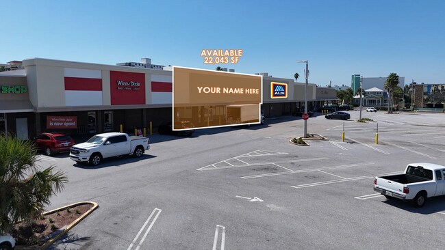
Current Lease Availabilities
NEARBY LISTINGS FOR SALE OR LEASE
Property Detail
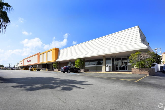
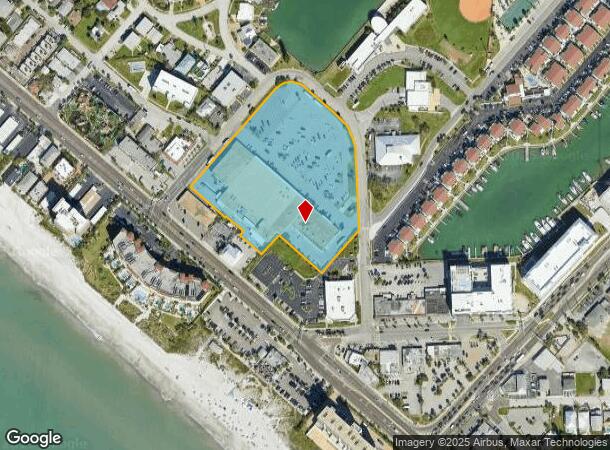
15100 Municipal Dr
09-31-15-00000-130-0300
(Carter Shopping Plaza)
Regionalshoppingcenterormallwithanchorstore
(CARTER SHOPPING PLAZA) FROM PNT ON S LN OF NE 1/4 OF SEC 9-31-15 & C/L OF GULF BLVD TH N48D3940W 320.55FT TH N41D2020E 233FT FOR POB TH N48D44W 199.82 FT TH S41D3540W 89.58FT TH N48D44W 99.74 FT TH N41D2320E 20FT TH N48D44W 80FT TH S41D23 20W 5FT TH
AE
Pinellas
12103C0191H
Florida
2024
5.37 AC
2025
South Pinellas
025108
Tampa/St Petersburg
71,904 SF
Tampa-St. Petersburg-Clearwater, FL
DEMOGRAPHICS near 15100 Municipal Dr
1 Mile
3 Mile
5 Mile
2024 Total Population
5,756
39,752
131,717
2029 Population
6,109
40,703
133,413
Pop Growth 2024-2029
+ 6.13%
+ 2.39%
+ 1.29%
Average Age
59
53
50
2024 Total Households
3,241
20,239
62,297
HH Growth 2024-2029
+ 6.05%
+ 2.48%
+ 1.40%
Median Household Inc
$70,654
$70,708
$67,803
Avg Household Size
1.80
1.90
2.00
2024 Avg HH Vehicles
1.00
2.00
2.00
Median Home Value
$470,818
$397,864
$327,620
Median Year Built
1974
1974
1973
Nearby Places
- Restaurants
- Banks
- Shops
- Fitness
- Groceries
PUBLIC TRANSPORTATION
AIRPORT
St Pete-Clearwater International
DRIVE
WALK
Distance
St Pete-Clearwater International
33 min
15.4 mi
Tampa International
DRIVE
WALK
Distance
Tampa International
44 min
26.1 mi
Freight Ports
Port Manatee
DRIVE
WALK
Distance
Port Manatee
51 min
33.3 mi
Nearby Properties
Address
Land Use
TOTAL SIZE
Lot Size
Zoning
Address
Land Use
TOTAL SIZE
Lot Size
Zoning
2,167,184 SF
297.75 AC
PSP
Address
Land Use
TOTAL SIZE
Lot Size
Zoning
372,952 SF
31.56 AC
Address
Land Use
TOTAL SIZE
Lot Size
Zoning
453,486 SF
15.73 AC
Address
Land Use
TOTAL SIZE
Lot Size
Zoning
328,466 SF
18.81 AC
Address
Land Use
TOTAL SIZE
Lot Size
Zoning
101,642 SF
1.43 AC
Address
Land Use
TOTAL SIZE
Lot Size
Zoning
5,647 SF
187.56 AC
AE
Address
Land Use
TOTAL SIZE
Lot Size
Zoning
29,644 SF
19.13 AC
Address
Land Use
TOTAL SIZE
Lot Size
Zoning
145,619 SF
1.68 AC
Address
Land Use
TOTAL SIZE
Lot Size
Zoning
160,086 SF
1.18 AC
Address
Land Use
TOTAL SIZE
Lot Size
Zoning
204,891 SF
18.20 AC
Address
Land Use
TOTAL SIZE
Lot Size
Zoning
236,240 SF
12.38 AC
RPD15
Address
Land Use
TOTAL SIZE
Lot Size
Zoning
222,888 SF
11.83 AC
RPD15
Address
Land Use
TOTAL SIZE
Lot Size
Zoning
385,858 SF
8.83 AC
Address
Land Use
TOTAL SIZE
Lot Size
Zoning
4,704 SF
3.36 AC
Address
Land Use
TOTAL SIZE
Lot Size
Zoning
176,209 SF
27.52 AC
Address
Land Use
TOTAL SIZE
Lot Size
Zoning
440 SF
3.47 AC
Address
Land Use
TOTAL SIZE
Lot Size
Zoning
151,421 SF
1.86 AC
Address
Land Use
TOTAL SIZE
Lot Size
Zoning
84,008 SF
1.49 AC
Address
Land Use
TOTAL SIZE
Lot Size
Zoning
151,149 SF
8.84 AC
RM15
Address
Land Use
TOTAL SIZE
Lot Size
Zoning
160,616 SF
11.88 AC
Address
Land Use
TOTAL SIZE
Lot Size
Zoning
6,531 SF
357.94 AC
PC
Address
Land Use
TOTAL SIZE
Lot Size
Zoning
147,755 SF
6.86 AC
Address
Land Use
TOTAL SIZE
Lot Size
Zoning
Address
Land Use
TOTAL SIZE
Lot Size
Zoning
132,714 SF
14.83 AC
UZ
Address
Land Use
TOTAL SIZE
Lot Size
Zoning
15,405 SF
31.79 AC
CR
Address
Land Use
TOTAL SIZE
Lot Size
Zoning
5,590 SF
6.38 AC
Address
Land Use
TOTAL SIZE
Lot Size
Zoning
139,181 SF
22.21 AC
R2
Address
Land Use
TOTAL SIZE
Lot Size
Zoning
57,532 SF
6.96 AC
Address
Land Use
TOTAL SIZE
Lot Size
Zoning
62,578 SF
5.45 AC
Address
Land Use
TOTAL SIZE
Lot Size
Zoning
235,268 SF
3.01 AC
The World's #1 Commercial Real Estate Marketplace
Connect with us
© 2025 CoStar Group
The information above has been obtained from sources believed reliable. While we do not doubt its accuracy we have not verified it and make no guarantee, warranty or representation about it. It is your responsibility to independently confirm its accuracy and completeness. Any projections, opinions, assumptions, or estimates used are for example only and do not represent the current or future performance of the property. The value of this transaction to you depends on tax and other factors which should be evaluated by your tax, financial, and legal advisors. You and your advisors should conduct a careful, independent investigation of the property to determine to your satisfaction the suitability of the property for your needs.