Property Record
15110 Highway 3, Webster, TX 77598


NEARBY LISTINGS FOR SALE OR LEASE
Property Detail
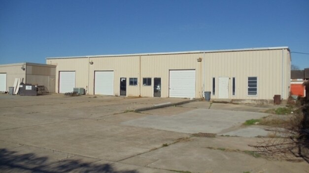
15110 Highway 3
Houston-The Woodlands-Sugar Land, TX
Abst 797 T Toby
0451010000032
TR 2F-8 ABST 797 T TOBY
Commercialacreage
Harris
X
Texas
48167C0010G
0.32 AC
2024
East-Southeast Far
2025
Houston
340900
DEMOGRAPHICS near 15110 Highway 3
1 Mile
3 Mile
5 Mile
2024 Total Population
14,497
76,126
173,979
2029 Population
14,604
77,402
177,708
Pop Growth 2024-2029
+ 0.74%
+ 1.68%
+ 2.14%
Average Age
37
38
39
2024 Total Households
6,183
30,981
67,136
HH Growth 2024-2029
+ 0.68%
+ 1.69%
+ 2.19%
Median Household Inc
$69,479
$73,058
$78,515
Avg Household Size
2.30
2.40
2.50
2024 Avg HH Vehicles
2.00
2.00
2.00
Median Home Value
$221,550
$242,231
$259,910
Median Year Built
1983
1984
1986
Nearby Places
Map Layers
Map Styles
 Street
 Aerial
- Restaurants
- Banks
- Shops
- Fitness
- Groceries
PUBLIC TRANSPORTATION
AIRPORT
William P Hobby
DRIVE
WALK
Distance
William P Hobby
23 min
11.5 mi
Freight Ports
Port of Houston
DRIVE
WALK
Distance
Port of Houston
28 min
17.9 mi
SALE & LEASE HISTORY
LISTING DATE
SALE/LEASE

Nov 26, 2018
For Lease
May 24, 2018
For Lease
Feb 07, 2019
For Lease
Nearby Properties
Address
Land Use
TOTAL SIZE
Lot Size
Zoning
Address
Land Use
TOTAL SIZE
Lot Size
Zoning
481,152 SF
22.69 AC
Address
Land Use
TOTAL SIZE
Lot Size
Zoning
538,570 SF
16.15 AC
Address
Land Use
TOTAL SIZE
Lot Size
Zoning
645,535 SF
4.40 AC
Address
Land Use
TOTAL SIZE
Lot Size
Zoning
417,465 SF
61.39 AC
Address
Land Use
TOTAL SIZE
Lot Size
Zoning
585,632 SF
7.24 AC
Address
Land Use
TOTAL SIZE
Lot Size
Zoning
614,377 SF
26.06 AC
Address
Land Use
TOTAL SIZE
Lot Size
Zoning
363,876 SF
11.74 AC
Address
Land Use
TOTAL SIZE
Lot Size
Zoning
541,172 SF
25.61 AC
Address
Land Use
TOTAL SIZE
Lot Size
Zoning
218,198 SF
7.27 AC
Address
Land Use
TOTAL SIZE
Lot Size
Zoning
511,000 SF
31.20 AC
Address
Land Use
TOTAL SIZE
Lot Size
Zoning
452,269 SF
29.63 AC
Address
Land Use
TOTAL SIZE
Lot Size
Zoning
323,638 SF
25.17 AC
Address
Land Use
TOTAL SIZE
Lot Size
Zoning
345,470 SF
9.06 AC
Address
Land Use
TOTAL SIZE
Lot Size
Zoning
282,860 SF
8.67 AC
Address
Land Use
TOTAL SIZE
Lot Size
Zoning
185,172 SF
4.15 AC
Address
Land Use
TOTAL SIZE
Lot Size
Zoning
166,816 SF
18.55 AC
Address
Land Use
TOTAL SIZE
Lot Size
Zoning
298,296 SF
13.31 AC
Address
Land Use
TOTAL SIZE
Lot Size
Zoning
338,667 SF
9.13 AC
Address
Land Use
TOTAL SIZE
Lot Size
Zoning
372,831 SF
20 AC
Address
Land Use
TOTAL SIZE
Lot Size
Zoning
441,889 SF
17.88 AC
Address
Land Use
TOTAL SIZE
Lot Size
Zoning
335,315 SF
20 AC
Address
Land Use
TOTAL SIZE
Lot Size
Zoning
364,008 SF
21.78 AC
Address
Land Use
TOTAL SIZE
Lot Size
Zoning
131,584 SF
25.37 AC
Address
Land Use
TOTAL SIZE
Lot Size
Zoning
126,874 SF
3.92 AC
Address
Land Use
TOTAL SIZE
Lot Size
Zoning
232,156 SF
22.84 AC
Address
Land Use
TOTAL SIZE
Lot Size
Zoning
376,153 SF
40.01 AC
Address
Land Use
TOTAL SIZE
Lot Size
Zoning
114,538 SF
4.65 AC
Address
Land Use
TOTAL SIZE
Lot Size
Zoning
104,720 SF
4.57 AC
Address
Land Use
TOTAL SIZE
Lot Size
Zoning
129,764 SF
14.85 AC
Address
Land Use
TOTAL SIZE
Lot Size
Zoning
325,084 SF
23.74 AC
The World's #1 Commercial Real Estate Marketplace
Connect with us
© 2025 CoStar Group
The information above has been obtained from sources believed reliable. While we do not doubt its accuracy we have not verified it and make no guarantee, warranty or representation about it. It is your responsibility to independently confirm its accuracy and completeness. Any projections, opinions, assumptions, or estimates used are for example only and do not represent the current or future performance of the property. The value of this transaction to you depends on tax and other factors which should be evaluated by your tax, financial, and legal advisors. You and your advisors should conduct a careful, independent investigation of the property to determine to your satisfaction the suitability of the property for your needs.