Property Record
1512 Schofield Ave, Schofield, WI 54476


Save to a Folder
{{folder.Name}}
{{folder.ListingIds.length}} Properties
{{folder.ListingIds.length}} Property
Create a New Folder
Property Detail
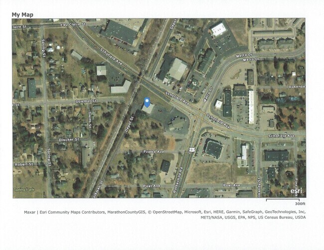
1512 Schofield Ave
Wausau, WI
HERMAN KUEHLS SUB-DIVISION OUTLOT 5 EX HWY EX VOL 285D-600 VOL 450D-110 A/D/A LOTS 1 & 2 CSM VOL 15 PG 149 (#4151) (DOC #8547
281-2808-182-1021
Marathon
Commercialnec
Wisconsin
B and X Area of moderate flood hazard, usually the area between the limits of the 100-year and 500-year floods.
1-2
2025
1.79 AC
2025
Wausau/Stevens Point
000900
Other Market Areas
NEARBY LISTINGS FOR SALE OR LEASE
DEMOGRAPHICS near 1512 Schofield Ave
1 mile
3 mile
5 mile
2025 Total Population
4,594
30,815
66,253
2030 Population
4,678
31,130
66,979
Pop Growth 2025-2030
+ 1.83%
+ 1.02%
+ 1.10%
Average Age
42
42
41
2025 Total Households
2,138
13,056
27,521
HH Growth 2025-2030
+ 1.87%
+ 1.06%
+ 1.13%
Median Household Inc
$51,446
$67,869
$70,029
Avg Household Size
2.10
2.30
2.30
2025 Avg HH Vehicles
2.00
2.00
2.00
Median Home Value
$175,095
$189,058
$194,094
Median Year Built
1972
1975
1972
Nearby Places
Map Layers
Map Styles
 Street
 Aerial
Layers
 Traffic
 Biking
Places
Listings with unknown addresses are not visible on the map
- Restaurants
- Banks
- Shops
- Fitness
- Groceries
PUBLIC TRANSPORTATION
AIRPORT
Central Wisconsin
Drive
Walk
Distance
Central Wisconsin
26 min
18.3 mi
Freight Ports
Port Milwaukee
Drive
Walk
Distance
Port Milwaukee
219 min
186.5 mi
SALE & LEASE HISTORY
LISTING DATE
SALE/LEASE

Oct 04, 2022
For Lease
Oct 04, 2022
For Sale
Nearby Properties
Address
Land Use
TOTAL SIZE
Lot Size
Zoning
Address
Land Use
TOTAL SIZE
Lot Size
Zoning
3 AC
INT
Address
Land Use
TOTAL SIZE
Lot Size
Zoning
26.27 AC
INT
Address
Land Use
TOTAL SIZE
Lot Size
Zoning
11.70 AC
Address
Land Use
TOTAL SIZE
Lot Size
Zoning
Address
Land Use
TOTAL SIZE
Lot Size
Zoning
25.01 AC
Address
Land Use
TOTAL SIZE
Lot Size
Zoning
1.82 AC
Address
Land Use
TOTAL SIZE
Lot Size
Zoning
12.58 AC
B2
Address
Land Use
TOTAL SIZE
Lot Size
Zoning
16.15 AC
Address
Land Use
TOTAL SIZE
Lot Size
Zoning
16.86 AC
Address
Land Use
TOTAL SIZE
Lot Size
Zoning
7.69 AC
UDD
Address
Land Use
TOTAL SIZE
Lot Size
Zoning
Address
Land Use
TOTAL SIZE
Lot Size
Zoning
62.07 AC
Address
Land Use
TOTAL SIZE
Lot Size
Zoning
31.43 AC
Address
Land Use
TOTAL SIZE
Lot Size
Zoning
43.18 AC
Address
Land Use
TOTAL SIZE
Lot Size
Zoning
12.96 AC
Address
Land Use
TOTAL SIZE
Lot Size
Zoning
17.88 AC
UDD
Address
Land Use
TOTAL SIZE
Lot Size
Zoning
8.19 AC
Address
Land Use
TOTAL SIZE
Lot Size
Zoning
7.58 AC
INT
Address
Land Use
TOTAL SIZE
Lot Size
Zoning
10.23 AC
MF
Address
Land Use
TOTAL SIZE
Lot Size
Zoning
Address
Land Use
TOTAL SIZE
Lot Size
Zoning
Address
Land Use
TOTAL SIZE
Lot Size
Zoning
9.94 AC
MF
Address
Land Use
TOTAL SIZE
Lot Size
Zoning
10.26 AC
Address
Land Use
TOTAL SIZE
Lot Size
Zoning
11.16 AC
UDD
Address
Land Use
TOTAL SIZE
Lot Size
Zoning
3.10 AC
Address
Land Use
TOTAL SIZE
Lot Size
Zoning
4.10 AC
Address
Land Use
TOTAL SIZE
Lot Size
Zoning
11.61 AC
Address
Land Use
TOTAL SIZE
Lot Size
Zoning
12.48 AC
Address
Land Use
TOTAL SIZE
Lot Size
Zoning
10.18 AC
B3
Address
Land Use
TOTAL SIZE
Lot Size
Zoning
8.28 AC
B2
The World's #1 Commercial Real Estate Marketplace
Connect with us
© 2026 CoStar Group
The information above has been obtained from sources believed reliable. While we do not doubt its accuracy we have not verified it and make no guarantee, warranty or representation about it. It is your responsibility to independently confirm its accuracy and completeness. Any projections, opinions, assumptions, or estimates used are for example only and do not represent the current or future performance of the property. The value of this transaction to you depends on tax and other factors which should be evaluated by your tax, financial, and legal advisors. You and your advisors should conduct a careful, independent investigation of the property to determine to your satisfaction the suitability of the property for your needs.