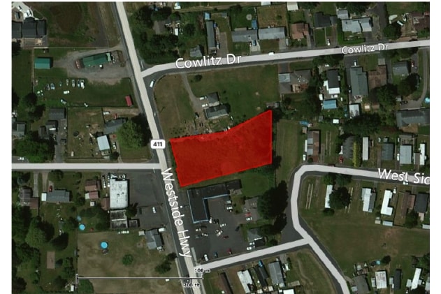
Property Record
1512 Westside Hwy, Kelso, WA 98626


NEARBY LISTINGS FOR SALE OR LEASE
Property Detail
1512 Westside Hwy
Longview, WA
Rocky Point Poultry Farms
6-3103
490 (ROCKY POINT POULTRY FARMS) -2C 11 -8N -2W EXC BEG SE COR TR 2 TH S 75-07-15 W 196 02 FT TO SW COR TH N 14-18-30 W 205 FT TH N 75-07-15 E TO E LI SD TR TH S ALG E LI TPOB EXC TR 2C-1 FEE 3042238 EXC R/W FEE 3060600 EXC R/W FEE 3287416.
Commercialacreage
Cowlitz
X
Washington
53015C0517G
2c
2025
0.74 AC
2024
Cowlitz County
000901
Portland
DEMOGRAPHICS near 1512 Westside Hwy
1 Mile
3 Mile
5 Mile
2024 Total Population
4,602
22,664
64,547
2029 Population
4,737
23,420
66,796
Pop Growth 2024-2029
+ 2.93%
+ 3.34%
+ 3.48%
Average Age
39
40
41
2024 Total Households
1,655
8,390
25,675
HH Growth 2024-2029
+ 2.90%
+ 3.38%
+ 3.58%
Median Household Inc
$80,391
$75,080
$64,198
Avg Household Size
2.70
2.70
2.40
2024 Avg HH Vehicles
2.00
2.00
2.00
Median Home Value
$286,465
$344,333
$327,665
Median Year Built
1987
1970
1968
Nearby Places
Map Layers
Map Styles
 Street
 Aerial
- Restaurants
- Banks
- Shops
- Fitness
- Groceries
PUBLIC TRANSPORTATION
COMMUTER RAIL
Kelso-Longview (Amtrak Cascades - Amtrak, Coast Starlight - Amtrak)
DRIVE
WALK
Distance
Kelso-Longview (Amtrak Cascades - Amtrak, Coast Starlight - Amtrak)
6 min
3.6 mi
Freight Ports
Port of Long View, WA
DRIVE
WALK
Distance
Port of Long View, WA
15 min
6.8 mi
SALE & LEASE HISTORY
LISTING DATE
SALE/LEASE

Dec 17, 2019
For Sale
Nearby Properties
Address
Land Use
TOTAL SIZE
Lot Size
Zoning
Address
Land Use
TOTAL SIZE
Lot Size
Zoning
2.49 AC
Address
Land Use
TOTAL SIZE
Lot Size
Zoning
9.24 AC
C02
Address
Land Use
TOTAL SIZE
Lot Size
Zoning
138,715 SF
7.43 AC
C04
Address
Land Use
TOTAL SIZE
Lot Size
Zoning
81,854 SF
20 AC
R02
Address
Land Use
TOTAL SIZE
Lot Size
Zoning
69,527 SF
8.45 AC
R01
Address
Land Use
TOTAL SIZE
Lot Size
Zoning
5.05 AC
UR0
Address
Land Use
TOTAL SIZE
Lot Size
Zoning
60,687 SF
1.06 AC
C03
Address
Land Use
TOTAL SIZE
Lot Size
Zoning
8.06 AC
R02
Address
Land Use
TOTAL SIZE
Lot Size
Zoning
39,417 SF
3.65 AC
R01
Address
Land Use
TOTAL SIZE
Lot Size
Zoning
28,200 SF
0.92 AC
C03
Address
Land Use
TOTAL SIZE
Lot Size
Zoning
2.16 AC
C03
Address
Land Use
TOTAL SIZE
Lot Size
Zoning
33,688 SF
17.75 AC
R01
Address
Land Use
TOTAL SIZE
Lot Size
Zoning
2.42 AC
UR0
Address
Land Use
TOTAL SIZE
Lot Size
Zoning
25,592 SF
5.42 AC
UR0
Address
Land Use
TOTAL SIZE
Lot Size
Zoning
18,867 SF
0.82 AC
C03
Address
Land Use
TOTAL SIZE
Lot Size
Zoning
24.76 AC
FR0
Address
Land Use
TOTAL SIZE
Lot Size
Zoning
3.53 AC
MF0
Address
Land Use
TOTAL SIZE
Lot Size
Zoning
4.44 AC
C03
Address
Land Use
TOTAL SIZE
Lot Size
Zoning
1.61 AC
UR0
Address
Land Use
TOTAL SIZE
Lot Size
Zoning
19,000 SF
3.45 AC
UR0
Address
Land Use
TOTAL SIZE
Lot Size
Zoning
33,072 SF
1.41 AC
C03
Address
Land Use
TOTAL SIZE
Lot Size
Zoning
17,800 SF
1.25 AC
C03
Address
Land Use
TOTAL SIZE
Lot Size
Zoning
15,251 SF
0.85 AC
C04
Address
Land Use
TOTAL SIZE
Lot Size
Zoning
2.44 AC
UR0
Address
Land Use
TOTAL SIZE
Lot Size
Zoning
1.06 AC
R03
Address
Land Use
TOTAL SIZE
Lot Size
Zoning
19,328 SF
3.86 AC
UZ0
Address
Land Use
TOTAL SIZE
Lot Size
Zoning
4,565 SF
1.14 AC
Address
Land Use
TOTAL SIZE
Lot Size
Zoning
1,008 SF
2.50 AC
UZ0
Address
Land Use
TOTAL SIZE
Lot Size
Zoning
27,816 SF
1 AC
UR0
Address
Land Use
TOTAL SIZE
Lot Size
Zoning
13,228 SF
1.02 AC
R03
The World's #1 Commercial Real Estate Marketplace
Connect with us
© 2025 CoStar Group
The information above has been obtained from sources believed reliable. While we do not doubt its accuracy we have not verified it and make no guarantee, warranty or representation about it. It is your responsibility to independently confirm its accuracy and completeness. Any projections, opinions, assumptions, or estimates used are for example only and do not represent the current or future performance of the property. The value of this transaction to you depends on tax and other factors which should be evaluated by your tax, financial, and legal advisors. You and your advisors should conduct a careful, independent investigation of the property to determine to your satisfaction the suitability of the property for your needs.