Property Record
15120 E 127Th St, Lemont, IL 60439


Property Detail
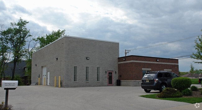
15120 E 127Th St
22-33-106-001-0000
Cook
Commercialnec
Illinois
B and X Area of moderate flood hazard, usually the area between the limits of the 100-year and 500-year floods.
15
2023
0.46 AC
2025
South I-55 Corridor
824006
Chicago
3,660 SF
Chicago-Naperville-Elgin, IL-IN
NEARBY LISTINGS FOR SALE OR LEASE
DEMOGRAPHICS near 15120 E 127Th St
1 mile
3 mile
5 mile
2025 Total Population
9,187
32,509
88,774
2030 Population
9,269
33,122
90,214
Pop Growth 2025-2030
+ 0.89%
+ 1.89%
+ 1.62%
Average Age
44
43
42
2025 Total Households
3,339
11,704
31,093
HH Growth 2025-2030
+ 0.69%
+ 1.72%
+ 1.58%
Median Household Inc
$115,371
$125,791
$111,827
Avg Household Size
2.70
2.70
2.80
2025 Avg HH Vehicles
2.00
2.00
2.00
Median Home Value
$439,153
$450,726
$390,234
Median Year Built
1990
1990
1988
Nearby Places
Map Layers
Map Styles
 Street
 Aerial
Layers
 Traffic
 Biking
Places
Listings with unknown addresses are not visible on the map
- Restaurants
- Banks
- Shops
- Fitness
- Groceries
PUBLIC TRANSPORTATION
COMMUTER RAIL
Lemont Station (Heritage Corridor Line - Northeast Illinois Regional Commuter Railroad (Metra))
Drive
Walk
Distance
Lemont Station (Heritage Corridor Line - Northeast Illinois Regional Commuter Railroad (Metra))
4 min
2.0 mi
Drive
Walk
Distance
10 min
4.7 mi
AIRPORT
Chicago Midway International
Drive
Walk
Distance
Chicago Midway International
29 min
19.2 mi
Chicago O'Hare International
Drive
Walk
Distance
Chicago O'Hare International
46 min
30.6 mi
SALE & LEASE HISTORY
LISTING DATE
SALE/LEASE

Apr 22, 2021
For Sale
Nearby Properties
Address
Land Use
TOTAL SIZE
Lot Size
Zoning
Address
Land Use
TOTAL SIZE
Lot Size
Zoning
32.82 AC
Address
Land Use
TOTAL SIZE
Lot Size
Zoning
24.65 AC
Address
Land Use
TOTAL SIZE
Lot Size
Zoning
264,310 SF
12.21 AC
I
Address
Land Use
TOTAL SIZE
Lot Size
Zoning
18.82 AC
Address
Land Use
TOTAL SIZE
Lot Size
Zoning
165.89 AC
Address
Land Use
TOTAL SIZE
Lot Size
Zoning
30.56 AC
Address
Land Use
TOTAL SIZE
Lot Size
Zoning
19.21 AC
Address
Land Use
TOTAL SIZE
Lot Size
Zoning
17.18 AC
Address
Land Use
TOTAL SIZE
Lot Size
Zoning
25.79 AC
Address
Land Use
TOTAL SIZE
Lot Size
Zoning
18.96 AC
Address
Land Use
TOTAL SIZE
Lot Size
Zoning
263,010 SF
13.56 AC
I
Address
Land Use
TOTAL SIZE
Lot Size
Zoning
74,782 SF
5.15 AC
Address
Land Use
TOTAL SIZE
Lot Size
Zoning
17.18 AC
Address
Land Use
TOTAL SIZE
Lot Size
Zoning
19.01 AC
Address
Land Use
TOTAL SIZE
Lot Size
Zoning
8,577 SF
160 AC
Address
Land Use
TOTAL SIZE
Lot Size
Zoning
121.17 AC
Address
Land Use
TOTAL SIZE
Lot Size
Zoning
119,270 SF
7 AC
I
Address
Land Use
TOTAL SIZE
Lot Size
Zoning
153,050 SF
8.95 AC
Address
Land Use
TOTAL SIZE
Lot Size
Zoning
165,524 SF
9.36 AC
I
Address
Land Use
TOTAL SIZE
Lot Size
Zoning
14,972 SF
2.91 AC
C
Address
Land Use
TOTAL SIZE
Lot Size
Zoning
24.85 AC
Address
Land Use
TOTAL SIZE
Lot Size
Zoning
Address
Land Use
TOTAL SIZE
Lot Size
Zoning
9.59 AC
Address
Land Use
TOTAL SIZE
Lot Size
Zoning
89,686 SF
5.50 AC
Address
Land Use
TOTAL SIZE
Lot Size
Zoning
9.15 AC
Address
Land Use
TOTAL SIZE
Lot Size
Zoning
70,848 SF
8.40 AC
Address
Land Use
TOTAL SIZE
Lot Size
Zoning
15.21 AC
Address
Land Use
TOTAL SIZE
Lot Size
Zoning
53,224 SF
4.84 AC
I
Address
Land Use
TOTAL SIZE
Lot Size
Zoning
67,229 SF
8.83 AC
Address
Land Use
TOTAL SIZE
Lot Size
Zoning
122,052 SF
11.61 AC
The World's #1 Commercial Real Estate Marketplace
Connect with us
© 2026 CoStar Group
The information above has been obtained from sources believed reliable. While we do not doubt its accuracy we have not verified it and make no guarantee, warranty or representation about it. It is your responsibility to independently confirm its accuracy and completeness. Any projections, opinions, assumptions, or estimates used are for example only and do not represent the current or future performance of the property. The value of this transaction to you depends on tax and other factors which should be evaluated by your tax, financial, and legal advisors. You and your advisors should conduct a careful, independent investigation of the property to determine to your satisfaction the suitability of the property for your needs.