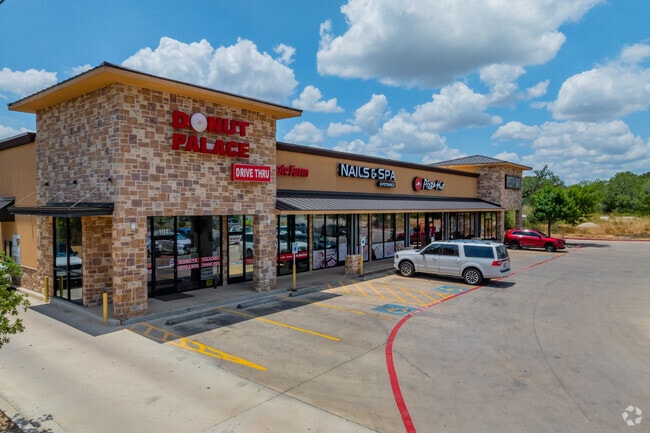
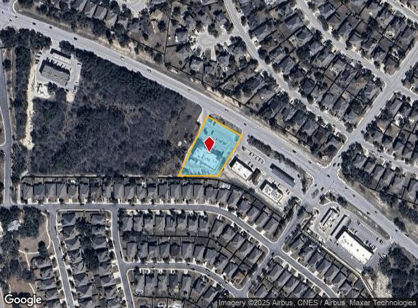
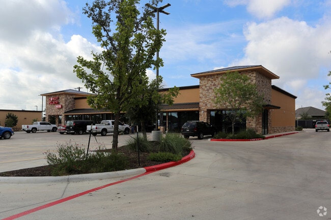
Property Record
15122 Potranco Rd, San Antonio, TX 78245
NEARBY LISTINGS FOR SALE OR LEASE
Property Detail
15122 Potranco Rd
San Antonio-New Braunfels, TX
Cb 4373A (Potranco Retail West)
04373-111-0280
CB 4373A (POTRANCO RETAIL WEST), BLOCK 11 LOT 28 2018 NEW ACCT PER PLAT 9710/35-8 FILED 01/06/2017.
Regionalshoppingcenterormallwithanchorstore
Bexar
X
Texas
48325C0400D
28
2024
1.19 AC
2025
Far West
171916
San Antonio
9,044 SF
DEMOGRAPHICS near 15122 Potranco Rd
1 Mile
3 Mile
5 Mile
2024 Total Population
9,352
30,616
81,658
2029 Population
10,459
34,164
90,309
Pop Growth 2024-2029
+ 11.84%
+ 11.59%
+ 10.59%
Average Age
32
33
35
2024 Total Households
2,819
9,296
25,650
HH Growth 2024-2029
+ 12.20%
+ 11.96%
+ 11.04%
Median Household Inc
$101,103
$108,026
$105,749
Avg Household Size
3.30
3.30
3.10
2024 Avg HH Vehicles
2.00
2.00
2.00
Median Home Value
$285,183
$301,094
$277,584
Median Year Built
2010
2010
2010
Nearby Places
Map Layers
Map Styles
 Street
 Aerial
- Restaurants
- Banks
- Shops
- Fitness
- Groceries
PUBLIC TRANSPORTATION
AIRPORT
San Antonio International
DRIVE
WALK
Distance
San Antonio International
33 min
22.3 mi
Nearby Properties
Address
Land Use
TOTAL SIZE
Lot Size
Zoning
Address
Land Use
TOTAL SIZE
Lot Size
Zoning
850,338 SF
93.98 AC
Address
Land Use
TOTAL SIZE
Lot Size
Zoning
333,308 SF
22.04 AC
Address
Land Use
TOTAL SIZE
Lot Size
Zoning
245,000 SF
44.68 AC
Address
Land Use
TOTAL SIZE
Lot Size
Zoning
268,776 SF
10 AC
Address
Land Use
TOTAL SIZE
Lot Size
Zoning
109,685 SF
37.52 AC
Address
Land Use
TOTAL SIZE
Lot Size
Zoning
332,145 SF
17.03 AC
Address
Land Use
TOTAL SIZE
Lot Size
Zoning
238,098 SF
13.93 AC
Address
Land Use
TOTAL SIZE
Lot Size
Zoning
497,319 SF
60 AC
Address
Land Use
TOTAL SIZE
Lot Size
Zoning
654.58 AC
Address
Land Use
TOTAL SIZE
Lot Size
Zoning
164,025 SF
21.46 AC
Address
Land Use
TOTAL SIZE
Lot Size
Zoning
242.77 AC
Address
Land Use
TOTAL SIZE
Lot Size
Zoning
128,713 SF
15.43 AC
Address
Land Use
TOTAL SIZE
Lot Size
Zoning
442.05 AC
Address
Land Use
TOTAL SIZE
Lot Size
Zoning
324.15 AC
Address
Land Use
TOTAL SIZE
Lot Size
Zoning
152,000 SF
21.83 AC
Address
Land Use
TOTAL SIZE
Lot Size
Zoning
94.43 AC
Address
Land Use
TOTAL SIZE
Lot Size
Zoning
30,800 SF
3.13 AC
Address
Land Use
TOTAL SIZE
Lot Size
Zoning
98,827 SF
3.23 AC
Address
Land Use
TOTAL SIZE
Lot Size
Zoning
92,876 SF
21.64 AC
Address
Land Use
TOTAL SIZE
Lot Size
Zoning
16,486 SF
1.98 AC
Address
Land Use
TOTAL SIZE
Lot Size
Zoning
19,951 SF
2.48 AC
Address
Land Use
TOTAL SIZE
Lot Size
Zoning
202.74 AC
Address
Land Use
TOTAL SIZE
Lot Size
Zoning
Address
Land Use
TOTAL SIZE
Lot Size
Zoning
45,025 SF
8.87 AC
Address
Land Use
TOTAL SIZE
Lot Size
Zoning
112.54 AC
Address
Land Use
TOTAL SIZE
Lot Size
Zoning
258,807 SF
15.73 AC
Address
Land Use
TOTAL SIZE
Lot Size
Zoning
126,600 SF
2.13 AC
Address
Land Use
TOTAL SIZE
Lot Size
Zoning
48,570 SF
7.19 AC
Address
Land Use
TOTAL SIZE
Lot Size
Zoning
11,560 SF
1.38 AC
Address
Land Use
TOTAL SIZE
Lot Size
Zoning
12,719 SF
1.62 AC
The World's #1 Commercial Real Estate Marketplace
Connect with us
© 2025 CoStar Group
The information above has been obtained from sources believed reliable. While we do not doubt its accuracy we have not verified it and make no guarantee, warranty or representation about it. It is your responsibility to independently confirm its accuracy and completeness. Any projections, opinions, assumptions, or estimates used are for example only and do not represent the current or future performance of the property. The value of this transaction to you depends on tax and other factors which should be evaluated by your tax, financial, and legal advisors. You and your advisors should conduct a careful, independent investigation of the property to determine to your satisfaction the suitability of the property for your needs.