Property Record
1513 E St, Bellingham, WA 98225


NEARBY LISTINGS FOR SALE OR LEASE
Property Detail
1513 E St
Bellingham, WA
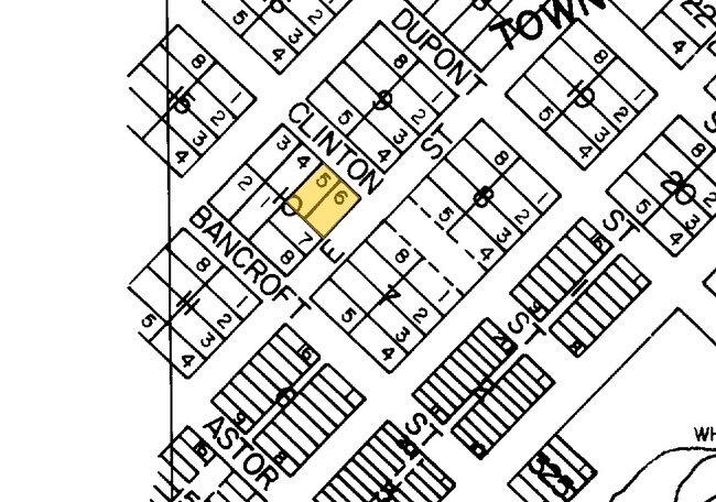
Supplemental Map Of Whatcom
380330-028399-0000
SUPPLEMENTAL MAP OF WHATCOM LOTS 5-6 BLK 10
Multifamilydwelling
Whatcom
X
Washington
53073C1213E
5-6
2025
0.23 AC
2025
Downtown Bellingham
000502
Other Market Areas
13,329 SF
DEMOGRAPHICS near 1513 E St
1 Mile
3 Mile
5 Mile
2024 Total Population
16,307
83,322
107,037
2029 Population
17,044
87,094
111,827
Pop Growth 2024-2029
+ 4.52%
+ 4.53%
+ 4.48%
Average Age
37
38
39
2024 Total Households
7,265
35,735
45,287
HH Growth 2024-2029
+ 4.65%
+ 4.75%
+ 4.66%
Median Household Inc
$56,061
$57,727
$63,761
Avg Household Size
2.10
2.10
2.20
2024 Avg HH Vehicles
2.00
2.00
2.00
Median Home Value
$572,998
$550,385
$582,885
Median Year Built
1958
1984
1987
Nearby Places
Map Layers
Map Styles
 Street
 Aerial
- Restaurants
- Banks
- Shops
- Fitness
- Groceries
PUBLIC TRANSPORTATION
COMMUTER RAIL
DRIVE
WALK
Distance
8 min
3.6 mi
AIRPORT
Bellingham International
DRIVE
WALK
Distance
Bellingham International
9 min
4.1 mi
Abbotsford International
DRIVE
WALK
Distance
Abbotsford International
48 min
26.9 mi
Vancouver International
DRIVE
WALK
Distance
Vancouver International
70 min
49.2 mi
Freight Ports
Port of Bellingham, WA
DRIVE
WALK
Distance
Port of Bellingham, WA
3 min
1.2 mi
Nearby Properties
Address
Land Use
TOTAL SIZE
Lot Size
Zoning
Address
Land Use
TOTAL SIZE
Lot Size
Zoning
3,003 SF
196 AC
IN
Address
Land Use
TOTAL SIZE
Lot Size
Zoning
507,750 SF
15.05 AC
IN
Address
Land Use
TOTAL SIZE
Lot Size
Zoning
32.09 AC
IN
Address
Land Use
TOTAL SIZE
Lot Size
Zoning
5.23 AC
WFUV
Address
Land Use
TOTAL SIZE
Lot Size
Zoning
203,749 SF
162.97 AC
CWF
Address
Land Use
TOTAL SIZE
Lot Size
Zoning
299,834 SF
15.25 AC
PC
Address
Land Use
TOTAL SIZE
Lot Size
Zoning
259,312 SF
2.76 AC
P
Address
Land Use
TOTAL SIZE
Lot Size
Zoning
290,450 SF
2.86 AC
RM1.0
Address
Land Use
TOTAL SIZE
Lot Size
Zoning
330,497 SF
30.17 AC
P
Address
Land Use
TOTAL SIZE
Lot Size
Zoning
46,850 SF
129.61 AC
RMPLAN
Address
Land Use
TOTAL SIZE
Lot Size
Zoning
154,763 SF
40.50 AC
P
Address
Land Use
TOTAL SIZE
Lot Size
Zoning
151,677 SF
12.84 AC
PCM
Address
Land Use
TOTAL SIZE
Lot Size
Zoning
256,155 SF
36.63 AC
PCW
Address
Land Use
TOTAL SIZE
Lot Size
Zoning
662,133 SF
118.82 AC
I
Address
Land Use
TOTAL SIZE
Lot Size
Zoning
177,740 SF
7.42 AC
PC
Address
Land Use
TOTAL SIZE
Lot Size
Zoning
239,925 SF
17.46 AC
PC
Address
Land Use
TOTAL SIZE
Lot Size
Zoning
112,423 SF
3.23 AC
RS
Address
Land Use
TOTAL SIZE
Lot Size
Zoning
89,174 SF
3.74 AC
PCLI
Address
Land Use
TOTAL SIZE
Lot Size
Zoning
201,508 SF
13.73 AC
P
Address
Land Use
TOTAL SIZE
Lot Size
Zoning
218,295 SF
13.22 AC
PRM2.5
Address
Land Use
TOTAL SIZE
Lot Size
Zoning
1.12 AC
RS12.0
Address
Land Use
TOTAL SIZE
Lot Size
Zoning
148,945 SF
1.51 AC
PCM
Address
Land Use
TOTAL SIZE
Lot Size
Zoning
239,299 SF
7.73 AC
PRM2.5
Address
Land Use
TOTAL SIZE
Lot Size
Zoning
104,251 SF
14.10 AC
PU
Address
Land Use
TOTAL SIZE
Lot Size
Zoning
215,766 SF
6.09 AC
PRM2.5
Address
Land Use
TOTAL SIZE
Lot Size
Zoning
459,793 SF
25.47 AC
PREC
Address
Land Use
TOTAL SIZE
Lot Size
Zoning
159,238 SF
1.54 AC
PICR
Address
Land Use
TOTAL SIZE
Lot Size
Zoning
152,381 SF
6.05 AC
PC
Address
Land Use
TOTAL SIZE
Lot Size
Zoning
84,006 SF
16.20 AC
PICR4
Address
Land Use
TOTAL SIZE
Lot Size
Zoning
117,801 SF
3.61 AC
PC
The World's #1 Commercial Real Estate Marketplace
Connect with us
© 2026 CoStar Group
The information above has been obtained from sources believed reliable. While we do not doubt its accuracy we have not verified it and make no guarantee, warranty or representation about it. It is your responsibility to independently confirm its accuracy and completeness. Any projections, opinions, assumptions, or estimates used are for example only and do not represent the current or future performance of the property. The value of this transaction to you depends on tax and other factors which should be evaluated by your tax, financial, and legal advisors. You and your advisors should conduct a careful, independent investigation of the property to determine to your satisfaction the suitability of the property for your needs.