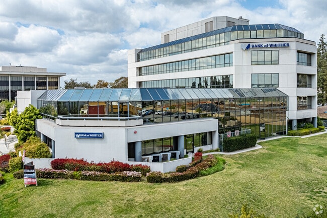
Property Record
15130 Janine Dr, Whittier, CA 90605
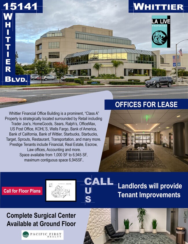


Current Lease Availabilities
NEARBY LISTINGS FOR SALE OR LEASE
Property Detail
15130 Janine Dr
Los Angeles-Long Beach-Glendale, CA
Parcel Map No 12737
8224-017-021
*TR=PARCEL MAP AS PER BK 131 P 86 OF P M LOT 5
Parkinglot
Los Angeles
X
California
06037C1835F
5
2024
1.76 AC
2025
Southeast Los Angeles
502901
Los Angeles
78,000 SF
DEMOGRAPHICS near 15130 Janine Dr
1 Mile
3 Mile
5 Mile
2024 Total Population
16,604
166,341
400,189
2029 Population
15,994
161,047
387,706
Pop Growth 2024-2029
(3.67%)
(3.18%)
(3.12%)
Average Age
40
40
40
2024 Total Households
5,234
51,763
122,812
HH Growth 2024-2029
(3.97%)
(3.41%)
(3.34%)
Median Household Inc
$111,888
$92,845
$92,520
Avg Household Size
3.10
3.10
3.10
2024 Avg HH Vehicles
3.00
2.00
2.00
Median Home Value
$791,723
$741,713
$729,100
Median Year Built
1955
1958
1960
Nearby Places
Map Layers
Map Styles
 Street
 Aerial
- Restaurants
- Banks
- Shops
- Fitness
- Groceries
PUBLIC TRANSPORTATION
COMMUTER RAIL
Norwalk/Santa Fe Springs (91 Line - Southern California Regional Rail Authority (Metrolink), Orange County Line - Southern California Regional Rail Authority (Metrolink))
DRIVE
WALK
Distance
Norwalk/Santa Fe Springs (91 Line - Southern California Regional Rail Authority (Metrolink), Orange County Line - Southern California Regional Rail Authority (Metrolink))
10 min
4.8 mi
Buena Park (91 Line - Southern California Regional Rail Authority (Metrolink), Orange County Line - Southern California Regional Rail Authority (Metrolink))
DRIVE
WALK
Distance
Buena Park (91 Line - Southern California Regional Rail Authority (Metrolink), Orange County Line - Southern California Regional Rail Authority (Metrolink))
11 min
6.1 mi
AIRPORT
Long Beach (Daugherty Field)
DRIVE
WALK
Distance
Long Beach (Daugherty Field)
32 min
18.6 mi
John Wayne/Orange County
DRIVE
WALK
Distance
John Wayne/Orange County
34 min
25.0 mi
Los Angeles International
DRIVE
WALK
Distance
Los Angeles International
38 min
26.7 mi
Freight Ports
Port of Long Beach
DRIVE
WALK
Distance
Port of Long Beach
37 min
23.2 mi
Nearby Properties
Address
Land Use
TOTAL SIZE
Lot Size
Zoning
Address
Land Use
TOTAL SIZE
Lot Size
Zoning
519,516 SF
25.37 AC
WHR3*
Address
Land Use
TOTAL SIZE
Lot Size
Zoning
1,100,900 SF
22.36 AC
SSM2*
Address
Land Use
TOTAL SIZE
Lot Size
Zoning
10.49 AC
Address
Land Use
TOTAL SIZE
Lot Size
Zoning
10.49 AC
Address
Land Use
TOTAL SIZE
Lot Size
Zoning
89,514 SF
21.28 AC
WHC2*
Address
Land Use
TOTAL SIZE
Lot Size
Zoning
85,245 SF
7.44 AC
WHT*
Address
Land Use
TOTAL SIZE
Lot Size
Zoning
425,816 SF
30.02 AC
SSM2*
Address
Land Use
TOTAL SIZE
Lot Size
Zoning
184,230 SF
4.55 AC
SSM2*
Address
Land Use
TOTAL SIZE
Lot Size
Zoning
60,710 SF
8.77 AC
LCA1*
Address
Land Use
TOTAL SIZE
Lot Size
Zoning
161,861 SF
17.50 AC
SSC4PD*
Address
Land Use
TOTAL SIZE
Lot Size
Zoning
108,296 SF
8.81 AC
WHM2*
Address
Land Use
TOTAL SIZE
Lot Size
Zoning
216,952 SF
23.54 AC
WHR4*
Address
Land Use
TOTAL SIZE
Lot Size
Zoning
96,802 SF
4.93 AC
Address
Land Use
TOTAL SIZE
Lot Size
Zoning
41,430 SF
5.85 AC
Address
Land Use
TOTAL SIZE
Lot Size
Zoning
67,692 SF
2.34 AC
WHC2*
Address
Land Use
TOTAL SIZE
Lot Size
Zoning
13.60 AC
Address
Land Use
TOTAL SIZE
Lot Size
Zoning
151,618 SF
7.70 AC
WHM1*
Address
Land Use
TOTAL SIZE
Lot Size
Zoning
69,056 SF
2.25 AC
WHM1*
Address
Land Use
TOTAL SIZE
Lot Size
Zoning
117,159 SF
1.50 AC
WHC2UD*
Address
Land Use
TOTAL SIZE
Lot Size
Zoning
192,740 SF
10.18 AC
Address
Land Use
TOTAL SIZE
Lot Size
Zoning
97,952 SF
4.18 AC
WHR3*
Address
Land Use
TOTAL SIZE
Lot Size
Zoning
408,784 SF
9.29 AC
Address
Land Use
TOTAL SIZE
Lot Size
Zoning
61,934 SF
2.37 AC
LCA1YY
Address
Land Use
TOTAL SIZE
Lot Size
Zoning
144,914 SF
1.88 AC
WHC2*
Address
Land Use
TOTAL SIZE
Lot Size
Zoning
142,430 SF
11.24 AC
Address
Land Use
TOTAL SIZE
Lot Size
Zoning
242,099 SF
3.64 AC
LMR1*
Address
Land Use
TOTAL SIZE
Lot Size
Zoning
269,602 SF
3.88 AC
WHR3*
Address
Land Use
TOTAL SIZE
Lot Size
Zoning
82,769 SF
4.25 AC
LMR3*
Address
Land Use
TOTAL SIZE
Lot Size
Zoning
83,364 SF
2.35 AC
WHR4*
Address
Land Use
TOTAL SIZE
Lot Size
Zoning
37.56 AC
The World's #1 Commercial Real Estate Marketplace
Connect with us
© 2025 CoStar Group
The information above has been obtained from sources believed reliable. While we do not doubt its accuracy we have not verified it and make no guarantee, warranty or representation about it. It is your responsibility to independently confirm its accuracy and completeness. Any projections, opinions, assumptions, or estimates used are for example only and do not represent the current or future performance of the property. The value of this transaction to you depends on tax and other factors which should be evaluated by your tax, financial, and legal advisors. You and your advisors should conduct a careful, independent investigation of the property to determine to your satisfaction the suitability of the property for your needs.