Property Record
15131 Albemarle Rd, Charlotte, NC 28227
NEARBY LISTINGS FOR SALE OR LEASE
Property Detail
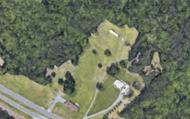
15131 Albemarle Rd
Charlotte-Concord-Gastonia, NC-SC
Waverly Hall Sec 03
111-251-17
Mecklenburg
Sfr
North Carolina
X
22
3710552400K
4.24 AC
2024
East Charlotte
2025
Charlotte
005621
DEMOGRAPHICS near 15131 Albemarle Rd
1 Mile
3 Mile
5 Mile
2024 Total Population
598
13,054
58,322
2029 Population
640
14,087
63,559
Pop Growth 2024-2029
+ 7.02%
+ 7.91%
+ 8.98%
Average Age
41
41
38
2024 Total Households
221
4,754
19,923
HH Growth 2024-2029
+ 6.33%
+ 7.32%
+ 8.48%
Median Household Inc
$78,125
$91,051
$84,340
Avg Household Size
2.70
2.70
2.90
2024 Avg HH Vehicles
3.00
2.00
2.00
Median Home Value
$333,802
$329,185
$318,952
Median Year Built
1988
1994
1996
Nearby Places
Map Layers
Map Styles
 Street
 Aerial
- Restaurants
- Banks
- Shops
- Fitness
- Groceries
PUBLIC TRANSPORTATION
AIRPORT
Concord-Padgett Regional
DRIVE
WALK
Distance
Concord-Padgett Regional
24 min
17.9 mi
Charlotte/Douglas International
DRIVE
WALK
Distance
Charlotte/Douglas International
39 min
22.9 mi
Freight Ports
North Charleston Terminal
DRIVE
WALK
Distance
North Charleston Terminal
247 min
216.2 mi
SALE & LEASE HISTORY
LISTING DATE
SALE/LEASE

Mar 20, 2024
For Sale
Nearby Properties
Address
Land Use
TOTAL SIZE
Lot Size
Zoning
Address
Land Use
TOTAL SIZE
Lot Size
Zoning
261,708 SF
34.03 AC
Address
Land Use
TOTAL SIZE
Lot Size
Zoning
290,268 SF
19.96 AC
R17MFCD
Address
Land Use
TOTAL SIZE
Lot Size
Zoning
333,774 SF
64.04 AC
I
Address
Land Use
TOTAL SIZE
Lot Size
Zoning
239,983 SF
21.41 AC
I-G(CD)
Address
Land Use
TOTAL SIZE
Lot Size
Zoning
58,134 SF
5.08 AC
IGCUD
Address
Land Use
TOTAL SIZE
Lot Size
Zoning
104,214 SF
1.69 AC
MUDD-O
Address
Land Use
TOTAL SIZE
Lot Size
Zoning
62,619 SF
11.93 AC
I-G(CD)
Address
Land Use
TOTAL SIZE
Lot Size
Zoning
68,653 SF
17.30 AC
R3
Address
Land Use
TOTAL SIZE
Lot Size
Zoning
69,108 SF
14.95 AC
I-G(CD)
Address
Land Use
TOTAL SIZE
Lot Size
Zoning
3,614 SF
7.57 AC
NS
Address
Land Use
TOTAL SIZE
Lot Size
Zoning
54,051 SF
25.06 AC
CR
Address
Land Use
TOTAL SIZE
Lot Size
Zoning
720 SF
35.60 AC
O-2(CD)
Address
Land Use
TOTAL SIZE
Lot Size
Zoning
188.38 AC
R-3
Address
Land Use
TOTAL SIZE
Lot Size
Zoning
5,528 SF
174.55 AC
O-1
Address
Land Use
TOTAL SIZE
Lot Size
Zoning
37,502 SF
24.21 AC
R
Address
Land Use
TOTAL SIZE
Lot Size
Zoning
1,512 SF
97.39 AC
IND
Address
Land Use
TOTAL SIZE
Lot Size
Zoning
4.12 AC
I-G(CD)
Address
Land Use
TOTAL SIZE
Lot Size
Zoning
8,800 SF
4.72 AC
IND
Address
Land Use
TOTAL SIZE
Lot Size
Zoning
4,642 SF
2.01 AC
B-1(CD)
Address
Land Use
TOTAL SIZE
Lot Size
Zoning
9,470 SF
24.34 AC
IND
Address
Land Use
TOTAL SIZE
Lot Size
Zoning
1,471 SF
14.60 AC
NS
Address
Land Use
TOTAL SIZE
Lot Size
Zoning
4,326 SF
2.36 AC
B-G
Address
Land Use
TOTAL SIZE
Lot Size
Zoning
21,916 SF
3 AC
R
Address
Land Use
TOTAL SIZE
Lot Size
Zoning
17,282 SF
2.36 AC
Address
Land Use
TOTAL SIZE
Lot Size
Zoning
70.10 AC
IND
Address
Land Use
TOTAL SIZE
Lot Size
Zoning
23,840 SF
5.48 AC
I-G(CD)
Address
Land Use
TOTAL SIZE
Lot Size
Zoning
23,840 SF
3.07 AC
I-G(CD)
Address
Land Use
TOTAL SIZE
Lot Size
Zoning
6,641 SF
81.32 AC
R3
Address
Land Use
TOTAL SIZE
Lot Size
Zoning
98.83 AC
RL
Address
Land Use
TOTAL SIZE
Lot Size
Zoning
12,682 SF
8.46 AC
CR
The World's #1 Commercial Real Estate Marketplace
Connect with us
© 2026 CoStar Group
The information above has been obtained from sources believed reliable. While we do not doubt its accuracy we have not verified it and make no guarantee, warranty or representation about it. It is your responsibility to independently confirm its accuracy and completeness. Any projections, opinions, assumptions, or estimates used are for example only and do not represent the current or future performance of the property. The value of this transaction to you depends on tax and other factors which should be evaluated by your tax, financial, and legal advisors. You and your advisors should conduct a careful, independent investigation of the property to determine to your satisfaction the suitability of the property for your needs.