Property Record
15141 E Highway 8, El Cajon, CA 92021
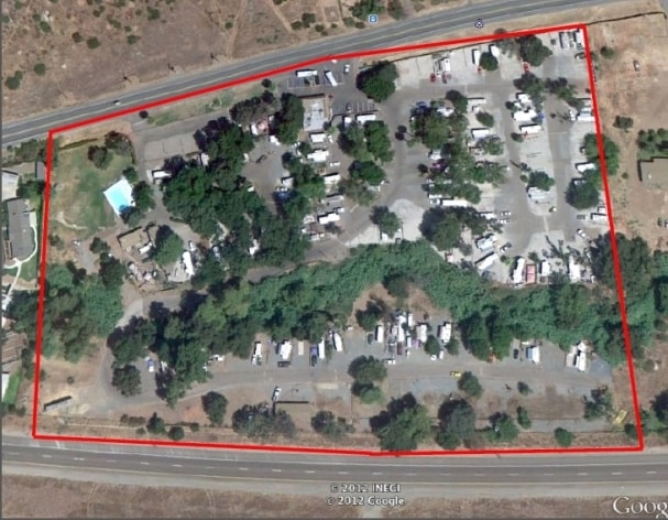

Property Detail
15141 E Highway 8
396-111-06
LOT 51 POR TR DB0170PG071
Campgroundrvpark
SAN DIEGO
M52
California
B and X Area of moderate flood hazard, usually the area between the limits of the 100-year and 500-year floods.
51
2024
8.43 AC
2025
Outlying SD County S
016401
San Diego
690 SF
San Diego-Chula Vista-Carlsbad, CA
NEARBY LISTINGS FOR SALE OR LEASE
DEMOGRAPHICS near 15141 E Highway 8
1 mile
3 mile
5 mile
2025 Total Population
1,669
16,762
64,026
2030 Population
1,638
16,743
64,144
Pop Growth 2025-2030
(1.86%)
(0.11%)
+ 0.18%
Average Age
49
45
42
2025 Total Households
670
6,011
22,422
HH Growth 2025-2030
(2.39%)
(0.35%)
0.00%
Median Household Inc
$68,174
$115,871
$106,570
Avg Household Size
2.40
2.70
2.80
2025 Avg HH Vehicles
2.00
2.00
2.00
Median Home Value
$672,155
$724,525
$713,295
Median Year Built
1980
1985
1980
Nearby Places
Map Layers
Map Styles
 Street
 Aerial
Layers
 Traffic
 Biking
Places
Listings with unknown addresses are not visible on the map
- Restaurants
- Banks
- Shops
- Fitness
- Groceries
PUBLIC TRANSPORTATION
AIRPORT
San Diego International
Drive
Walk
Distance
San Diego International
34 min
25.3 mi
Freight Ports
Port of San Diego
Drive
Walk
Distance
Port of San Diego
33 min
24.1 mi
Nearby Properties
Address
Land Use
TOTAL SIZE
Lot Size
Zoning
Address
Land Use
TOTAL SIZE
Lot Size
Zoning
38.80 AC
RMH8
Address
Land Use
TOTAL SIZE
Lot Size
Zoning
35,424 SF
3.13 AC
RV
Address
Land Use
TOTAL SIZE
Lot Size
Zoning
38,483 SF
2.69 AC
M52
Address
Land Use
TOTAL SIZE
Lot Size
Zoning
19,169 SF
3.91 AC
C36
Address
Land Use
TOTAL SIZE
Lot Size
Zoning
5,574 SF
2.87 AC
M52
Address
Land Use
TOTAL SIZE
Lot Size
Zoning
4.93 AC
RV
Address
Land Use
TOTAL SIZE
Lot Size
Zoning
6.11 AC
M54
Address
Land Use
TOTAL SIZE
Lot Size
Zoning
13,200 SF
1.16 AC
M52
Address
Land Use
TOTAL SIZE
Lot Size
Zoning
4 AC
RMH11
Address
Land Use
TOTAL SIZE
Lot Size
Zoning
188.24 AC
R1
Address
Land Use
TOTAL SIZE
Lot Size
Zoning
956 SF
4.80 AC
M54
Address
Land Use
TOTAL SIZE
Lot Size
Zoning
71,000 SF
3.40 AC
C36
Address
Land Use
TOTAL SIZE
Lot Size
Zoning
2,537 SF
10.17 AC
RMH10
Address
Land Use
TOTAL SIZE
Lot Size
Zoning
6,807 SF
2.23 AC
M54
Address
Land Use
TOTAL SIZE
Lot Size
Zoning
3.01 AC
A70
Address
Land Use
TOTAL SIZE
Lot Size
Zoning
45.01 AC
A70
Address
Land Use
TOTAL SIZE
Lot Size
Zoning
19,527 SF
3.43 AC
RR
Address
Land Use
TOTAL SIZE
Lot Size
Zoning
16,475 SF
1.19 AC
M52
Address
Land Use
TOTAL SIZE
Lot Size
Zoning
14.86 AC
A70
Address
Land Use
TOTAL SIZE
Lot Size
Zoning
254.18 AC
S92
Address
Land Use
TOTAL SIZE
Lot Size
Zoning
38,400 SF
2.58 AC
C36
Address
Land Use
TOTAL SIZE
Lot Size
Zoning
11,000 SF
1.11 AC
M52
Address
Land Use
TOTAL SIZE
Lot Size
Zoning
15.33 AC
RMH7
Address
Land Use
TOTAL SIZE
Lot Size
Zoning
3,004 SF
18.02 AC
A70
Address
Land Use
TOTAL SIZE
Lot Size
Zoning
111.59 AC
R1
Address
Land Use
TOTAL SIZE
Lot Size
Zoning
3,860 SF
1.08 AC
C36
Address
Land Use
TOTAL SIZE
Lot Size
Zoning
5,338 SF
50.09 AC
A70
Address
Land Use
TOTAL SIZE
Lot Size
Zoning
9,955 SF
0.70 AC
M52
Address
Land Use
TOTAL SIZE
Lot Size
Zoning
2.01 AC
RR
The World's #1 Commercial Real Estate Marketplace
Connect with us
© 2026 CoStar Group
The information above has been obtained from sources believed reliable. While we do not doubt its accuracy we have not verified it and make no guarantee, warranty or representation about it. It is your responsibility to independently confirm its accuracy and completeness. Any projections, opinions, assumptions, or estimates used are for example only and do not represent the current or future performance of the property. The value of this transaction to you depends on tax and other factors which should be evaluated by your tax, financial, and legal advisors. You and your advisors should conduct a careful, independent investigation of the property to determine to your satisfaction the suitability of the property for your needs.