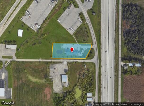
Property Record
1515 Planeview Dr, Oshkosh, WI 54904
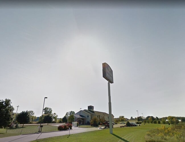

This Property Is For Sale
NEARBY LISTINGS FOR SALE OR LEASE
-
-
View all Oshkosh listings for sale on LoopNet.com
Property Detail
1515 Planeview Dr
Oshkosh-Neenah, WI
Certified Surv Map #6520
13-69560000
LOT 2 CSM 6520 DOC #1567266 R OF D
Commercialnec
Winnebago
X
Wisconsin
55039C0100F
2
2024
1.85 AC
2024
Appleton/Oshkosh
001900
Other Market Areas
15,039 SF
DEMOGRAPHICS near 1515 Planeview Dr
1 Mile
3 Mile
5 Mile
2024 Total Population
88
2,480
24,937
2029 Population
89
2,494
25,033
Pop Growth 2024-2029
+ 1.14%
+ 0.56%
+ 0.38%
Average Age
46
46
41
2024 Total Households
42
1,156
11,013
HH Growth 2024-2029
0.00%
+ 0.35%
+ 0.25%
Median Household Inc
$81,250
$80,435
$68,869
Avg Household Size
2.10
2.10
2.20
2024 Avg HH Vehicles
2.00
2.00
2.00
Median Home Value
$240,000
$238,745
$173,951
Median Year Built
1993
1992
1973
Nearby Places
Map Layers
Map Styles
 Street
 Aerial
- Restaurants
- Banks
- Shops
- Fitness
- Groceries
PUBLIC TRANSPORTATION
AIRPORT
Appleton International
DRIVE
WALK
Distance
Appleton International
34 min
26.3 mi
Freight Ports
Port Milwaukee
DRIVE
WALK
Distance
Port Milwaukee
98 min
83.2 mi
Nearby Properties
Address
Land Use
TOTAL SIZE
Lot Size
Zoning
Address
Land Use
TOTAL SIZE
Lot Size
Zoning
15.37 AC
SMU-PD
Address
Land Use
TOTAL SIZE
Lot Size
Zoning
18.38 AC
UIPD
Address
Land Use
TOTAL SIZE
Lot Size
Zoning
41.70 AC
HI
Address
Land Use
TOTAL SIZE
Lot Size
Zoning
110,200 SF
14.77 AC
MR-12-PD
Address
Land Use
TOTAL SIZE
Lot Size
Zoning
238,238 SF
22.60 AC
M3
Address
Land Use
TOTAL SIZE
Lot Size
Zoning
271,088 SF
36.80 AC
M3
Address
Land Use
TOTAL SIZE
Lot Size
Zoning
58,465 SF
43.67 AC
M3
Address
Land Use
TOTAL SIZE
Lot Size
Zoning
32,430 SF
7.44 AC
M1
Address
Land Use
TOTAL SIZE
Lot Size
Zoning
28,512 SF
6.20 AC
M1
Address
Land Use
TOTAL SIZE
Lot Size
Zoning
42,092 SF
3.21 AC
C2
Address
Land Use
TOTAL SIZE
Lot Size
Zoning
126,814 SF
22.60 AC
HI
Address
Land Use
TOTAL SIZE
Lot Size
Zoning
62,880 SF
5.78 AC
M3
Address
Land Use
TOTAL SIZE
Lot Size
Zoning
66,456 SF
5.91 AC
MR-12-PD
Address
Land Use
TOTAL SIZE
Lot Size
Zoning
38,858 SF
8.15 AC
M1
Address
Land Use
TOTAL SIZE
Lot Size
Zoning
13.67 AC
Address
Land Use
TOTAL SIZE
Lot Size
Zoning
13.75 AC
Address
Land Use
TOTAL SIZE
Lot Size
Zoning
20,544 SF
4.16 AC
M-1PD
Address
Land Use
TOTAL SIZE
Lot Size
Zoning
67,734 SF
5.62 AC
MR-12-PD
Address
Land Use
TOTAL SIZE
Lot Size
Zoning
150,000 SF
17.87 AC
M3
Address
Land Use
TOTAL SIZE
Lot Size
Zoning
596 SF
4.94 AC
R3
Address
Land Use
TOTAL SIZE
Lot Size
Zoning
89,520 SF
7 AC
M3
Address
Land Use
TOTAL SIZE
Lot Size
Zoning
561 SF
8.24 AC
R3
Address
Land Use
TOTAL SIZE
Lot Size
Zoning
57,297 SF
3.23 AC
M1
Address
Land Use
TOTAL SIZE
Lot Size
Zoning
119,046 SF
5.45 AC
M3
Address
Land Use
TOTAL SIZE
Lot Size
Zoning
101,265 SF
9.76 AC
M3
Address
Land Use
TOTAL SIZE
Lot Size
Zoning
117,249 SF
22.05 AC
M3
Address
Land Use
TOTAL SIZE
Lot Size
Zoning
20,038 SF
2.60 AC
M3
Address
Land Use
TOTAL SIZE
Lot Size
Zoning
25,000 SF
6.94 AC
HI
Address
Land Use
TOTAL SIZE
Lot Size
Zoning
18,150 SF
4.30 AC
M1
Address
Land Use
TOTAL SIZE
Lot Size
Zoning
78,000 SF
19.02 AC
M3
The World's #1 Commercial Real Estate Marketplace
Connect with us
© 2026 CoStar Group
The information above has been obtained from sources believed reliable. While we do not doubt its accuracy we have not verified it and make no guarantee, warranty or representation about it. It is your responsibility to independently confirm its accuracy and completeness. Any projections, opinions, assumptions, or estimates used are for example only and do not represent the current or future performance of the property. The value of this transaction to you depends on tax and other factors which should be evaluated by your tax, financial, and legal advisors. You and your advisors should conduct a careful, independent investigation of the property to determine to your satisfaction the suitability of the property for your needs.