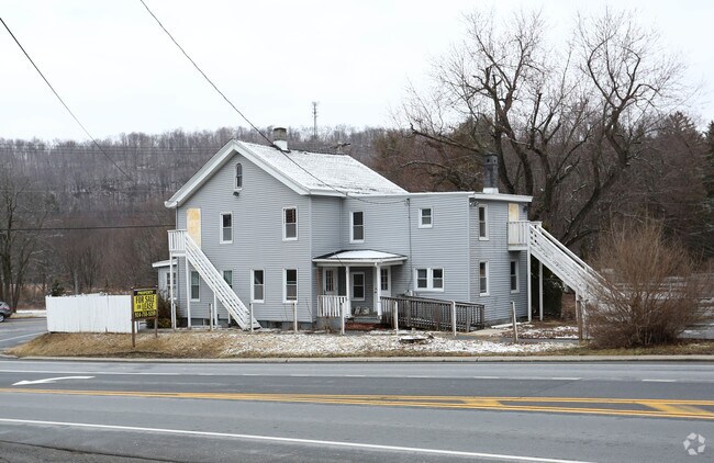
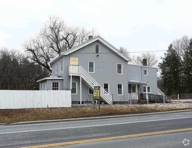
Property Record
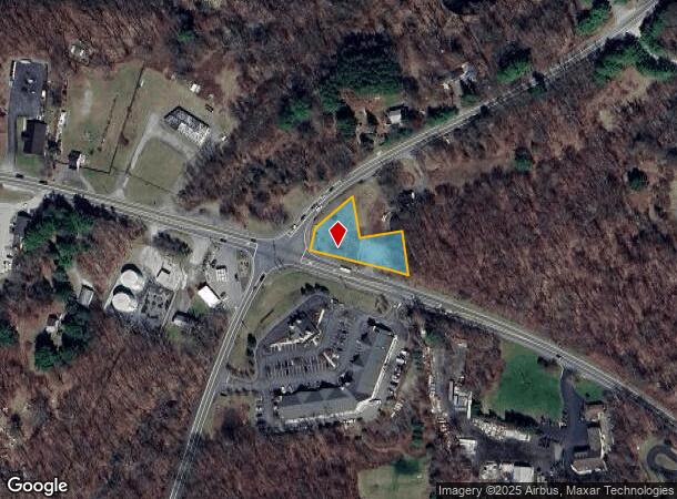
1515 Route 55, Lagrangeville, NY 12540
NEARBY LISTINGS FOR SALE OR LEASE
Property Detail
1515 Route 55
133400-6560-02-582930-0000
0.56 AC (C) 1666 0864 1621 0390
Commercialacreage
Dutchess
X
New York
36027C0392E
582
2025
0.56 AC
2024
Fishkill
080104
Westchester/So Connecticut
2,420 SF
Dutchess County-Putnam County, NY
DEMOGRAPHICS near 1515 Route 55
1 Mile
3 Mile
5 Mile
2024 Total Population
865
8,070
28,764
2029 Population
863
8,097
28,846
Pop Growth 2024-2029
(0.23%)
+ 0.33%
+ 0.29%
Average Age
42
43
42
2024 Total Households
305
2,866
10,035
HH Growth 2024-2029
(0.33%)
+ 0.35%
+ 0.29%
Median Household Inc
$99,492
$112,344
$118,466
Avg Household Size
2.70
2.80
2.80
2024 Avg HH Vehicles
2.00
2.00
2.00
Median Home Value
$448,076
$439,194
$412,411
Median Year Built
1978
1980
1979
Nearby Places
- Restaurants
- Banks
- Shops
- Fitness
- Groceries
PUBLIC TRANSPORTATION
COMMUTER RAIL
Poughkeepsie Station (Hudson Line - Metro-North Commuter Railroad Company (Metro-North))
DRIVE
WALK
Distance
Poughkeepsie Station (Hudson Line - Metro-North Commuter Railroad Company (Metro-North))
19 min
10.0 mi
AIRPORT
New York Stewart International
DRIVE
WALK
Distance
New York Stewart International
40 min
33.2 mi
Freight Ports
Albany, NY Port
DRIVE
WALK
Distance
Albany, NY Port
1 min
66.0 mi
SALE & LEASE HISTORY
LISTING DATE
SALE/LEASE

Sep 26, 2017
For Lease
Nearby Properties
Address
Land Use
TOTAL SIZE
Lot Size
Zoning
Address
Land Use
TOTAL SIZE
Lot Size
Zoning
247,216 SF
65.67 AC
RFD
Address
Land Use
TOTAL SIZE
Lot Size
Zoning
100 SF
86.38 AC
TC
Address
Land Use
TOTAL SIZE
Lot Size
Zoning
13.98 AC
TC
Address
Land Use
TOTAL SIZE
Lot Size
Zoning
122,319 SF
23.12 AC
TCR
Address
Land Use
TOTAL SIZE
Lot Size
Zoning
10,448 SF
80.50 AC
RLD
Address
Land Use
TOTAL SIZE
Lot Size
Zoning
55,520 SF
26.30 AC
RLD
Address
Land Use
TOTAL SIZE
Lot Size
Zoning
200 SF
486.87 AC
SPR
Address
Land Use
TOTAL SIZE
Lot Size
Zoning
34,805 SF
560.32 AC
SPR
Address
Land Use
TOTAL SIZE
Lot Size
Zoning
Address
Land Use
TOTAL SIZE
Lot Size
Zoning
3.65 AC
RFD
Address
Land Use
TOTAL SIZE
Lot Size
Zoning
Address
Land Use
TOTAL SIZE
Lot Size
Zoning
171,944 SF
10.49 AC
GB
Address
Land Use
TOTAL SIZE
Lot Size
Zoning
64,052 SF
18.57 AC
GH
Address
Land Use
TOTAL SIZE
Lot Size
Zoning
48,600 SF
3.88 AC
TCB
Address
Land Use
TOTAL SIZE
Lot Size
Zoning
38,610 SF
14.52 AC
TCB
Address
Land Use
TOTAL SIZE
Lot Size
Zoning
Address
Land Use
TOTAL SIZE
Lot Size
Zoning
4,611 SF
388.78 AC
RA3
Address
Land Use
TOTAL SIZE
Lot Size
Zoning
23,053 SF
165.05 AC
RA3
Address
Land Use
TOTAL SIZE
Lot Size
Zoning
71,124 SF
5.05 AC
TCB
Address
Land Use
TOTAL SIZE
Lot Size
Zoning
21,925 SF
4.20 AC
GB
Address
Land Use
TOTAL SIZE
Lot Size
Zoning
83,570 SF
21 AC
C
Address
Land Use
TOTAL SIZE
Lot Size
Zoning
22,912 SF
14.47 AC
C
Address
Land Use
TOTAL SIZE
Lot Size
Zoning
11,472 SF
28.56 AC
TCR
Address
Land Use
TOTAL SIZE
Lot Size
Zoning
7,458 SF
246.70 AC
RLD
Address
Land Use
TOTAL SIZE
Lot Size
Zoning
Address
Land Use
TOTAL SIZE
Lot Size
Zoning
32,484 SF
13.49 AC
TCB
Address
Land Use
TOTAL SIZE
Lot Size
Zoning
21,540 SF
9.80 AC
TCB
Address
Land Use
TOTAL SIZE
Lot Size
Zoning
27,942 SF
2.25 AC
TCB
Address
Land Use
TOTAL SIZE
Lot Size
Zoning
29,287 SF
2.05 AC
TCB
Address
Land Use
TOTAL SIZE
Lot Size
Zoning
14,403 SF
2.81 AC
TCB
The World's #1 Commercial Real Estate Marketplace
Connect with us
© 2025 CoStar Group
The information above has been obtained from sources believed reliable. While we do not doubt its accuracy we have not verified it and make no guarantee, warranty or representation about it. It is your responsibility to independently confirm its accuracy and completeness. Any projections, opinions, assumptions, or estimates used are for example only and do not represent the current or future performance of the property. The value of this transaction to you depends on tax and other factors which should be evaluated by your tax, financial, and legal advisors. You and your advisors should conduct a careful, independent investigation of the property to determine to your satisfaction the suitability of the property for your needs.