Property Record
1515 S Main St, South Hutchinson, KS 67505
NEARBY LISTINGS FOR SALE OR LEASE
-
-
View all South Hutchinson listings for sale on LoopNet.com
Property Detail
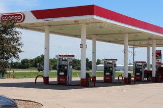
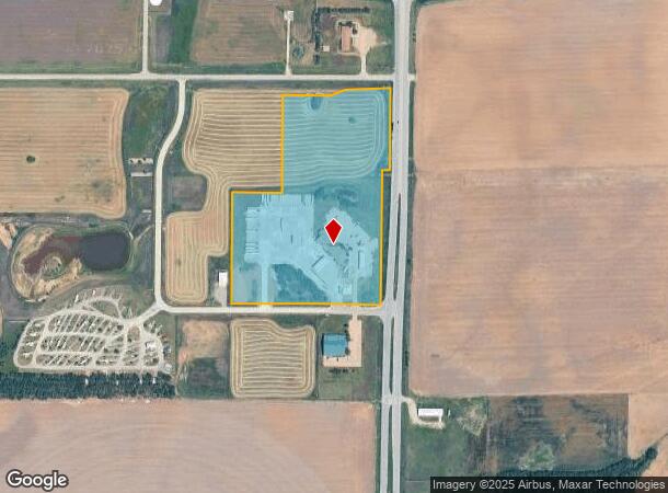
1515 S Main St
127-35-0-10-01-005.00
South Hutchinson City
Restaurantdrivein
SOUTH HUTCHINSON CITY, S35, T23, R06W, ACRES 19.83, TR COM AT NE COR NE/4 TH S 800 FT FOR POB TH CONT S 1220FT TH W 944FT TH
X
Reno
20155C0289G
Kansas
2024
19.84 AC
2024
Kansas Area
001300
Other Market Areas
13,673 SF
Hutchinson, KS
DEMOGRAPHICS near 1515 S Main St
1 Mile
3 Mile
5 Mile
2024 Total Population
699
5,052
29,498
2029 Population
692
5,037
29,547
Pop Growth 2024-2029
(1.00%)
(0.30%)
+ 0.17%
Average Age
45
43
40
2024 Total Households
322
2,218
12,667
HH Growth 2024-2029
(0.93%)
(0.41%)
+ 0.13%
Median Household Inc
$39,374
$39,613
$45,656
Avg Household Size
2.10
2.20
2.20
2024 Avg HH Vehicles
2.00
2.00
2.00
Median Home Value
$114,210
$91,422
$79,311
Median Year Built
1972
1959
1953
Nearby Places
Map Layers
Map Styles
 Street
 Aerial
- Restaurants
- Banks
- Shops
- Fitness
- Groceries
PUBLIC TRANSPORTATION
COMMUTER RAIL
Hutchinson Amtrak Station (Southwest Chief - Amtrak)
DRIVE
WALK
Distance
Hutchinson Amtrak Station (Southwest Chief - Amtrak)
8 min
3.8 mi
Freight Ports
Tulsa Port Of Catoosa
DRIVE
WALK
Distance
Tulsa Port Of Catoosa
256 min
238.6 mi
SALE & LEASE HISTORY
LISTING DATE
SALE/LEASE

Jun 28, 2018
For Sale
Nearby Properties
Address
Land Use
TOTAL SIZE
Lot Size
Zoning
Address
Land Use
TOTAL SIZE
Lot Size
Zoning
94,825 SF
10 AC
Address
Land Use
TOTAL SIZE
Lot Size
Zoning
1,960 SF
15.96 AC
Address
Land Use
TOTAL SIZE
Lot Size
Zoning
36,000 SF
19.49 AC
Address
Land Use
TOTAL SIZE
Lot Size
Zoning
1,136 SF
4.68 AC
Address
Land Use
TOTAL SIZE
Lot Size
Zoning
1,848 SF
12.35 AC
Address
Land Use
TOTAL SIZE
Lot Size
Zoning
2,250 SF
91.13 AC
Address
Land Use
TOTAL SIZE
Lot Size
Zoning
151.45 AC
Address
Land Use
TOTAL SIZE
Lot Size
Zoning
1,752 SF
103.49 AC
Address
Land Use
TOTAL SIZE
Lot Size
Zoning
468 SF
34.12 AC
Address
Land Use
TOTAL SIZE
Lot Size
Zoning
4,000 SF
15.02 AC
I2
Address
Land Use
TOTAL SIZE
Lot Size
Zoning
154.95 AC
Address
Land Use
TOTAL SIZE
Lot Size
Zoning
58,907 SF
6.63 AC
Address
Land Use
TOTAL SIZE
Lot Size
Zoning
9,600 SF
17.98 AC
Address
Land Use
TOTAL SIZE
Lot Size
Zoning
2,035 SF
43.77 AC
Address
Land Use
TOTAL SIZE
Lot Size
Zoning
39,856 SF
12.80 AC
PI
Address
Land Use
TOTAL SIZE
Lot Size
Zoning
7,326 SF
0.80 AC
Address
Land Use
TOTAL SIZE
Lot Size
Zoning
7,326 SF
0.74 AC
Address
Land Use
TOTAL SIZE
Lot Size
Zoning
33,622 SF
2.83 AC
P
Address
Land Use
TOTAL SIZE
Lot Size
Zoning
180 SF
73.59 AC
PI
Address
Land Use
TOTAL SIZE
Lot Size
Zoning
15,214 SF
2.83 AC
P
Address
Land Use
TOTAL SIZE
Lot Size
Zoning
35,153 SF
3.22 AC
Address
Land Use
TOTAL SIZE
Lot Size
Zoning
2,615 SF
9.07 AC
Address
Land Use
TOTAL SIZE
Lot Size
Zoning
39,133 SF
2.45 AC
P
Address
Land Use
TOTAL SIZE
Lot Size
Zoning
240 SF
91.51 AC
Address
Land Use
TOTAL SIZE
Lot Size
Zoning
459 SF
37.22 AC
I3
Address
Land Use
TOTAL SIZE
Lot Size
Zoning
26,000 SF
27.88 AC
C4
Address
Land Use
TOTAL SIZE
Lot Size
Zoning
240 SF
45.50 AC
Address
Land Use
TOTAL SIZE
Lot Size
Zoning
26,478 SF
0.75 AC
P
Address
Land Use
TOTAL SIZE
Lot Size
Zoning
300 SF
2.78 AC
I3
Address
Land Use
TOTAL SIZE
Lot Size
Zoning
15,072 SF
1.36 AC
P
The World's #1 Commercial Real Estate Marketplace
Connect with us
© 2025 CoStar Group
The information above has been obtained from sources believed reliable. While we do not doubt its accuracy we have not verified it and make no guarantee, warranty or representation about it. It is your responsibility to independently confirm its accuracy and completeness. Any projections, opinions, assumptions, or estimates used are for example only and do not represent the current or future performance of the property. The value of this transaction to you depends on tax and other factors which should be evaluated by your tax, financial, and legal advisors. You and your advisors should conduct a careful, independent investigation of the property to determine to your satisfaction the suitability of the property for your needs.