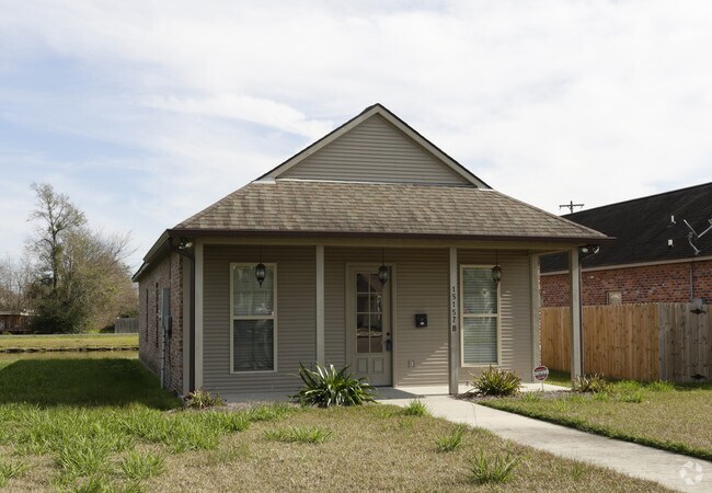
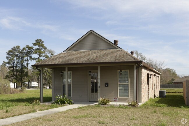
Property Record
15153 B Hwy, Darrow, LA 70725
NEARBY LISTINGS FOR SALE OR LEASE
-
-
View all Darrow listings for sale on LoopNet.com
Property Detail
15153 B Hwy
Baton Rouge, LA
Sagefield Condos
20034-723
.79 AC. SEC. 5-9-3, B-2-A-1-A-1-A (FKA UNIT B OF SAGEFIELD, A COMMERCIAL CONDOMINIUM DEVELOPMENT)
Officebuilding
Ascension
X
Louisiana
22005C0110E
b2a1
2024
0.79 AC
2024
Ascension Parish
030214
Baton Rouge
DEMOGRAPHICS near 15153 B Hwy
1 Mile
3 Mile
5 Mile
2024 Total Population
5,597
42,995
89,966
2029 Population
6,067
46,681
97,499
Pop Growth 2024-2029
+ 8.40%
+ 8.57%
+ 8.37%
Average Age
36
36
37
2024 Total Households
2,033
15,423
32,196
HH Growth 2024-2029
+ 8.56%
+ 8.74%
+ 8.60%
Median Household Inc
$67,911
$73,553
$75,302
Avg Household Size
2.70
2.70
2.70
2024 Avg HH Vehicles
2.00
2.00
2.00
Median Home Value
$202,322
$218,532
$232,650
Median Year Built
2002
2002
2002
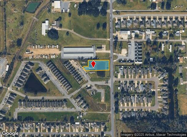
Nearby Places
Map Layers
Map Styles
 Street
 Aerial
- Restaurants
- Banks
- Shops
- Fitness
- Groceries
PUBLIC TRANSPORTATION
AIRPORT
Baton Rouge Metro Ryan Field
DRIVE
WALK
Distance
Baton Rouge Metro Ryan Field
36 min
23.9 mi
Freight Ports
Port of Greater Baton Rouge
DRIVE
WALK
Distance
Port of Greater Baton Rouge
35 min
25.0 mi
Nearby Properties
Address
Land Use
TOTAL SIZE
Lot Size
Zoning
Address
Land Use
TOTAL SIZE
Lot Size
Zoning
Address
Land Use
TOTAL SIZE
Lot Size
Zoning
17.88 AC
Address
Land Use
TOTAL SIZE
Lot Size
Zoning
Address
Land Use
TOTAL SIZE
Lot Size
Zoning
20 AC
RM
Address
Land Use
TOTAL SIZE
Lot Size
Zoning
19.93 AC
RM
Address
Land Use
TOTAL SIZE
Lot Size
Zoning
23.87 AC
RM
Address
Land Use
TOTAL SIZE
Lot Size
Zoning
34.85 AC
MU
Address
Land Use
TOTAL SIZE
Lot Size
Zoning
9.91 AC
MU
Address
Land Use
TOTAL SIZE
Lot Size
Zoning
13 AC
MU
Address
Land Use
TOTAL SIZE
Lot Size
Zoning
16.18 AC
RM
Address
Land Use
TOTAL SIZE
Lot Size
Zoning
30.44 AC
RM
Address
Land Use
TOTAL SIZE
Lot Size
Zoning
5.41 AC
MU
Address
Land Use
TOTAL SIZE
Lot Size
Zoning
6.72 AC
MU
Address
Land Use
TOTAL SIZE
Lot Size
Zoning
6.03 AC
CC
Address
Land Use
TOTAL SIZE
Lot Size
Zoning
1.38 AC
MU2
Address
Land Use
TOTAL SIZE
Lot Size
Zoning
7.17 AC
RM
Address
Land Use
TOTAL SIZE
Lot Size
Zoning
11.59 AC
Address
Land Use
TOTAL SIZE
Lot Size
Zoning
2.59 AC
MU2
Address
Land Use
TOTAL SIZE
Lot Size
Zoning
2.76 AC
MU
Address
Land Use
TOTAL SIZE
Lot Size
Zoning
2.57 AC
MU
Address
Land Use
TOTAL SIZE
Lot Size
Zoning
5.14 AC
MU
Address
Land Use
TOTAL SIZE
Lot Size
Zoning
10,977 SF
66.80 AC
Address
Land Use
TOTAL SIZE
Lot Size
Zoning
2.81 AC
RM
Address
Land Use
TOTAL SIZE
Lot Size
Zoning
5.81 AC
MU
Address
Land Use
TOTAL SIZE
Lot Size
Zoning
6.65 AC
MU
Address
Land Use
TOTAL SIZE
Lot Size
Zoning
1.03 AC
Address
Land Use
TOTAL SIZE
Lot Size
Zoning
7.42 AC
MU
Address
Land Use
TOTAL SIZE
Lot Size
Zoning
10.72 AC
MU
Address
Land Use
TOTAL SIZE
Lot Size
Zoning
The World's #1 Commercial Real Estate Marketplace
Connect with us
© 2026 CoStar Group
The information above has been obtained from sources believed reliable. While we do not doubt its accuracy we have not verified it and make no guarantee, warranty or representation about it. It is your responsibility to independently confirm its accuracy and completeness. Any projections, opinions, assumptions, or estimates used are for example only and do not represent the current or future performance of the property. The value of this transaction to you depends on tax and other factors which should be evaluated by your tax, financial, and legal advisors. You and your advisors should conduct a careful, independent investigation of the property to determine to your satisfaction the suitability of the property for your needs.