Property Record
1517 N Salisbury Blvd, Salisbury, MD 21801


NEARBY LISTINGS FOR SALE OR LEASE
Property Detail
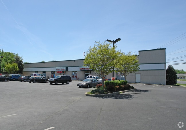
1517 N Salisbury Blvd
05-005981
Homer Street Heights
Storebuilding
L-149.8 X 290.4 1527 SALIS BLVD CITY OF SALIS
X
Wicomico
10005C0575L
Maryland
2025
1 AC
2025
Chesapeake Bay/Salisbury
010300
Other Market Areas
18,480 SF
Salisbury, MD-DE
DEMOGRAPHICS near 1517 N Salisbury Blvd
1 Mile
3 Mile
5 Mile
2024 Total Population
9,358
46,612
75,701
2029 Population
9,487
47,458
77,200
Pop Growth 2024-2029
+ 1.38%
+ 1.81%
+ 1.98%
Average Age
36
37
38
2024 Total Households
3,323
18,525
29,176
HH Growth 2024-2029
+ 1.44%
+ 1.89%
+ 2.05%
Median Household Inc
$55,626
$54,364
$59,379
Avg Household Size
2.60
2.40
2.40
2024 Avg HH Vehicles
2.00
2.00
2.00
Median Home Value
$175,828
$182,033
$215,137
Median Year Built
1964
1977
1981
Nearby Places
Map Layers
Map Styles
 Street
 Aerial
- Restaurants
- Banks
- Shops
- Fitness
- Groceries
PUBLIC TRANSPORTATION
AIRPORT
Salisbury-Ocean City Wicomico Regional
DRIVE
WALK
Distance
Salisbury-Ocean City Wicomico Regional
17 min
7.4 mi
SALE & LEASE HISTORY
LISTING DATE
SALE/LEASE

May 24, 2017
For Lease
Aug 20, 2019
For Sale
Aug 20, 2019
For Lease
Nearby Properties
Address
Land Use
TOTAL SIZE
Lot Size
Zoning
Address
Land Use
TOTAL SIZE
Lot Size
Zoning
1,792 SF
76.32 AC
R20
Address
Land Use
TOTAL SIZE
Lot Size
Zoning
602,336 SF
22.69 AC
H
Address
Land Use
TOTAL SIZE
Lot Size
Zoning
18,951 SF
35.15 AC
R8
Address
Land Use
TOTAL SIZE
Lot Size
Zoning
28,442 SF
34.88 AC
GC
Address
Land Use
TOTAL SIZE
Lot Size
Zoning
25,000 SF
23.46 AC
I-2
Address
Land Use
TOTAL SIZE
Lot Size
Zoning
208,457 SF
3.05 AC
C
Address
Land Use
TOTAL SIZE
Lot Size
Zoning
79,596 SF
21.52 AC
Address
Land Use
TOTAL SIZE
Lot Size
Zoning
118,330 SF
1.99 AC
CBD
Address
Land Use
TOTAL SIZE
Lot Size
Zoning
103,992 SF
0.59 AC
CBD
Address
Land Use
TOTAL SIZE
Lot Size
Zoning
160,552 SF
15.48 AC
Address
Land Use
TOTAL SIZE
Lot Size
Zoning
164,178 SF
55.53 AC
R5A
Address
Land Use
TOTAL SIZE
Lot Size
Zoning
219,584 SF
23.60 AC
PRD
Address
Land Use
TOTAL SIZE
Lot Size
Zoning
4,093 SF
75.38 AC
R8
Address
Land Use
TOTAL SIZE
Lot Size
Zoning
14,988 SF
7.51 AC
R8A
Address
Land Use
TOTAL SIZE
Lot Size
Zoning
15,180 SF
15.20 AC
LBIR8
Address
Land Use
TOTAL SIZE
Lot Size
Zoning
488,450 SF
28.70 AC
GC
Address
Land Use
TOTAL SIZE
Lot Size
Zoning
14,614 SF
17.23 AC
R8A
Address
Land Use
TOTAL SIZE
Lot Size
Zoning
105,626 SF
53.26 AC
R-8
Address
Land Use
TOTAL SIZE
Lot Size
Zoning
12,024 SF
12.98 AC
R5A
Address
Land Use
TOTAL SIZE
Lot Size
Zoning
28,365 SF
11.21 AC
R1A
Address
Land Use
TOTAL SIZE
Lot Size
Zoning
15,531 SF
15.26 AC
GC
Address
Land Use
TOTAL SIZE
Lot Size
Zoning
22,431 SF
8.74 AC
R10
Address
Land Use
TOTAL SIZE
Lot Size
Zoning
92,168 SF
13.40 AC
Address
Land Use
TOTAL SIZE
Lot Size
Zoning
5,760 SF
12.09 AC
LBI
Address
Land Use
TOTAL SIZE
Lot Size
Zoning
6,136 SF
52.49 AC
R-10
Address
Land Use
TOTAL SIZE
Lot Size
Zoning
36.64 AC
C3
Address
Land Use
TOTAL SIZE
Lot Size
Zoning
40,690 SF
9.02 AC
PDD
Address
Land Use
TOTAL SIZE
Lot Size
Zoning
3,408 SF
69.67 AC
I
Address
Land Use
TOTAL SIZE
Lot Size
Zoning
33,900 SF
4.24 AC
LBI
Address
Land Use
TOTAL SIZE
Lot Size
Zoning
76,999 SF
7.72 AC
R-8
The World's #1 Commercial Real Estate Marketplace
Connect with us
© 2025 CoStar Group
The information above has been obtained from sources believed reliable. While we do not doubt its accuracy we have not verified it and make no guarantee, warranty or representation about it. It is your responsibility to independently confirm its accuracy and completeness. Any projections, opinions, assumptions, or estimates used are for example only and do not represent the current or future performance of the property. The value of this transaction to you depends on tax and other factors which should be evaluated by your tax, financial, and legal advisors. You and your advisors should conduct a careful, independent investigation of the property to determine to your satisfaction the suitability of the property for your needs.