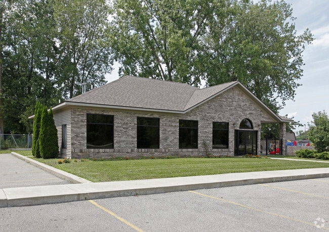
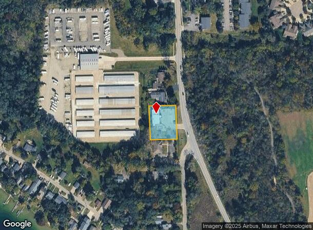
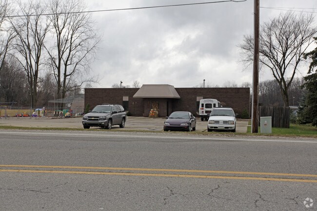
Property Record
15178 Linden Rd, Linden, MI 48451
NEARBY LISTINGS FOR SALE OR LEASE
Property Detail
15178 Linden Rd
06-29-100-028
Supervisors Plat
Commercialnec
A PARCEL OF LAND BEG N 510 FT FROM SUPERVISOR'S PLAT NO 7 TH N 89 DEG 11 MIN 19 SEC W 150.10 FT TH N 189.12 FT TH S 89 DEG 11
X
Genesee
26049C0416D
Michigan
2024
0.64 AC
2025
Flint
013112
Detroit
3,300 SF
Flint, MI
DEMOGRAPHICS near 15178 Linden Rd
1 Mile
3 Mile
5 Mile
2024 Total Population
3,273
18,216
43,021
2029 Population
3,193
17,888
42,379
Pop Growth 2024-2029
(2.44%)
(1.80%)
(1.49%)
Average Age
43
43
42
2024 Total Households
1,267
7,151
17,213
HH Growth 2024-2029
(2.60%)
(1.93%)
(1.60%)
Median Household Inc
$89,423
$92,663
$88,607
Avg Household Size
2.50
2.50
2.40
2024 Avg HH Vehicles
2.00
2.00
2.00
Median Home Value
$242,666
$293,018
$276,946
Median Year Built
1990
1990
1985
Nearby Places
Map Layers
Map Styles
 Street
 Aerial
- Restaurants
- Banks
- Shops
- Fitness
- Groceries
PUBLIC TRANSPORTATION
AIRPORT
Bishop International
DRIVE
WALK
Distance
Bishop International
32 min
17.6 mi
Freight Ports
Port of Toledo
DRIVE
WALK
Distance
Port of Toledo
122 min
101.2 mi
Nearby Properties
Address
Land Use
TOTAL SIZE
Lot Size
Zoning
Address
Land Use
TOTAL SIZE
Lot Size
Zoning
215,494 SF
25.02 AC
GBD
Address
Land Use
TOTAL SIZE
Lot Size
Zoning
162,144 SF
8 AC
PUD
Address
Land Use
TOTAL SIZE
Lot Size
Zoning
167,681 SF
20.39 AC
HDR
Address
Land Use
TOTAL SIZE
Lot Size
Zoning
82,447 SF
8.96 AC
GBD
Address
Land Use
TOTAL SIZE
Lot Size
Zoning
92,006 SF
7.89 AC
R-3
Address
Land Use
TOTAL SIZE
Lot Size
Zoning
148,951 SF
10.02 AC
HDR
Address
Land Use
TOTAL SIZE
Lot Size
Zoning
114,408 SF
13.53 AC
GBD
Address
Land Use
TOTAL SIZE
Lot Size
Zoning
87,925 SF
13.49 AC
GBD
Address
Land Use
TOTAL SIZE
Lot Size
Zoning
87,847 SF
12.71 AC
GBD
Address
Land Use
TOTAL SIZE
Lot Size
Zoning
63,504 SF
8.26 AC
PUD
Address
Land Use
TOTAL SIZE
Lot Size
Zoning
126,064 SF
10.80 AC
GBD
Address
Land Use
TOTAL SIZE
Lot Size
Zoning
13,220 SF
7.90 AC
GBD
Address
Land Use
TOTAL SIZE
Lot Size
Zoning
97,830 SF
12.16 AC
GBD
Address
Land Use
TOTAL SIZE
Lot Size
Zoning
145,076 SF
11.95 AC
HDR
Address
Land Use
TOTAL SIZE
Lot Size
Zoning
3,380 SF
152.79 AC
R-5
Address
Land Use
TOTAL SIZE
Lot Size
Zoning
112,330 SF
11.82 AC
IND
Address
Land Use
TOTAL SIZE
Lot Size
Zoning
89,158 SF
7.87 AC
C-3
Address
Land Use
TOTAL SIZE
Lot Size
Zoning
44,343 SF
3.94 AC
NO DATA TO
Address
Land Use
TOTAL SIZE
Lot Size
Zoning
48,096 SF
6.39 AC
GBD
Address
Land Use
TOTAL SIZE
Lot Size
Zoning
30,000 SF
0.66 AC
HDR
Address
Land Use
TOTAL SIZE
Lot Size
Zoning
26,719 SF
4.07 AC
GBD
Address
Land Use
TOTAL SIZE
Lot Size
Zoning
103,896 SF
7.30 AC
IND
Address
Land Use
TOTAL SIZE
Lot Size
Zoning
73,243 SF
7.55 AC
NO DATA TO
Address
Land Use
TOTAL SIZE
Lot Size
Zoning
47,372 SF
7.12 AC
GBD
Address
Land Use
TOTAL SIZE
Lot Size
Zoning
20,969 SF
3.67 AC
LDR
Address
Land Use
TOTAL SIZE
Lot Size
Zoning
19,650 SF
2.70 AC
GBD
Address
Land Use
TOTAL SIZE
Lot Size
Zoning
59,089 SF
10.29 AC
IND
Address
Land Use
TOTAL SIZE
Lot Size
Zoning
78,232 SF
4.79 AC
IND
Address
Land Use
TOTAL SIZE
Lot Size
Zoning
3,558 SF
10.01 AC
AG
Address
Land Use
TOTAL SIZE
Lot Size
Zoning
70,541 SF
6.05 AC
IND
The World's #1 Commercial Real Estate Marketplace
Connect with us
© 2025 CoStar Group
The information above has been obtained from sources believed reliable. While we do not doubt its accuracy we have not verified it and make no guarantee, warranty or representation about it. It is your responsibility to independently confirm its accuracy and completeness. Any projections, opinions, assumptions, or estimates used are for example only and do not represent the current or future performance of the property. The value of this transaction to you depends on tax and other factors which should be evaluated by your tax, financial, and legal advisors. You and your advisors should conduct a careful, independent investigation of the property to determine to your satisfaction the suitability of the property for your needs.