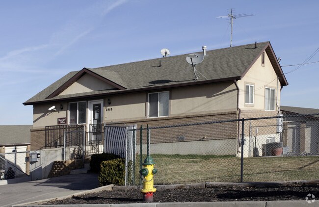
Property Record
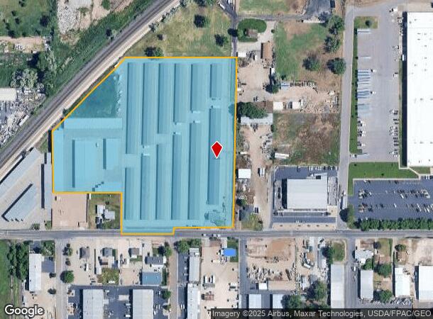
1518 W 3300 S, Ogden, UT 84401
NEARBY LISTINGS FOR SALE OR LEASE
Property Detail
1518 W 3300 S
15-102-0044
PART OF THE SOUTH HALF OF SECTION 36, TOWNSHIP 6 NORTH, RANGE 2 WEST, SALT LAKE BASE AND MERIDIAN, DESCRIBED AS FOLLOWS:
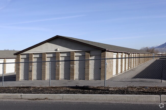
Publicstorage
Weber
X
Utah
49057C0409F
2
2025
10.22 AC
2025
Davis/Weber Counties
201900
Salt Lake City
7,860 SF
Ogden, UT
DEMOGRAPHICS near 1518 W 3300 S
1 Mile
3 Mile
5 Mile
2024 Total Population
2,752
68,252
186,089
2029 Population
2,947
73,769
199,851
Pop Growth 2024-2029
+ 7.09%
+ 8.08%
+ 7.40%
Average Age
31
35
36
2024 Total Households
1,122
24,194
65,059
HH Growth 2024-2029
+ 7.22%
+ 8.24%
+ 7.59%
Median Household Inc
$74,401
$63,217
$66,816
Avg Household Size
2.40
2.70
2.80
2024 Avg HH Vehicles
2.00
2.00
2.00
Median Home Value
$370,588
$328,404
$338,912
Median Year Built
2008
1980
1978
Nearby Places
Map Layers
Map Styles
 Street
 Aerial
- Restaurants
- Banks
- Shops
- Fitness
- Groceries
PUBLIC TRANSPORTATION
COMMUTER RAIL
Roy (FrontRunner North - Utah Transit Authority (UTA))
DRIVE
WALK
Distance
Roy (FrontRunner North - Utah Transit Authority (UTA))
6 min
2.4 mi
Ogden (FrontRunner North - Utah Transit Authority (UTA))
DRIVE
WALK
Distance
Ogden (FrontRunner North - Utah Transit Authority (UTA))
8 min
3.4 mi
AIRPORT
Salt Lake City International
DRIVE
WALK
Distance
Salt Lake City International
47 min
38.3 mi
Freight Ports
Port of Stockton
DRIVE
WALK
Distance
Port of Stockton
747 min
728.7 mi
Nearby Properties
Address
Land Use
TOTAL SIZE
Lot Size
Zoning
Address
Land Use
TOTAL SIZE
Lot Size
Zoning
841,756 SF
45.79 AC
Address
Land Use
TOTAL SIZE
Lot Size
Zoning
35,219 SF
58.98 AC
Address
Land Use
TOTAL SIZE
Lot Size
Zoning
7,492 SF
8.96 AC
Address
Land Use
TOTAL SIZE
Lot Size
Zoning
97,932 SF
3.07 AC
Address
Land Use
TOTAL SIZE
Lot Size
Zoning
52,200 SF
9.95 AC
Address
Land Use
TOTAL SIZE
Lot Size
Zoning
305,444 SF
1.58 AC
Address
Land Use
TOTAL SIZE
Lot Size
Zoning
152,877 SF
4.96 AC
Address
Land Use
TOTAL SIZE
Lot Size
Zoning
9,464 SF
6.82 AC
Address
Land Use
TOTAL SIZE
Lot Size
Zoning
71,940 SF
11 AC
Address
Land Use
TOTAL SIZE
Lot Size
Zoning
21,684 SF
8.38 AC
Address
Land Use
TOTAL SIZE
Lot Size
Zoning
48,177 SF
5.54 AC
Address
Land Use
TOTAL SIZE
Lot Size
Zoning
98,660 SF
3.18 AC
Address
Land Use
TOTAL SIZE
Lot Size
Zoning
106,752 SF
10.35 AC
Address
Land Use
TOTAL SIZE
Lot Size
Zoning
8,580 SF
6.40 AC
Address
Land Use
TOTAL SIZE
Lot Size
Zoning
66,896 SF
7.50 AC
Address
Land Use
TOTAL SIZE
Lot Size
Zoning
101,191 SF
4.14 AC
Address
Land Use
TOTAL SIZE
Lot Size
Zoning
119,043 SF
2.05 AC
Address
Land Use
TOTAL SIZE
Lot Size
Zoning
95,949 SF
3.29 AC
Address
Land Use
TOTAL SIZE
Lot Size
Zoning
149,400 SF
26.88 AC
Address
Land Use
TOTAL SIZE
Lot Size
Zoning
115,094 SF
13.88 AC
Address
Land Use
TOTAL SIZE
Lot Size
Zoning
166,800 SF
0.12 AC
Address
Land Use
TOTAL SIZE
Lot Size
Zoning
225,497 SF
20.33 AC
Address
Land Use
TOTAL SIZE
Lot Size
Zoning
19,594 SF
1.12 AC
Address
Land Use
TOTAL SIZE
Lot Size
Zoning
47,750 SF
2.10 AC
The World's #1 Commercial Real Estate Marketplace
Connect with us
© 2026 CoStar Group
The information above has been obtained from sources believed reliable. While we do not doubt its accuracy we have not verified it and make no guarantee, warranty or representation about it. It is your responsibility to independently confirm its accuracy and completeness. Any projections, opinions, assumptions, or estimates used are for example only and do not represent the current or future performance of the property. The value of this transaction to you depends on tax and other factors which should be evaluated by your tax, financial, and legal advisors. You and your advisors should conduct a careful, independent investigation of the property to determine to your satisfaction the suitability of the property for your needs.