Property Record
1518 Wirt Rd, Houston, TX 77055
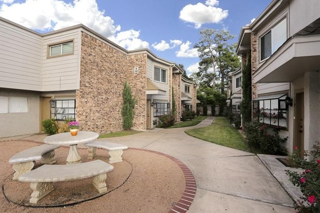
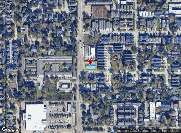
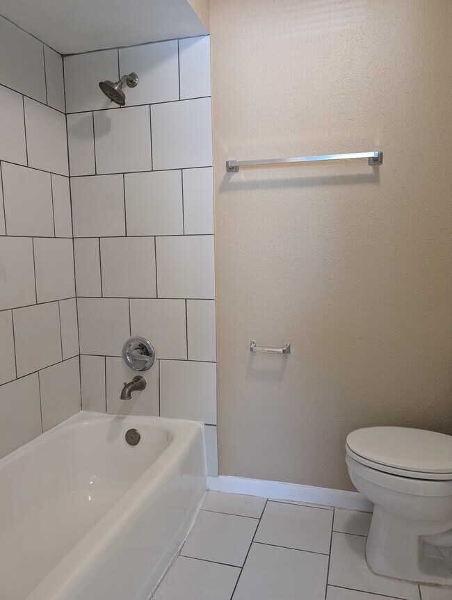
This Property Is For Sale
NEARBY LISTINGS FOR SALE OR LEASE
Property Detail
1518 Wirt Rd
Houston-The Woodlands-Sugar Land, TX
Craig Woods 25Th Par R/P
0770390340002
RES B BLK 1 CRAIG WOODS 25TH PAR R/P
Apartment
Harris
X
Texas
48201C0665M
3
2024
0.32 AC
2025
Spring Branch East
520302
Houston
10,740 SF
DEMOGRAPHICS near 1518 Wirt Rd
1 Mile
3 Mile
5 Mile
2024 Total Population
21,163
135,120
426,220
2029 Population
21,824
139,705
440,906
Pop Growth 2024-2029
+ 3.12%
+ 3.39%
+ 3.45%
Average Age
37
38
38
2024 Total Households
7,841
53,310
184,772
HH Growth 2024-2029
+ 3.15%
+ 3.46%
+ 3.56%
Median Household Inc
$62,626
$65,827
$74,995
Avg Household Size
2.60
2.40
2.20
2024 Avg HH Vehicles
2.00
2.00
2.00
Median Home Value
$548,902
$443,915
$440,445
Median Year Built
1979
1977
1983
Nearby Places
- Restaurants
- Banks
- Shops
- Fitness
- Groceries
PUBLIC TRANSPORTATION
COMMUTER RAIL
Houston (Sunset Limited - Amtrak)
DRIVE
WALK
Distance
Houston (Sunset Limited - Amtrak)
14 min
9.6 mi
AIRPORT
William P Hobby
DRIVE
WALK
Distance
William P Hobby
35 min
21.9 mi
George Bush Intcntl/Houston
DRIVE
WALK
Distance
George Bush Intcntl/Houston
32 min
24.0 mi
Freight Ports
Port of Houston
DRIVE
WALK
Distance
Port of Houston
28 min
18.7 mi
Nearby Properties
Address
Land Use
TOTAL SIZE
Lot Size
Zoning
Address
Land Use
TOTAL SIZE
Lot Size
Zoning
527,312 SF
2.58 AC
Address
Land Use
TOTAL SIZE
Lot Size
Zoning
402,886 SF
17.95 AC
Address
Land Use
TOTAL SIZE
Lot Size
Zoning
497,932 SF
3.97 AC
Address
Land Use
TOTAL SIZE
Lot Size
Zoning
224,114 SF
4.24 AC
Address
Land Use
TOTAL SIZE
Lot Size
Zoning
714,049 SF
25.73 AC
Address
Land Use
TOTAL SIZE
Lot Size
Zoning
504,256 SF
6.09 AC
Address
Land Use
TOTAL SIZE
Lot Size
Zoning
366,386 SF
10.85 AC
Address
Land Use
TOTAL SIZE
Lot Size
Zoning
726,444 SF
7.29 AC
Address
Land Use
TOTAL SIZE
Lot Size
Zoning
375,693 SF
9.16 AC
Address
Land Use
TOTAL SIZE
Lot Size
Zoning
605,420 SF
7.51 AC
Address
Land Use
TOTAL SIZE
Lot Size
Zoning
365,266 SF
2.02 AC
Address
Land Use
TOTAL SIZE
Lot Size
Zoning
279,934 SF
8 AC
Address
Land Use
TOTAL SIZE
Lot Size
Zoning
721,788 SF
10.14 AC
Address
Land Use
TOTAL SIZE
Lot Size
Zoning
211,190 SF
2.53 AC
Address
Land Use
TOTAL SIZE
Lot Size
Zoning
276,479 SF
3.14 AC
Address
Land Use
TOTAL SIZE
Lot Size
Zoning
1,099,083 SF
4.76 AC
Address
Land Use
TOTAL SIZE
Lot Size
Zoning
251,980 SF
2.55 AC
Address
Land Use
TOTAL SIZE
Lot Size
Zoning
292,292 SF
10.36 AC
Address
Land Use
TOTAL SIZE
Lot Size
Zoning
151,313 SF
1.21 AC
Address
Land Use
TOTAL SIZE
Lot Size
Zoning
443,228 SF
3.15 AC
Address
Land Use
TOTAL SIZE
Lot Size
Zoning
478,524 SF
5.68 AC
Address
Land Use
TOTAL SIZE
Lot Size
Zoning
750,156 SF
22.95 AC
Address
Land Use
TOTAL SIZE
Lot Size
Zoning
311,485 SF
142.25 AC
Address
Land Use
TOTAL SIZE
Lot Size
Zoning
293,407 SF
9.19 AC
Address
Land Use
TOTAL SIZE
Lot Size
Zoning
378,225 SF
11.51 AC
Address
Land Use
TOTAL SIZE
Lot Size
Zoning
774,668 SF
7.12 AC
Address
Land Use
TOTAL SIZE
Lot Size
Zoning
377,639 SF
7.88 AC
Address
Land Use
TOTAL SIZE
Lot Size
Zoning
418,456 SF
5.72 AC
Address
Land Use
TOTAL SIZE
Lot Size
Zoning
247,490 SF
2 AC
Address
Land Use
TOTAL SIZE
Lot Size
Zoning
833,210 SF
5.29 AC
The World's #1 Commercial Real Estate Marketplace
Connect with us
© 2025 CoStar Group
The information above has been obtained from sources believed reliable. While we do not doubt its accuracy we have not verified it and make no guarantee, warranty or representation about it. It is your responsibility to independently confirm its accuracy and completeness. Any projections, opinions, assumptions, or estimates used are for example only and do not represent the current or future performance of the property. The value of this transaction to you depends on tax and other factors which should be evaluated by your tax, financial, and legal advisors. You and your advisors should conduct a careful, independent investigation of the property to determine to your satisfaction the suitability of the property for your needs.