Property Record
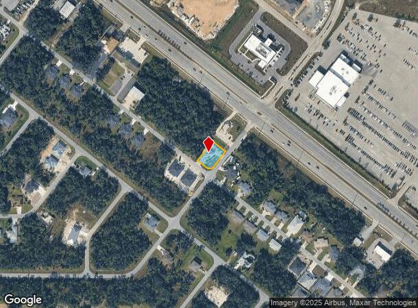
15182 Dahlgren Ave, Port Charlotte, FL 33953
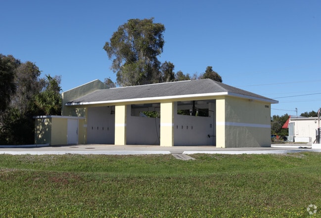
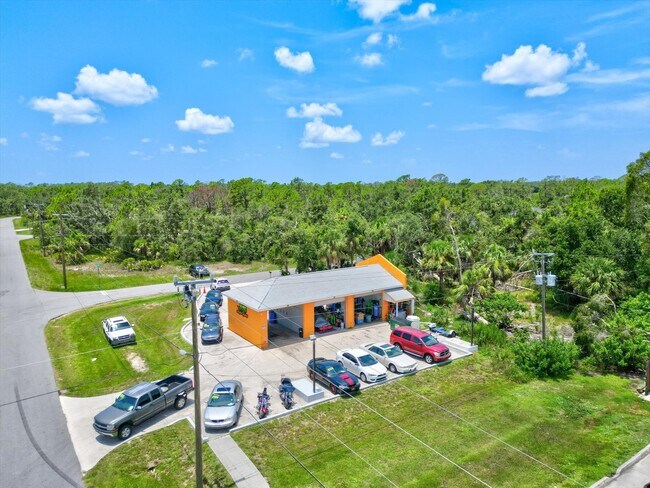
This Property Is For Sale
NEARBY LISTINGS FOR SALE OR LEASE
Property Detail
15182 Dahlgren Ave
Punta Gorda, FL
Port Charlotte
402103176006
PORT CHARLOTTE SEC32 BLK2443 LT 18 231/620 772/2121 995/390 1060/1933 1184/1761 2369/1159 2737/1985 4360/1752 4646/2119 4927/890 4956/1463
Warehouse
Charlotte
X
Florida
12015C0040G
18
2024
0.24 AC
2025
Charlotte County
020402
Southwest Florida
1,249 SF
DEMOGRAPHICS near 15182 Dahlgren Ave
1 Mile
3 Mile
5 Mile
2024 Total Population
3,881
30,671
85,397
2029 Population
4,539
35,415
99,033
Pop Growth 2024-2029
+ 16.95%
+ 15.47%
+ 15.97%
Average Age
45
47
47
2024 Total Households
1,538
12,764
35,646
HH Growth 2024-2029
+ 17.17%
+ 15.55%
+ 16.18%
Median Household Inc
$57,694
$61,364
$61,350
Avg Household Size
2.50
2.30
2.30
2024 Avg HH Vehicles
2.00
2.00
2.00
Median Home Value
$262,043
$244,206
$237,311
Median Year Built
1999
2001
1999
Nearby Places
- Restaurants
- Banks
- Shops
- Fitness
- Groceries
PUBLIC TRANSPORTATION
AIRPORT
Punta Gorda
DRIVE
WALK
Distance
Punta Gorda
30 min
16.1 mi
Sarasota/Bradenton International
DRIVE
WALK
Distance
Sarasota/Bradenton International
62 min
43.7 mi
Freight Ports
Port Manatee
DRIVE
WALK
Distance
Port Manatee
74 min
56.2 mi
Nearby Properties
Address
Land Use
TOTAL SIZE
Lot Size
Zoning
Address
Land Use
TOTAL SIZE
Lot Size
Zoning
316,994 SF
40.88 AC
V
Address
Land Use
TOTAL SIZE
Lot Size
Zoning
103,886 SF
21.48 AC
PD
Address
Land Use
TOTAL SIZE
Lot Size
Zoning
267,412 SF
23.26 AC
AC1
Address
Land Use
TOTAL SIZE
Lot Size
Zoning
132,969 SF
80.28 AC
PKR
Address
Land Use
TOTAL SIZE
Lot Size
Zoning
302,632 SF
15.71 AC
AC2
Address
Land Use
TOTAL SIZE
Lot Size
Zoning
131,053 SF
14.40 AC
PD
Address
Land Use
TOTAL SIZE
Lot Size
Zoning
205,624 SF
21.37 AC
AC1
Address
Land Use
TOTAL SIZE
Lot Size
Zoning
9,511 SF
40.53 AC
PD
Address
Land Use
TOTAL SIZE
Lot Size
Zoning
114,985 SF
29.77 AC
GU
Address
Land Use
TOTAL SIZE
Lot Size
Zoning
79,944 SF
15.64 AC
AC1
Address
Land Use
TOTAL SIZE
Lot Size
Zoning
94,423 SF
12.87 AC
V
Address
Land Use
TOTAL SIZE
Lot Size
Zoning
196,163 SF
15.60 AC
AC1
Address
Land Use
TOTAL SIZE
Lot Size
Zoning
142,364 SF
13.87 AC
AC1
Address
Land Use
TOTAL SIZE
Lot Size
Zoning
95.20 AC
PD
Address
Land Use
TOTAL SIZE
Lot Size
Zoning
37,567 SF
36.76 AC
PKR
Address
Land Use
TOTAL SIZE
Lot Size
Zoning
65,103 SF
10.16 AC
AC2
Address
Land Use
TOTAL SIZE
Lot Size
Zoning
18.49 AC
PCDN
Address
Land Use
TOTAL SIZE
Lot Size
Zoning
85,529 SF
11.41 AC
AC1
Address
Land Use
TOTAL SIZE
Lot Size
Zoning
105,046 SF
12.69 AC
AC1
Address
Land Use
TOTAL SIZE
Lot Size
Zoning
115,678 SF
8.58 AC
R3
Address
Land Use
TOTAL SIZE
Lot Size
Zoning
48,392 SF
3.89 AC
PD
Address
Land Use
TOTAL SIZE
Lot Size
Zoning
42,923 SF
403.06 AC
R1
Address
Land Use
TOTAL SIZE
Lot Size
Zoning
30,242 SF
7.40 AC
CG
Address
Land Use
TOTAL SIZE
Lot Size
Zoning
63,016 SF
2.56 AC
AC1
Address
Land Use
TOTAL SIZE
Lot Size
Zoning
43,387 SF
5.09 AC
AC2
Address
Land Use
TOTAL SIZE
Lot Size
Zoning
40,467 SF
2.89 AC
CG
Address
Land Use
TOTAL SIZE
Lot Size
Zoning
22.07 AC
PD
Address
Land Use
TOTAL SIZE
Lot Size
Zoning
12,670 SF
17.20 AC
CG
Address
Land Use
TOTAL SIZE
Lot Size
Zoning
31,470 SF
20.05 AC
PD
Address
Land Use
TOTAL SIZE
Lot Size
Zoning
29,760 SF
118.84 AC
PD
The World's #1 Commercial Real Estate Marketplace
Connect with us
© 2025 CoStar Group
The information above has been obtained from sources believed reliable. While we do not doubt its accuracy we have not verified it and make no guarantee, warranty or representation about it. It is your responsibility to independently confirm its accuracy and completeness. Any projections, opinions, assumptions, or estimates used are for example only and do not represent the current or future performance of the property. The value of this transaction to you depends on tax and other factors which should be evaluated by your tax, financial, and legal advisors. You and your advisors should conduct a careful, independent investigation of the property to determine to your satisfaction the suitability of the property for your needs.