Property Record
15186 W Freeway Dr Ne, Forest Lake, MN 55025
NEARBY LISTINGS FOR SALE OR LEASE
-
-
-
-
6015 190th Street North (NWQ of HW 61 and 190th St
Forest Lake, MN 55025
$1,200,000
24.50 AC Lots
Land
-
-
-
View all Forest Lake listings for sale on LoopNet.com
Property Detail
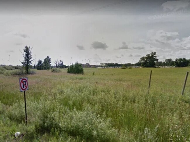
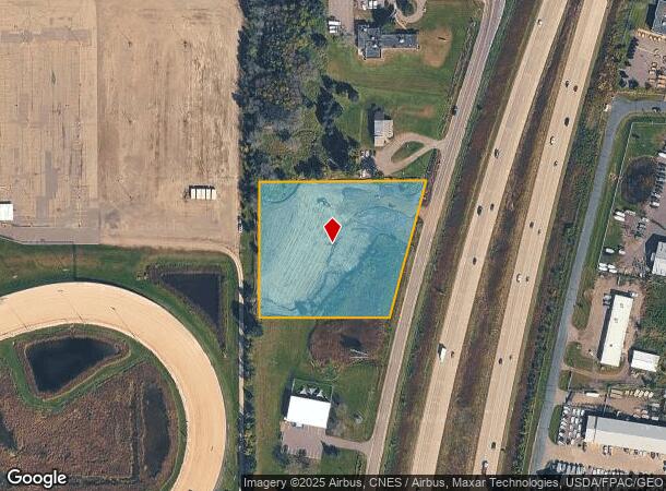
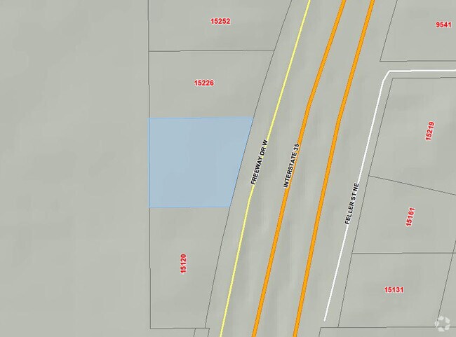
15186 W Freeway Dr Ne
24-32-22-42-0010
THAT PRT OF S 346 FT OF N 846 FT OF NW1/4 OF SE1/4 OF SEC 24 TWP 32 RGE 22; LYG WLY OF WLY R/W LINE OF I35; SUBJ TO EASE OF R
Commercialacreage
Anoka
X
Minnesota
27003C0360E
3.09 AC
2025
Anoka County Outlying
2025
Minneapolis/St Paul
050210
Minneapolis-St. Paul-Bloomington, MN-WI
DEMOGRAPHICS near 15186 W Freeway Dr Ne
1 Mile
3 Mile
5 Mile
2024 Total Population
382
13,383
28,127
2029 Population
402
14,417
30,247
Pop Growth 2024-2029
+ 5.24%
+ 7.73%
+ 7.54%
Average Age
40
38
40
2024 Total Households
143
5,256
10,886
HH Growth 2024-2029
+ 4.90%
+ 7.90%
+ 7.67%
Median Household Inc
$94,078
$80,973
$93,289
Avg Household Size
2.70
2.50
2.50
2024 Avg HH Vehicles
2.00
2.00
2.00
Median Home Value
$409,000
$349,276
$364,007
Median Year Built
1999
1997
1992
Nearby Places
Map Layers
Map Styles
 Street
 Aerial
- Restaurants
- Banks
- Shops
- Fitness
- Groceries
PUBLIC TRANSPORTATION
AIRPORT
Minneapolis-St Paul International/Wold-Chamberlain
DRIVE
WALK
Distance
Minneapolis-St Paul International/Wold-Chamberlain
42 min
32.4 mi
Freight Ports
Port Milwaukee
DRIVE
WALK
Distance
Port Milwaukee
384 min
348.8 mi
SALE & LEASE HISTORY
LISTING DATE
SALE/LEASE

Sep 25, 2016
For Lease
Sep 24, 2016
For Sale
Mar 31, 2017
For Sale
Jul 20, 2023
For Sale
Nearby Properties
Address
Land Use
TOTAL SIZE
Lot Size
Zoning
Address
Land Use
TOTAL SIZE
Lot Size
Zoning
317,520 SF
22.87 AC
Address
Land Use
TOTAL SIZE
Lot Size
Zoning
76,748 SF
2.75 AC
Address
Land Use
TOTAL SIZE
Lot Size
Zoning
39,032 SF
12.34 AC
Address
Land Use
TOTAL SIZE
Lot Size
Zoning
93,292 SF
Address
Land Use
TOTAL SIZE
Lot Size
Zoning
56,512 SF
18.60 AC
Address
Land Use
TOTAL SIZE
Lot Size
Zoning
136,162 SF
17.60 AC
Address
Land Use
TOTAL SIZE
Lot Size
Zoning
183,622 SF
20.24 AC
Address
Land Use
TOTAL SIZE
Lot Size
Zoning
80,512 SF
44.70 AC
Address
Land Use
TOTAL SIZE
Lot Size
Zoning
54,507 SF
8.63 AC
Address
Land Use
TOTAL SIZE
Lot Size
Zoning
64,903 SF
7.83 AC
Address
Land Use
TOTAL SIZE
Lot Size
Zoning
125,884 SF
10.22 AC
Address
Land Use
TOTAL SIZE
Lot Size
Zoning
77,637 SF
5.43 AC
Address
Land Use
TOTAL SIZE
Lot Size
Zoning
103,200 SF
13.20 AC
Address
Land Use
TOTAL SIZE
Lot Size
Zoning
71,450 SF
Address
Land Use
TOTAL SIZE
Lot Size
Zoning
66,155 SF
6.51 AC
Address
Land Use
TOTAL SIZE
Lot Size
Zoning
68,008 SF
Address
Land Use
TOTAL SIZE
Lot Size
Zoning
66,084 SF
7.30 AC
Address
Land Use
TOTAL SIZE
Lot Size
Zoning
114,251 SF
7.58 AC
Address
Land Use
TOTAL SIZE
Lot Size
Zoning
50,304 SF
29.31 AC
Address
Land Use
TOTAL SIZE
Lot Size
Zoning
74,178 SF
5.02 AC
Address
Land Use
TOTAL SIZE
Lot Size
Zoning
75,099 SF
3.44 AC
Address
Land Use
TOTAL SIZE
Lot Size
Zoning
75,099 SF
3.82 AC
Address
Land Use
TOTAL SIZE
Lot Size
Zoning
1,052 SF
140.60 AC
Address
Land Use
TOTAL SIZE
Lot Size
Zoning
81,248 SF
1.07 AC
Address
Land Use
TOTAL SIZE
Lot Size
Zoning
67,616 SF
Address
Land Use
TOTAL SIZE
Lot Size
Zoning
95,384 SF
13.40 AC
Address
Land Use
TOTAL SIZE
Lot Size
Zoning
56,120 SF
3.44 AC
Address
Land Use
TOTAL SIZE
Lot Size
Zoning
51,860 SF
78.12 AC
Address
Land Use
TOTAL SIZE
Lot Size
Zoning
45,087 SF
0.85 AC
Address
Land Use
TOTAL SIZE
Lot Size
Zoning
45,087 SF
0.80 AC
The World's #1 Commercial Real Estate Marketplace
Connect with us
© 2025 CoStar Group
The information above has been obtained from sources believed reliable. While we do not doubt its accuracy we have not verified it and make no guarantee, warranty or representation about it. It is your responsibility to independently confirm its accuracy and completeness. Any projections, opinions, assumptions, or estimates used are for example only and do not represent the current or future performance of the property. The value of this transaction to you depends on tax and other factors which should be evaluated by your tax, financial, and legal advisors. You and your advisors should conduct a careful, independent investigation of the property to determine to your satisfaction the suitability of the property for your needs.