Property Record
15186 Washington St, Haymarket, VA 20169

NEARBY LISTINGS FOR SALE OR LEASE
Property Detail
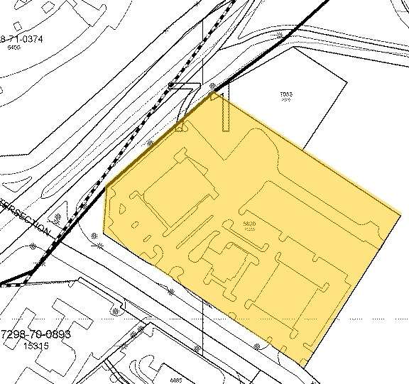
15186 Washington St
Washington, DC
Haymarket Meladon Center Land Condominiu
Washington-Arlington-Alexandria, DC-VA-MD-WV
HAYMARKET MELADON CENTER LAND CONDOMINIUM UNIT 1
7298-71-6403.01
Prince William
Financialbuilding
Virginia
2024
6020
2025
4.13 AC
901511
Route 29/I-66 Corridor
21,739 SF
DEMOGRAPHICS near 15186 Washington St
1 Mile
3 Mile
5 Mile
2024 Total Population
8,709
49,671
73,583
2029 Population
9,029
51,282
75,840
Pop Growth 2024-2029
+ 3.67%
+ 3.24%
+ 3.07%
Average Age
35
41
40
2024 Total Households
2,765
16,777
23,903
HH Growth 2024-2029
+ 3.73%
+ 3.25%
+ 3.13%
Median Household Inc
$139,155
$144,315
$146,837
Avg Household Size
3.10
2.90
3.00
2024 Avg HH Vehicles
2.00
2.00
2.00
Median Home Value
$522,930
$637,231
$642,916
Median Year Built
2006
2005
2004
Nearby Places
Map Layers
Map Styles
 Street
 Aerial
- Restaurants
- Banks
- Shops
- Fitness
- Groceries
PUBLIC TRANSPORTATION
AIRPORT
Washington Dulles International
DRIVE
WALK
Distance
Washington Dulles International
36 min
24.2 mi
Ronald Reagan Washington Ntl
DRIVE
WALK
Distance
Ronald Reagan Washington Ntl
50 min
38.8 mi
Nearby Properties
Address
Land Use
TOTAL SIZE
Lot Size
Zoning
Address
Land Use
TOTAL SIZE
Lot Size
Zoning
220,552 SF
30.95 AC
PMD
Address
Land Use
TOTAL SIZE
Lot Size
Zoning
298,474 SF
11.60 AC
PMR
Address
Land Use
TOTAL SIZE
Lot Size
Zoning
280,221 SF
78.35 AC
RPC
Address
Land Use
TOTAL SIZE
Lot Size
Zoning
333,737 SF
37.06 AC
RPC
Address
Land Use
TOTAL SIZE
Lot Size
Zoning
75,317 SF
13.68 AC
R16
Address
Land Use
TOTAL SIZE
Lot Size
Zoning
241,328 SF
8.66 AC
B1
Address
Land Use
TOTAL SIZE
Lot Size
Zoning
92,182 SF
19.90 AC
B1
Address
Land Use
TOTAL SIZE
Lot Size
Zoning
18.22 AC
A1
Address
Land Use
TOTAL SIZE
Lot Size
Zoning
Address
Land Use
TOTAL SIZE
Lot Size
Zoning
140,285 SF
20.51 AC
RPC
Address
Land Use
TOTAL SIZE
Lot Size
Zoning
285,889 SF
19.61 AC
M1
Address
Land Use
TOTAL SIZE
Lot Size
Zoning
125,653 SF
19.78 AC
MIXED
Address
Land Use
TOTAL SIZE
Lot Size
Zoning
144,869 SF
40.78 AC
A1
Address
Land Use
TOTAL SIZE
Lot Size
Zoning
80,141 SF
8.67 AC
B1
Address
Land Use
TOTAL SIZE
Lot Size
Zoning
107,175 SF
6.96 AC
RPC
Address
Land Use
TOTAL SIZE
Lot Size
Zoning
134,520 SF
11.12 AC
MIXED
Address
Land Use
TOTAL SIZE
Lot Size
Zoning
99,391 SF
24.31 AC
SR1
Address
Land Use
TOTAL SIZE
Lot Size
Zoning
12.40 AC
MIXED
Address
Land Use
TOTAL SIZE
Lot Size
Zoning
102,058 SF
7.07 AC
PBD
Address
Land Use
TOTAL SIZE
Lot Size
Zoning
158,198 SF
7.13 AC
M1
Address
Land Use
TOTAL SIZE
Lot Size
Zoning
89,949 SF
15 AC
R4
Address
Land Use
TOTAL SIZE
Lot Size
Zoning
128,240 SF
10.06 AC
PMD
Address
Land Use
TOTAL SIZE
Lot Size
Zoning
97,037 SF
11.69 AC
B1
Address
Land Use
TOTAL SIZE
Lot Size
Zoning
104,161 SF
38.96 AC
A1
Address
Land Use
TOTAL SIZE
Lot Size
Zoning
136,530 SF
1.98 AC
M1
Address
Land Use
TOTAL SIZE
Lot Size
Zoning
133,296 SF
6.24 AC
M2
Address
Land Use
TOTAL SIZE
Lot Size
Zoning
81,462 SF
PMD
Address
Land Use
TOTAL SIZE
Lot Size
Zoning
65,405 SF
7.37 AC
RPC
Address
Land Use
TOTAL SIZE
Lot Size
Zoning
39,927 SF
9.32 AC
PMD
Address
Land Use
TOTAL SIZE
Lot Size
Zoning
81,015 SF
20.17 AC
RPC
The World's #1 Commercial Real Estate Marketplace
Connect with us
© 2026 CoStar Group
The information above has been obtained from sources believed reliable. While we do not doubt its accuracy we have not verified it and make no guarantee, warranty or representation about it. It is your responsibility to independently confirm its accuracy and completeness. Any projections, opinions, assumptions, or estimates used are for example only and do not represent the current or future performance of the property. The value of this transaction to you depends on tax and other factors which should be evaluated by your tax, financial, and legal advisors. You and your advisors should conduct a careful, independent investigation of the property to determine to your satisfaction the suitability of the property for your needs.