Property Record
1519 Industrial Rd, Las Vegas, NV 89102
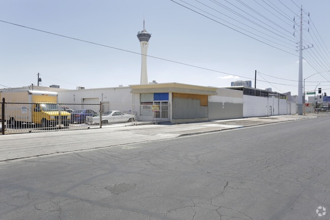
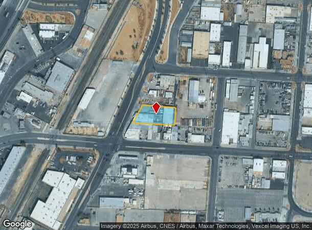
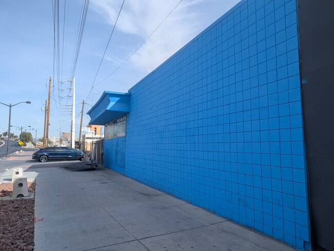

This Property Is For Sale
NEARBY LISTINGS FOR SALE OR LEASE
Property Detail
1519 Industrial Rd
162-04-608-006
Sierra Vista Addition
Shipyard
PT SE4 NE4 SEC 04 21 61
X
Clark
32003C2170F
Nevada
2025
0.51 AC
2025
Central Las Vegas
001100
Las Vegas
14,985 SF
Las Vegas-Henderson-Paradise, NV
DEMOGRAPHICS near 1519 Industrial Rd
1 Mile
3 Mile
5 Mile
2024 Total Population
13,770
182,369
513,935
2029 Population
14,992
196,876
552,197
Pop Growth 2024-2029
+ 8.87%
+ 7.95%
+ 7.44%
Average Age
43
38
38
2024 Total Households
6,972
75,279
194,811
HH Growth 2024-2029
+ 9.04%
+ 8.00%
+ 7.57%
Median Household Inc
$36,057
$36,011
$40,458
Avg Household Size
1.90
2.30
2.50
2024 Avg HH Vehicles
1.00
1.00
1.00
Median Home Value
$392,719
$287,920
$262,948
Median Year Built
1978
1977
1980
Nearby Places
Map Layers
Map Styles
 Street
 Aerial
- Restaurants
- Banks
- Shops
- Fitness
- Groceries
PUBLIC TRANSPORTATION
AIRPORT
Harry Reid International
DRIVE
WALK
Distance
Harry Reid International
13 min
5.4 mi
Boulder City Municipal
DRIVE
WALK
Distance
Boulder City Municipal
36 min
26.0 mi
Nearby Properties
Address
Land Use
TOTAL SIZE
Lot Size
Zoning
Address
Land Use
TOTAL SIZE
Lot Size
Zoning
3,693,440 SF
43.59 AC
Address
Land Use
TOTAL SIZE
Lot Size
Zoning
3,391,505 SF
68.55 AC
Address
Land Use
TOTAL SIZE
Lot Size
Zoning
1,044,724 SF
56.56 AC
Address
Land Use
TOTAL SIZE
Lot Size
Zoning
1,172,527 SF
19.67 AC
H1
Address
Land Use
TOTAL SIZE
Lot Size
Zoning
820,224 SF
59.80 AC
H1
Address
Land Use
TOTAL SIZE
Lot Size
Zoning
1,494,289 SF
65.25 AC
H1
Address
Land Use
TOTAL SIZE
Lot Size
Zoning
2,414,853 SF
16.59 AC
H1
Address
Land Use
TOTAL SIZE
Lot Size
Zoning
8,805 SF
45.63 AC
Address
Land Use
TOTAL SIZE
Lot Size
Zoning
74,148 SF
18.51 AC
Address
Land Use
TOTAL SIZE
Lot Size
Zoning
763,204 SF
10.47 AC
H1
Address
Land Use
TOTAL SIZE
Lot Size
Zoning
248,689 SF
19.45 AC
H1
Address
Land Use
TOTAL SIZE
Lot Size
Zoning
171,303 SF
17.87 AC
H1
Address
Land Use
TOTAL SIZE
Lot Size
Zoning
318,259 SF
29.92 AC
Address
Land Use
TOTAL SIZE
Lot Size
Zoning
299,144 SF
19.37 AC
Address
Land Use
TOTAL SIZE
Lot Size
Zoning
315,865 SF
19.85 AC
Address
Land Use
TOTAL SIZE
Lot Size
Zoning
873,377 SF
28.08 AC
Address
Land Use
TOTAL SIZE
Lot Size
Zoning
1,345,377 SF
88.53 AC
H1
Address
Land Use
TOTAL SIZE
Lot Size
Zoning
79,707 SF
2.76 AC
Address
Land Use
TOTAL SIZE
Lot Size
Zoning
1,069,498 SF
28.36 AC
H1
Address
Land Use
TOTAL SIZE
Lot Size
Zoning
39,972 SF
3.04 AC
CV
Address
Land Use
TOTAL SIZE
Lot Size
Zoning
987,719 SF
12.98 AC
H1
Address
Land Use
TOTAL SIZE
Lot Size
Zoning
162,214 SF
4.32 AC
Address
Land Use
TOTAL SIZE
Lot Size
Zoning
126,656 SF
8.18 AC
H1
Address
Land Use
TOTAL SIZE
Lot Size
Zoning
497,331 SF
24.44 AC
Address
Land Use
TOTAL SIZE
Lot Size
Zoning
524,471 SF
59.01 AC
Address
Land Use
TOTAL SIZE
Lot Size
Zoning
162,501 SF
5.77 AC
C2
Address
Land Use
TOTAL SIZE
Lot Size
Zoning
34,354 SF
33.06 AC
Address
Land Use
TOTAL SIZE
Lot Size
Zoning
1,617,320 SF
7.21 AC
PD
Address
Land Use
TOTAL SIZE
Lot Size
Zoning
48.58 AC
PF
Address
Land Use
TOTAL SIZE
Lot Size
Zoning
115,059 SF
30.12 AC
The World's #1 Commercial Real Estate Marketplace
Connect with us
© 2025 CoStar Group
The information above has been obtained from sources believed reliable. While we do not doubt its accuracy we have not verified it and make no guarantee, warranty or representation about it. It is your responsibility to independently confirm its accuracy and completeness. Any projections, opinions, assumptions, or estimates used are for example only and do not represent the current or future performance of the property. The value of this transaction to you depends on tax and other factors which should be evaluated by your tax, financial, and legal advisors. You and your advisors should conduct a careful, independent investigation of the property to determine to your satisfaction the suitability of the property for your needs.